Port of Karachi
| Port of Karachi | |
|---|---|
| Location | |
| Country |
|
| Location | Karachi, Sindh on the Arabian Sea |
| Details | |
| Opened | 1854 |
| Operated by | Karachi Port Trust |
| Owned by | Ministry of Ports and Shipping and Government of Pakistan |
| Type of harbor | Natural |
| Size of harbor | 32 km (20 mi) |
| Available berths | 30 |
| Wharfs | 8 |
| Statistics | |
| Annual cargo tonnage | 65.25 million Metric tons |
| Annual container volume | 1.563 million TEUs |
|
Website www | |
The Port of Karachi (Urdu: کراچی بندرگاہ Bandar gāh Karāchī) is one of South Asia's largest and busiest deep-water seaports, handling about 60% of the nation's cargo (25 million tons per annum) located in Karachi, Pakistan. It is located between the Karachi towns of Kiamari and Saddar, close to the main business district and several industrial areas. The geographic position of the port places it in close proximity to major shipping routes such as the Strait of Hormuz. The administration of the port is carried out by the Karachi Port Trust, which was established in the nineteenth century.
History

The history of the port is intertwined with that of the city of Karachi. Several ancient ports have been attributed in the area including "Krokola", "Morontobara" (Woman's Harbour) (mentioned by Nearchus),[1] Barbarikon (the Periplus of the Erythraean Sea,[2] and Debal (a city captured by the Muslim general Muhammad bin Qasim in 712 CE). There is a reference to the early existence of the port of Karachi in the "Umdah", by the Arab navigator Sulaiman al Mahri (AD 1511), who mentions "Ras al Karazi" and "Ras Karashi" while describing a route along the coast from Pasni to Ras Karashi. Karachi is also mentioned in the sixteenth century Turkish treatise Mir'ât ül Memâlik (Mirror of Countries, 1557) by the Ottoman captain Seydi Ali Reis, which is a compilation of sailing directions from the Portuguese island of Diu to Hormuz in the Persian Gulf. It warns sailors about whirlpools and advises them to seek safety in "Kaurashi" harbour if they found themselves drifting dangerously. There is a legend of a prosperous coastal town called Kharak in the estuary of the Hub River (west of modern Karachi) in the late 17th and early eighteenth century.
In 1728 heavy rains silted up the harbour and resulted in the merchants of Kharak relocating to the area of modern Karachi. In 1729, they built a new fortified town called Kolachi (also known as Kalachi-jo-Kun and Kolachi-jo-Goth) on high ground north of Karachi bay, surrounded by a 16-foot (5 m) high mud and timber-reinforced wall with gun-mounted turrets and two gates. The gate facing the sea was called "Kharadar" (salt gate), and the gate facing the Lyari River was called "Mithadar" (sweet gate). The modern neighbourhoods around the location of the gates are called Mithadar and Kharadar. Surrounded by mangrove swamps to the east, the sea to the southwest, and the Layari river to the north, the town was well defended and engaged in a profitable trade with Muscat and Bahrain. From 1729 to 1783 the strategic location of Kolachi saw the town change hands several times between the Khans of Kalat and the rulers of Sind. In 1783, after two prolonged sieges the town fell to the Talpur Mirs of Sind, who constructed a fort mounted with cannons on Manora island at the harbour entrance.[3]

The prominence of the port attracted the British, who opened a factory in Karachi at the end of the eighteenth century but disagreements with the Mirs on trade tariffs led to the closure of the factory. The British were concerned about Russian expansion towards the Arabian Sea, so in 1839 they occupied Karachi and later the whole of the Sindh. The port served as a landing point for troops during the First Afghan War. The river Indus was an important artery of communication between Karachi and Jhirk Near Kotri Sindh, was an important river port. The Indus flotilla used large quantities of firewood and it was kept to fuel steamboats. A number of British companies opened offices and warehouses in Karachi and the population increased rapidly. By 1852, Karachi was an established city with a population of 14,000 and a prosperous overseas trade. The modern port began to take shape in 1854, when the main navigation channel was dredged and a mole or causeway was constructed to link the main harbour with the rest of the city. This was followed by construction of Manora breakwater, Keamari Groyne, the Napier Mole Bridge and the Native Jetty Bridge. The construction of the wharves started in 1882, and by 1914 the East Wharf and the Napier Mole Boat Wharf were complete while 1927 and 1944, the West Wharf, the lighterage berths and the ship-repair berths were constructed between 1927 and 1944.
From the 1861 the Sindh Railway line connected Karachi to the cotton and wheat producing areas of the Sindh and northern British raj and by 1899 Karachi was the largest wheat and cotton exporting port in South Asia. The period between 1856 and 1872 saw a marked increase in trade, especially during the American Civil War when cotton from Sindh replaced American cotton as a raw material in the British textile industry and the opening of the Suez Canal in 1869. Another major export was oil brought by rail from the Sui region in Balochistan. Karachi's importance as a gateway to British India increased in 1911 when the capital was moved from Calcutta to Delhi. Karachi was an important military base during the First World War (1914–18) because it was the first British raj port of call for ships coming through the Suez Canal and was the gateway to Afghanistan and the Russian Empire. In 1936 the Sindh district of the Bombay Presidency was reorganised as a new province with Karachi as the capital instead of the traditional capital of Hyderabad. This led to new public services and buildings, thus increasing its population and importance. Karachi was again a military base and port for supplies to the Russian front during the Second World War (1939–1945). In 1947, Karachi became the capital of the new nation of Pakistan, resulting in a growth in population as it absorbed hundreds of thousands of refugees. Although the capital moved to Islamabad in 1959, Karachi remains the economic center of Pakistan, accounting for the largest proportion of national GDP based in part on the commerce conducted through the Port of Karachi and Port Qasim.
Historical Background
The new trade corridor realism of Gwadar port for promotion and advancement of economic activities can be justified in the historic reality of extensive regional and cross-continental commerce existed between Europe and Asia (East, Central and South) over centuries (Kazi, 2006). Historically, Seaport of Barbarikon, now known as Pakistan coast, used to be an important and cost-effective trade node between these regions for economic activities through land and sea network famous as “Silk-route” (79). Before the Arab conquest, the Great Kushans ruled the entire region stretching from modern Central Asia, Afghanistan and Pakistan. Under Kushans rule, coastal harbor of Barbarikon – located between Gwadar and Karachi port, served as a key regional trade hub on the warm waters of Arabian Sea for trading. The Barbarikon coastal harbor further contributed in the cross-continental trade among Rome, China and Kushans (p. 84). It is worth noting that land routes used by the Kushans rulers are the same being used by the government of Pakistan, but with much improved infrastructure.
Port facilities
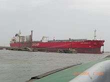
The port comprises a deep natural harbour with an 11 kilometre long approach channel which provides safe navigation for vessels up to 75,000 tonnes deadweight (DWT). The main areas of port activity are two wharves; East Wharf with seventeen vessel berths and West Wharf with thirteen vessel berths. The maximum depth alongside the berths is currently 11.3 metres. The two wharves extend in opposite directions along the upper harbour – the East Wharf northeast from Kiamari Island and the West Wharf southwest from Saddar town. The two wharves each include a container terminal:
- Karachi International Container Terminal (KICT) opened in 1996 at West Wharf berths 28-30. It has a handling capacity of 300,000 TEUs per annum and handles container ships up to 11-metre draught. The total quay length is 600 metres divided into two container berths. The terminal is equipped with three Panamax cranes and one post-Panamax crane.
- Pakistan International Container Terminal (PICT) in 2002 at East Wharf berths 6-9. It has a handling capacity of 350,000 TEUs per annum and handles container ships up to 11.5-metre draught. The total quay length is 600 metres divided into two container berths. The terminal is equipped with two Panamax cranes.
- KICT and PICT have a nearby competitor in the privately operated Al-Hamd International Container Terminal (AICT), which opened in 2001 at a site west of the Layari river. AICT is situated next to the Sindh Industrial Trading Estate, the new truck stand at Hawkes Bay Road and close to the RCD Highway, Super Highway and the future Layari Bypass.
There are also three liquid cargo-handling berths (oil piers), two ship repair jetties and a shipyard and engineering facility.[4] The shipyard carries out shipbuilding and repair for both commercial and military customers on a 29-hectare (70 acres) site at the West Wharf. The facilities include a large shipbuilding hall, three shipbuilding berths, two dry-docks and three foundries.[5]
Expansion

The flow of cargo to and from the port is hampered by severe congestion in the harbour with several other maritime facilities located close to the port. Adjacent to the West Wharf is the Karachi Fishing Harbour, which is administered separately from the port and is the base for a fleet of several thousand fishing vessels. The West Wharf also hosts a ship repair facility and shipyard and a naval dockyard at the tip of the wharf, while to the south of the port are the Karachi Naval Base and the Kiamari Boat Club.
The Port of Karachi also faces competition from a new private terminal located 5 kilometres to the west. In recent years the federal government has attempted to alleviate the increased congestion by constructing a second port in Karachi thirty kilometres to the east at Port Qasim and a third major port at Gwadar, about 650 kilometres west of Karachi.
The Karachi Fishing Harbour has been upgraded recently, and a second fishing harbour has been built 18 kilometres away at Korangi. The transfer of some naval vessels to the new naval base at Ormara has brought about further reductions in congestion.
Further deepening of the port has been planned by the Karachi Port Trust in order to enhance facilities. The channel is being dredged initially to 13.5 metres deep to cater for 12-metre draught vessels at all tides. At Kiamari Groyne, located at the outer tip of the harbour, dredging will be to 16.5 metres to enable vessels up to 300 metres long to dock. Other projects to expand the port include:[6]
- An increase the handling capacity of KICT from 300,000 TEUs to 400,000 TEUs per annum
- Two new berths at KICT with 14 metres depth alongside and an additional 100,000 m² terminal/stacking area
- Installation of modern facilities at PICT (completed in April 2004)
- A new bulk cargo terminal at East Wharf
- Reconstruction of the oldest oil pier to allow tankers of 90,000 tonnes deadweight (DWT) to berth
- A new 100-acre (0.4 km2) cargo village to cater for containers and general and bulk cargo
- Reconstruction of the 100-year-old NMB Wharf to enhance the berthing of passenger vessels
- The purchase of a new dredger, two hopper barges, two harbour tugs, two water barges, an anchor hoist vessel, two pilot boats, and a dredger tender
- A new desalination plant to address the city's water shortage problem
- A 500-foot (150 m) high Port Tower for commercial and recreational use including a revolving restaurant
- The construction of a 500-acre (2 km²) Port Town with 13,000 homes for port workers at nearby Hawkes Bay
- A new Port Club at Chinna Creek adjacent to the East Wharf
On 9 November 2007, the Karachi Port Trust signed a US$1 billion agreement with Hutchison Port Holdings to construct a new terminal called the "Pakistan Deep Water Container Port", which would begin operations by 2010, and would have ten berths capable of handling Super Post Panamax container ships.[7][8]
Environmental concerns

The area around the harbour includes several mangrove forests which are constantly under threat from human activities. To the east of the port lies Chinna Creek, which covers about 6 km² and is dotted with mangrove islands. To the southwest of the port is another much larger mangrove forest in the bay formed by several islands and Manora breakwater; the river Layari flows into this bay, bringing waste from upstream suburbs.[9]
The beach immediately east of the harbour was the scene of a significant oil spillage when the Greek-registered Tasman Spirit ran aground on 28 July 2003.[10] The environmental impact included large numbers of dead fish and turtles and damage to a key mangrove forest, as well as dozens of people suffering nausea.[11] 6.4 Regional Energy Requirement The rapid economic development has resulted in the depletion of energy resources which have created a sense of conscious among energy starved nations. Trends reflect that world’s growing energy demand will continue to mount and grow at fast momentum. According to United Nations Conference on Trade and Development (UNCTAD), by 2020, natural gas requirement will increase by 2.77 percent per annum while crude oil seaborne shipments will increase by 3.5 percent in the same period (2004). Now nations are reviewing their strategies to secure their future. China, India and Pakistan are vulnerable to energy dilemma and there is a high time for these countries to capitalize energy potential of Central Asia for sustainable economic growth. China and India are growing economies and by 2030 these two giant economies would be almost double in size with USA (p. 30). Such rapid economic growth has also developed apprehension about energy as their industrial appetite for energy is increasing day by day. According to the statistics revealed by US department of energy, the world energy consumption is estimated to grow by 2.6 percent per annum from current level to 2030 while during the same period China and India’s energy consumption would increase by 5 percent and 3.8 percent respectively (Aziz, 2005, p. 62). According to the estimates of Bush Jason, (2005), until 2025 China will require 14.2 million barrels of oil per day to meet its energy consumption of the industry whereas India will need 5 million barrels of oil per day to sustain its economic growth. In the natural gas import, India’s utilization is estimated to grow up to almost 6.8 billion cubic feet a day for a period of ten years and will reach sixfold after twenty years time which is equivalent to about 400 million cubic meters a day (India in-Depth, 2006). As bilateral relations between Pakistan and India are back to normalcy and improvement in different economic sectors has been made, India will still prove to be the ultimate buyer of the Central Asian energy (Fredholm, 2008, p. 58).
Pakistan along with India is equally devoid of energy resources for industrial development. These two countries account for half of South Asia’s GDP. In Pakistan, after hydropower, natural gas is considered the second most important source of energy and means of modernization (Fredholm, 2008, p. 58). Pakistan’s proven domestic natural gas and oil reserves are shrinking to meet emerging energy demand of its industrial and other economic sectors. Pakistan’s present 1 trillion cubic feet consumption per annum is increasing at a fast pace and if Central Asian oil and gas reserves are not capitalized in the near future, the country’s industrial, commercial, transport, household and other sectors of economy would go standstill (Wirsing, 2008, p. 9).
Abundant natural resources of Central Asia become important factor for South Asia which has the scantiest endowment of hydrocarbons to fulfill their energy requirements. In this context, Gwadar port can play a significant role as an energy corridor to link Central and South Asia into economic integration to achieve a sustainable economic growth. Located just a few hundred miles away, the energy corridor will connect the Central Asian states of Uzbekistan, Turkmenistan and Afghanistan to exploit over 217 trillion cubic feet of gas reserves which are more in quantum than Saudi Arabia’s resources (Aziz, 2005, p. 63). Moreover, South Asia can enable Central Asian States to diversify their economies by supplying gas and oil on global market prices as Russia’s Gasprom, oil and gas company, is exploiting the Central Asian countries’ energy flow on a very minimal price. The Central Asia has old gas pipeline network which known as the Central Asia-Center (CAC) gas pipeline system runs from Turkmenistan through Uzbekistan and Kazakhstan to Russia. The CAC is a network of five separate pipelines which are being used for transportation of energy from the Central Asia to Russia. These pipelines were started constructing in 1966 and completed in 1987. Keeping in view the rich energy resources of Central Asia, Russia has increased its transit capacity to retain energy from the Central Asia (Fredholm, 2008, p. 42). The Russian monopoly and exploitation is because of the fact that during former Soviet’s period, all supply routes of Central Asia were designed in such a way to direct its energy resources only to Russia and left the region with no option but to continue supplying Russian energy market. This approach of exploitation at the hands of Russia has severely thwarted the region’s economic development. The energy corridor will also contribute for economic development of Afghanistan as the country is located in the middle of two regions and can serve as a viable transit corridor for uninterrupted energy. It is a high time for both the region to act as fueling prices are steadily going up since 2002 and delay may cause a severe blow to regional prosperity and to both the economies of India and Pakistan whose people are living below the poverty line (p. 63).
Labour relations
The Karachi Dock Labour Board (KDLB) is responsible for labour relations between employees and the Karachi Port Trust. In October 2006, the Pakistan government decided to close down Karachi Dock Labour Board by the end of the year as part of its port strategy and under the National Trade Corridor (NTC) programme. The closure of KDLB would cost around Rs 4.2 billion ($70 million) to the national exchequer.[12]
KPT have their own apprenticeship training institute at Manora. The college offers: 3 year Marine Engineering apprenticeship plus 2 year bond service on KPT vessels
See also
- Pakistan Marine Academy
- Pakistan Merchant Navy
- Gwadar port
- Transport in Karachi
- Transport in Pakistan
References
- ↑ Jona Lendering, Livius.org. "Nearchus". Retrieved 2007-11-17.
- ↑ "Indian Ocean Trade". University of Pennsylvania Museum of Archaeology and Anthropology. Retrieved 2007-11-17.
- ↑ "Ecologically destructive projects on Karachi coast". Dawn Group of Newspapers. Retrieved 2007-11-19.
- ↑ "Ships Repair". Karachi Port Trust. Archived from the original on 21 October 2007. Retrieved 2007-11-19.
- ↑ "Company Profile". Karachi Shipyard & Engineering Works. Archived from the original on 9 October 2007. Retrieved 2007-11-19.
- ↑ "Projects". Karachi Port Trust. Retrieved 2007-11-19.
- ↑ "$1bn deep water port agreement signed". The News International. Retrieved 2007-11-19.
- ↑ "Information Memorandum Shipyard" (PDF). Government of Pakistan. 5 October 2007. Archived from the original (PDF) on 7 December 2007. Retrieved 2007-11-20.
- ↑ "Education for Environment & Biodiversity of Pakistan: Water". IUCN Pakistan. Archived from the original on 3 December 2007.
- ↑ "Pakistan tackles huge oil spill". BBC News. 15 August 2003. Retrieved 2007-11-19.
- ↑ "PAKISTAN: Oil spill threatens marine life, coastal ecosystems". Integrated Regional Information Networks, United Nations Office for the Coordination of Humanitarian Affairs. Retrieved 2007-11-19.
- ↑ Masroor Afzal Pasha. "KDLB to be closed down by December". Business Recorder. Retrieved 2007-11-20.
External links
Coordinates: 24°50′N 66°59′E / 24.84°N 66.98°E