Kasawo
| Kasawo | |
|---|---|
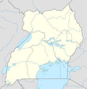 Kasawo Location in Uganda | |
| Coordinates: 00°40′48″N 32°49′30″E / 0.68000°N 32.82500°E | |
| Country |
|
| Region | Central Region |
| District | Mukono District |
| Elevation | 3,600 ft (1,100 m) |
Kasawo is an urban centre in the Mukono District, Central Region of Uganda.
Location
Kasawo is approximately 62 kilometres (39 mi), by road, northeast of Kampala, the capital and largest city of Uganda.[1] This location lies on the western banks of River Sezibwa, approximately 42 kilometres (26 mi), by road, northeast of Mukono, where the district headquarters are located.[2] The coordinates of Kasawo are 0° 40' 48.00"N, 32° 49' 30.00"E (Latitude:0.6800; Longitude:32.8250).[3]
Overview
Kasawo lies in a relatively fertile valley. The surrounding communities are sources of food crops such as bananas, pineapples, pumpkins, and sugar cane, along with cash crops like coffee.
The prevalent diseases in the community include malaria,[4] respiratory infections, diarrheal diseases, and problems related to access of antenatal and postnatal care. HIV/AIDS prevention and treatment is also a concern.[5]
Recent developments
As of December 2013, students from Drake University, a private institution of higher education in Des Moines, Iowa, United States, in collaboration with the Shining Star Foundation, a US-based non-governmental organization, and with Des Moines Rotary AM and with Sunrise Rotary of Kampala, were in the process of building a self-sustaining Level II health center in Kasawo. The aim of the project is to relieve the acute lack of healthcare services in Kasawo and surrounding communities. The health center plans to use St. Francis Hospital Nagalama as its referral center.[6]
Points of interest
The following points of interest lie within or near Kasawo:
- offices of Kasawo Town Council
- Kasawo central market
References
- ↑ GFC (15 March 2016). "Distance between Kampala Road, Kampala, Central Region, Uganda and Kasawo Muslim Primary School, Kasawo, Central Region, Uganda". Globefeed.com (GFC). Retrieved 15 March 2016.
- ↑ GFC (15 March 2016). "Distance between Mukono, Central Region, Uganda and Kasawo Muslim Primary School, Kasawo, Central Region, Uganda". Globefeed.com (GFC). Retrieved 15 March 2016.
- ↑ Google (15 March 2016). "Location of Kasawo, Mukono District, Central Uganda" (Map). Google Maps. Google. Retrieved 15 March 2016.
- ↑ Anthony Mbonye, Richard Ndyomugyenyi et. al. (21 December 2010). "The feasibility of introducing rapid diagnostic tests for malaria in drug shops in Uganda". Malaria Journal 2010 9:367. Retrieved 15 March 2016.
- ↑ Bagala, Andrew (29 April 2013). "Are evil spirits killing people in rural areas?". Daily Monitor. Kampala. Retrieved 15 March 2016.
- ↑ "Medical Clinic Kasawo Uganda". Shiningcity.org. Retrieved 17 December 2013.
External links
Capital: Mukono | ||
| Counties and sub-counties |
|  |
| Towns and villages | ||
| Economy |
| |
| Banking | ||
| Notable landmarks | ||
| Transport | ||
| Education | ||
| Energy | ||
| Health | ||
| Notable people | ||
Coordinates: 00°40′48″N 32°49′30″E / 0.68000°N 32.82500°E