Mukono–Kayunga–Njeru Road
| Mukono–Kayunga–Njeru Road | |
|---|---|
| Route information | |
| Length: | 58.4 mi (94.0 km) |
| History: |
Designation in 2015 Expected completion in 2018 |
| Major junctions | |
| West end: | Mukono Town |
|
Kalagi Kayunga | |
| East end: | Njeru |
| Highway system | |
| Roads in Uganda | |
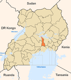
Mukono–Kayunga–Njeru Road is a road in the Central Region of Uganda, connecting the city of Mukono to the town of Njeru at the Nalubaale Power Station.
Location
The road starts at Mukono, the headquarters of Mukono District. The road continues northwards to Kalagi, approximately 19 kilometres (12 mi), north of Mukono.[1] At Kalagi, the road takes a northeasterly turn to Kayunga, the headquarters of Kayunga District, a distance of approximately 33 kilometres (21 mi).[2] At Kayunga, the road turns south to end at Njeru, approximately 47 kilometres (29 mi) away from Kayunga.[3] The total road project is given as 94 kilometres (58 mi), by Uganda National Roads Authority[4]
Upgrading to bitumen
The road with a bitumen surface, in varying degrees of disrepair was earmarked for improvement to class II bitumen surface, with shoulders, drainage channels and culverts.[5]
References
- ↑ GFC (11 January 2016). "Distance between Mukono, Central Region, Uganda and Kalagi, Central Region, Uganda". Globefeed.com (GFC). Retrieved 11 January 2016.
- ↑ GFC (11 January 2016). "Distance between Kalagi, Central Region, Uganda and Kayunga Market, Kayunga, Central Region, Uganda". Globefeed.com (GFC). Retrieved 11 January 2016.
- ↑ GFC (11 January 2016). "Distance between Kayunga Market, Kayunga, Central Region, Uganda and Njeru, Central Region, Uganda". Globefeed.com (GFC). Retrieved 11 January 2016.
- ↑ Kezaabu, Carol (30 December 2014). "The following roads will commence in 2015". Uganda National Roads Authority. Retrieved 11 January 2016 – via Facebook.
- ↑ NTV (7 June 2015). "Road Expansion: Mukono, Kayunga residents to be compensated". Kampala: Facebook.com Quoting Nation TV Uganda (NTV). Retrieved 11 January 2016.
External links
Capital: Buikwe | |
| Towns and villages | |
| Geography | |
| Economy |
|
| Energy | |
| Notable landmarks |
|
| Health | |
| Transport | |
| Education | |
| Notable people | |
Capital: Kayunga | ||
| Counties and sub-counties |
|  |
| Towns and villages | ||
| Transport | ||
| Energy | ||
| Health | ||
| Notable landmarks | ||
| Geography | ||
| Education |
| |
| Notable people | ||
Capital: Mukono | ||
| Counties and sub-counties |
|  |
| Towns and villages | ||
| Economy |
| |
| Banking | ||
| Notable landmarks | ||
| Transport | ||
| Education | ||
| Energy | ||
| Health | ||
| Notable people | ||