Kawai, Iwate
For other uses, see Kawai (disambiguation).
| Kawai 川井村 | ||
|---|---|---|
| Former municipality | ||
| ||
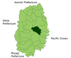 Location of Kawai in Iwate Prefecture | ||
| Coordinates: 39°36′00″N 141°40′59″E / 39.600°N 141.683°ECoordinates: 39°36′00″N 141°40′59″E / 39.600°N 141.683°E | ||
| Country | Japan | |
| Region | Tōhoku | |
| Prefecture | Iwate Prefecture | |
| District | Shimohei District | |
| Merged |
January 1, 2010 (now part of Miyako) | |
| Area | ||
| • Total | 567.07 km2 (218.95 sq mi) | |
| Population (November 1, 2009) | ||
| • Total | 2,952 | |
| • Density | 5.2/km2 (13/sq mi) | |
| Symbols | ||
| • Tree | Betula pendula | |
| • Flower | Azalea | |
| • Bird | Copper pheasant | |
| Time zone | Japan Standard Time (UTC+9) | |

Kawai (川井村 Kawai-mura) was a village located in Shimohei District, Iwate Prefecture, Japan.
History
The village of Kawai was created on April 1, 1889 within Nakahei District with the establishment of the municipalities system. Nakahei was merged with Higashihei and Kitahei districts to form Shimohei District on March 29, 1896. On July 1, 1955, Kawai annexed the neighboring village of Oguni.
On January 1, 2010, Kawai was merged into the expanded city of Miyako, and no longer exists as an independent municipality.[1]
As of January 1, 2006, the village had an estimated population of 2,952 and a population density of 5.2 persons per km². The total area was 563.07 km².
References
External links
 Media related to Kawai, Iwate at Wikimedia Commons
- Official website of Miyako (Japanese)
This article is issued from Wikipedia - version of the 11/5/2015. The text is available under the Creative Commons Attribution/Share Alike but additional terms may apply for the media files.