Kennedy, Alabama
| Kennedy, Alabama | |
|---|---|
| Town | |
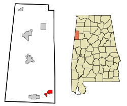 Location in Lamar County and the state of Alabama | |
| Coordinates: 33°34′50″N 87°59′2″W / 33.58056°N 87.98389°W | |
| Country | United States |
| State | Alabama |
| County | Lamar |
| Area | |
| • Total | 3.1 sq mi (8 km2) |
| • Land | 3.1 sq mi (8 km2) |
| • Water | 0 sq mi (0 km2) |
| Elevation | 289 ft (88 m) |
| Population (2010) | |
| • Total | 447 |
| • Density | 174.5/sq mi (67.6/km2) |
| Time zone | Central (CST) (UTC−6) |
| • Summer (DST) | CDT (UTC−5) |
| ZIP code | 35574 |
| Area code | 205 |
| FIPS code | 01-39520 |
| GNIS feature ID | 0121145 |
Kennedy is a town in Lamar County, Alabama, United States. It was incorporated by an act of the legislature on February 18, 1895.[1] At the 2010 census the population was 447, down from 541 in 2000.
Geography
Kennedy is located at 33°34′50″N 87°59′2″W / 33.58056°N 87.98389°W (33.580683, -87.983830).[2]
According to the U.S. Census Bureau, the town has a total area of 3.1 square miles (8.0 km2), all land.
Demographics
| Historical population | |||
|---|---|---|---|
| Census | Pop. | %± | |
| 1900 | 166 | — | |
| 1910 | 261 | 57.2% | |
| 1920 | 203 | −22.2% | |
| 1930 | 277 | 36.5% | |
| 1940 | 367 | 32.5% | |
| 1950 | 393 | 7.1% | |
| 1960 | 379 | −3.6% | |
| 1970 | 415 | 9.5% | |
| 1980 | 604 | 45.5% | |
| 1990 | 523 | −13.4% | |
| 2000 | 541 | 3.4% | |
| 2010 | 447 | −17.4% | |
| Est. 2015 | 428 | [3] | −4.3% |
| U.S. Decennial Census[4] 2013 Estimate[5] | |||
As of the census[6] of 2000, there were 541 people, 226 households, and 169 families residing in the town. The population density was 176.2 people per square mile (68.0/km²). There were 260 housing units at an average density of 84.7 per square mile (32.7/km²). The racial makeup of the town was 85.40% White, 13.68% Black or African American, 0.55% Native American, and 0.37% from two or more races. 0.18% of the population were Hispanic or Latino of any race.
There were 226 households out of which 33.6% had children under the age of 18 living with them, 58.8% were married couples living together, 13.7% had a female householder with no husband present, and 24.8% were non-families. 23.0% of all households were made up of individuals and 11.1% had someone living alone who was 65 years of age or older. The average household size was 2.39 and the average family size was 2.82.
In the town the age distribution of the population shows 23.7% under the age of 18, 8.5% from 18 to 24, 27.5% from 25 to 44, 24.2% from 45 to 64, and 16.1% who were 65 years of age or older. The median age was 39 years. For every 100 females there were 82.8 males. For every 100 females age 18 and over, there were 78.0 males.
The median income for a household in the town was $24,750, and the median income for a family was $30,909. Males had a median income of $30,278 versus $19,250 for females. The per capita income for the town was $12,447. About 14.3% of families and 16.0% of the population were below the poverty line, including 23.3% of those under age 18 and 17.4% of those age 65 or over.
Notable people
- William J. Hibbler, former United States federal judge
- John C. McAdams, associate professor of political science at Marquette University
- Jake Propst, Major League Baseball player for the Washington Senators
- Lee Stripling, singer and fiddler
References
- ↑ https://books.google.com/books?id=Z5E3AAAAIAAJ&pg=PA726&lpg=PA726&dq=%22kennedy%22+%22incorporated%22+%22lamar+county%22&source=bl&ots=MLPxvasRpU&sig=p9bF6Yib8GhSRVlydv4sFjOHcSQ&hl=en&sa=X&ved=0ahUKEwjpgsLq0eXKAhUGJiYKHX1tAio4ChDoAQgnMAI#v=onepage&q=%22kennedy%22%20%22incorporated%22%20%22lamar%20county%22&f=false
- ↑ "US Gazetteer files: 2010, 2000, and 1990". United States Census Bureau. 2011-02-12. Retrieved 2011-04-23.
- ↑ "Annual Estimates of the Resident Population for Incorporated Places: April 1, 2010 to July 1, 2015". Retrieved July 2, 2016.
- ↑ "U.S. Decennial Census". Census.gov. Retrieved June 6, 2013.
- ↑ "Annual Estimates of the Resident Population: April 1, 2010 to July 1, 2013". Retrieved June 3, 2014.
- ↑ "American FactFinder". United States Census Bureau. Retrieved 2008-01-31.
Coordinates: 33°34′50″N 87°59′02″W / 33.580683°N 87.98383°W
Municipalities and communities of Lamar County, Alabama, United States | ||
|---|---|---|
| Cities | 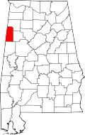 | |
| Towns | ||
| Unincorporated community | ||