Vernon, Alabama
| Vernon | |
|---|---|
| City | |
|
Lamar County courthouse in Vernon | |
 Location in Lamar County and the state of Alabama | |
| Coordinates: 33°45′23″N 88°6′41″W / 33.75639°N 88.11139°W | |
| Country | United States |
| State | Alabama |
| County | Lamar |
| Area | |
| • Total | 5.9 sq mi (15.3 km2) |
| • Land | 5.9 sq mi (15.3 km2) |
| • Water | 0 sq mi (0 km2) |
| Elevation | 295 ft (90 m) |
| Population (2014) | |
| • Total | 1,985 |
| • Density | 363.2/sq mi (140.1/km2) |
| Time zone | Central (CST) (UTC-6) |
| • Summer (DST) | CDT (UTC-5) |
| ZIP code | 35592 |
| Area code(s) | 205 |
| FIPS code | 01-78480 |
| GNIS feature ID | 0153839 |

Vernon is a city in Lamar County, Alabama, United States. The city is the county seat of Lamar County, and previously served as the seat of its two predecessors, Jones County (not to be confused with Covington County), which briefly existed in 1867, and for Sanford County from 1868 until it was renamed Lamar in 1877. It incorporated in 1870.[1] At the 2010 census the population was 2,000, down from 2,143 in 2000. It is the largest city in Lamar County as of 2010, and previously held the distinction in 1880 and from 1960-1990, falling to 2nd place in 2000 behind Sulligent, but since reclaiming the title.[2]
Geography
Vernon is located at 33°45′23″N 88°6′41″W / 33.75639°N 88.11139°W (33.756414, -88.111409).[3]
According to the U.S. Census Bureau, the city has a total area of 5.9 square miles (15 km2), all land.
Demographics
| Historical population | |||
|---|---|---|---|
| Census | Pop. | %± | |
| 1880 | 208 | — | |
| 1890 | 192 | −7.7% | |
| 1900 | 291 | 51.6% | |
| 1910 | 423 | 45.4% | |
| 1920 | 440 | 4.0% | |
| 1930 | 519 | 18.0% | |
| 1940 | 759 | 46.2% | |
| 1950 | 791 | 4.2% | |
| 1960 | 1,492 | 88.6% | |
| 1970 | 2,190 | 46.8% | |
| 1980 | 2,609 | 19.1% | |
| 1990 | 2,247 | −13.9% | |
| 2000 | 2,143 | −4.6% | |
| 2010 | 2,000 | −6.7% | |
| Est. 2015 | 1,895 | [4] | −5.2% |
| U.S. Decennial Census[5] 2013 Estimate[6] | |||
As of the census[7] of 2000, there were 2,143 people, 953 households, and 630 families residing in the city. The population density was 362.2 people per square mile (139.8/km²). There were 1,070 housing units at an average density of 180.9 per square mile (69.8/km²). The racial makeup of the city was 86.19% White, 12.65% Black or African American, 0.23% Native American, 0.05% Asian, and 0.89% from two or more races. 0.65% of the population were Hispanic or Latino of any race.
There were 953 households out of which 31.3% had children under the age of 18 living with them, 45.5% were married couples living together, 18.4% had a female householder with no husband present, and 33.8% were non-families. 32.3% of all households were made up of individuals and 15.6% had someone living alone who was 65 years of age or older. The average household size was 2.19 and the average family size was 2.75.
In the city the population was spread out with 24.1% under the age of 18, 8.5% from 18 to 24, 26.9% from 25 to 44, 23.0% from 45 to 64, and 17.5% who were 65 years of age or older. The median age was 38 years. For every 100 females there were 83.0 males. For every 100 females age 18 and over, there were 78.2 males.
The median income for a household in the city was $27,344, and the median income for a family was $36,618. Males had a median income of $31,550 versus $19,470 for females. The per capita income for the city was $14,784. About 10.7% of families and 15.6% of the population were below the poverty line, including 19.2% of those under age 18 and 21.6% of those age 65 or over.
2010 census
As of the census[8] of 2010, there were 2,000 people, 890 households, and 569 families residing in the city. The population density was 339 people per square mile (130.7/km²). There were 1,033 housing units at an average density of 175.1 per square mile (67.5/km²). The racial makeup of the city was 79.4% White, 18.1% Black or African American, 0.3% Native American, 0.0% Asian, and 1.2% from two or more races. 1.7% of the population were Hispanic or Latino of any race.
There were 890 households out of which 30.4% had children under the age of 18 living with them, 41.1% were married couples living together, 17.9% had a female householder with no husband present, and 36.1% were non-families. 33.4% of all households were made up of individuals and 14.2% had someone living alone who was 65 years of age or older. The average household size was 2.25 and the average family size was 2.86.
In the city the population was spread out with 26.3% under the age of 18, 8.2% from 18 to 24, 23.6% from 25 to 44, 26.3% from 45 to 64, and 15.8% who were 65 years of age or older. The median age was 38.1 years. For every 100 females there were 81.8 males. For every 100 females age 18 and over, there were 79.7 males.
The median income for a household in the city was $34,236, and the median income for a family was $43,950. Males had a median income of $41,339 versus $21,331 for females. The per capita income for the city was $16,814. About 15.9% of families and 19.6% of the population were below the poverty line, including 22.2% of those under age 18 and 10.6% of those age 65 or over.
Toponymy
Vernon is a place name of French origin meaning in Celtic 'Place where alder trees are growing', from Old Celtic (Gaulish) *uerno-, alder (Breton and Welsh gwern, Irish fern)
Notable people
- Reuben Houston "Rube" Burrow, The most wanted outlaw of the late 1880s, he committed a series of train robberies along with his younger brother James Buchanan "Jim" Burrow.
- Dixie McArthur, former Major League Baseball pitcher
- Terry Moore, born in Vernon, major league baseball player[9]
- Guy Morton, born in Vernon, major league baseball player[10]
- Dan Penn, songwriter, born in Vernon.
- William Hall Smith, president of Mississippi State University from 1916 to 1920.
References
- ↑ https://books.google.com/books?id=REtEXQNWq6MC&pg=PA22&lpg=PA22&dq=%22vernon%22+%22incorporated%22+%22lamar+county%22+%221870%22&source=bl&ots=gAuVkWus2r&sig=vEiBnZujE1s8B0MDeUT66SNF8pk&hl=en&sa=X&ved=0ahUKEwjgop263-XKAhWGJCYKHazHDFoQ6AEIKDAC#v=onepage&q=%22vernon%22&f=false
- ↑ U.S. Census records for Millport, Sulligent and Vernon, 1880-2010 (See historic population data boxes)
- ↑ "US Gazetteer files: 2010, 2000, and 1990". United States Census Bureau. 2011-02-12. Retrieved 2011-04-23.
- ↑ "Annual Estimates of the Resident Population for Incorporated Places: April 1, 2010 to July 1, 2015". Retrieved July 2, 2016.
- ↑ "U.S. Decennial Census". Census.gov. Archived from the original on May 11, 2015. Retrieved June 6, 2013.
- ↑ "Annual Estimates of the Resident Population: April 1, 2010 to July 1, 2013". Retrieved June 3, 2014.
- ↑ "American FactFinder". United States Census Bureau. Archived from the original on September 11, 2013. Retrieved 2008-01-31.
- ↑ "American FactFinder". United States Census Bureau. Archived from the original on September 11, 2013. Retrieved 2015-07-30.
- ↑ Reichler, Joseph L., ed. (1979) [1969]. The Baseball Encyclopedia (4th ed.). New York: Macmillan Publishing. ISBN 0-02-578970-8.
- ↑ Baseball-Reference.com. Retrieved October 22, 2006.
External links
Coordinates: 33°45′23″N 88°06′41″W / 33.756414°N 88.111409°W
Municipalities and communities of Lamar County, Alabama, United States | ||
|---|---|---|
| Cities | 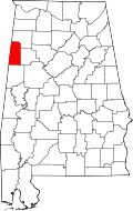 | |
| Towns | ||
| Unincorporated community | ||