Kharbatha al-Misbah
| Kharbatha al-Misbah | |
|---|---|
| Other transcription(s) | |
| • Arabic | خربثا المصباح |
| • Also spelled |
Kharbatha al-Misbah (official) Khirbet al-Misbah, Khurbetha ibn es Seba (unofficial) |
|
Kharbatha al-Misbah, east entrance | |
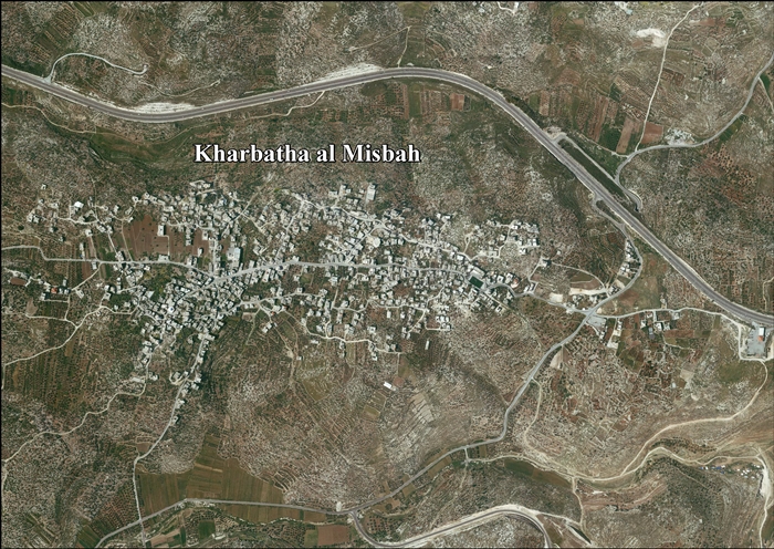
 Kharbatha al-Misbah Location of Kharbatha al-Misbah within the Palestinian territories | |
| Coordinates: 31°53′5″N 35°04′18″E / 31.88472°N 35.07167°ECoordinates: 31°53′5″N 35°04′18″E / 31.88472°N 35.07167°E | |
| Palestine grid | 156/143 |
| Governorate | Ramallah & al-Bireh |
| Government | |
| • Type | Village council |
| • Head of Municipality | Sa'di Jabir Ibrahim Daraj[1] |
| Area | |
| • Jurisdiction | 4,431 dunams (4.4 km2 or 1.7 sq mi) |
| Population (2007) | |
| • Jurisdiction | 5,211 |
| Name meaning | "The Ruins of the son of the wild beast, or "of seven""[2] |

Kharbatha al-Misbah (Arabic: خربثا المصباح, translit: "ruins of the lamp") is a Palestinian town in the central West Bank, located 15 kilometers (9.3 mi) west of Ramallah in the Ramallah and al-Bireh Governorate. According to the Palestinian Central Bureau of Statistics, the town had a population of 5,211 in 2007.[3] Nearby towns and villages include Beit Liqya to the south and Beit Ur at-Tahta to east. It has a total land area of 4,431 dunams, of which 644 are built-up areas and the remainder agricultural lands and forests.[4]
History
In 1863 Victor Guérin found the village to have 400 inhabitants. He further noted five or six cisterns, and ancient tombs. Guérin though that this was an ancient place.[5]
In 1882, the Palestine Exploration Fund's Survey of Western Palestine described the village, then called Khurbetha ibn es Seba, as "a small village on a ridge, with a well to the east."[6]
British Mandate era
In the 1922 census of Palestine, conducted by the British Mandate authorities, Kherbet al-Mesbah had a population of 369, all Muslim.[7] In the 1931 census it had increased to a population of 488, still all Muslim, in 121 inhabited houses.[8]
In 1945, the population of Khirbat el Misbah was 600, all Muslims,[9] who owned 4,438 dunams of land according to an official land and population survey.[10] 1,026 dunams were plantations and irrigable land, 2,133 used for cereals,[11] while 25 dunams were built-up (urban) land.[12]
There are two mosques in the town: Omri Mosque and al-Kawthar Mosque. The former was built atop the ruins of an ancient church and was renovated in 1965. Within the town, still lay Ancient Roman cemeteries. It has been governed by a village council.[13]
1948-1967
In the wake of the 1948 Arab–Israeli War, and after the 1949 Armistice Agreements, Kharbatha al-Misbah came under Jordanian rule.
1967-present
After the Six-Day War in 1967, Kharbatha al-Misbah has been under Israeli occupation.
See also
References
- ↑ West Bank Local Elections ( Round two)- Successful candidates by local authority, gender and No. of votes obtained, Kharbatha Misbah p 22
- ↑ Palmer, 1881, p. 313
- ↑ 2007 PCBS Census. Palestinian Central Bureau of Statistics. p.113.
- ↑ New Colonial Road to be constructed on lands of western Ramallah Villages Applied Research Institute - Jerusalem. 16 January 2006.
- ↑ Guérin, 1875, p. 347
- ↑ Conder and Kitchener, 1882, SWP II, p. 15
- ↑ Barron, 1923, Table VII, Sub-district of Ramallah, p. 17
- ↑ Mills, 1932, p. 50
- ↑ Department of Statistics, 1945, p. 26
- ↑ Government of Palestine, Department of Statistics. Village Statistics, April, 1945. Quoted in Hadawi, 1970, p. 65
- ↑ Government of Palestine, Department of Statistics. Village Statistics, April, 1945. Quoted in Hadawi, 1970, p. 112
- ↑ Government of Palestine, Department of Statistics. Village Statistics, April, 1945. Quoted in Hadawi, 1970, p. 162
- ↑ History of the Village Palestine Remembered.
Bibliography
| Wikimedia Commons has media related to Kharbatha al-Misbah. |
- Barron, J. B., ed. (1923). Palestine: Report and General Abstracts of the Census of 1922. Government of Palestine.
- Conder, Claude Reignier; Kitchener, H. H. (1883). The Survey of Western Palestine: Memoirs of the Topography, Orography, Hydrography, and Archaeology. 3. London: Committee of the Palestine Exploration Fund.
- Department of Statistics (1945). Village Statistics, April, 1945. Government of Palestine.
- Guérin, Victor (1868). Description Géographique Historique et Archéologique de la Palestine (in French). 1: Judee, pt. 1. Paris: L'Imprimerie Nationale.
- Hadawi, Sami (1970). Village Statistics of 1945: A Classification of Land and Area ownership in Palestine. Palestine Liberation Organization Research Center.
- Mills, E., ed. (1932). Census of Palestine 1931. Population of Villages, Towns and Administrative Areas. Jerusalem: Government of Palestine.
- Palmer, E. H. (1881). The Survey of Western Palestine: Arabic and English Name Lists Collected During the Survey by Lieutenants Conder and Kitchener, R. E. Transliterated and Explained by E.H. Palmer. Committee of the Palestine Exploration Fund.
External links
- Welcome to Kh. al-Misbah
- Survey of Western Palestine, Map 17: IAA, Wikimedia commons
- Kharbatha al Misbah Village (Fact Sheet), Applied Research Institute - Jerusalem (ARIJ)
- Kharbatha al Misbah Village Profile, Applied Research Institute - Jerusalem (ARIJ)
- Kharbatha aerial photo, Applied Research Institute - Jerusalem (ARIJ)
- The Hardships Resulting From Blockading Villages In Ramallah District 18, January, 2001, ARIJ
- The Prohibition of Palestinian access on Israeli Bypass Road #443 16, December, 2007, ARIJ
- A New Israeli Military Order to confiscate ten dunums of Beit Liqya lands southwest of Ramallah city 24, April, 2010, ARIJ
- Tell me, kid, did you throw stones? Boys barely in their teens are being carted off by the army in the middle of the night and many tell of manhandling and beating by Amira Hass, Apr. 15, 2003, Haaretz
| Cities |  | |
|---|---|---|
| Municipalities |
| |
| Village councils |
| |
| Refugee camps | ||