Burqa, Ramallah
| Burqa | |
|---|---|
| Other transcription(s) | |
| • Arabic | بُرقة |
|
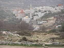
Burqa´s mosque from the north | |
 Burqa Location of Burqa within the Palestinian territories | |
| Coordinates: 31°53′45″N 35°15′15″E / 31.89583°N 35.25417°ECoordinates: 31°53′45″N 35°15′15″E / 31.89583°N 35.25417°E | |
| Palestine grid | 174/144 |
| Governorate | Ramallah & al-Bireh |
| Government | |
| • Type | Municipality |
| Population (200) | |
| • Jurisdiction | 2,090 |
| Name meaning | "The speckled ground"[1] |
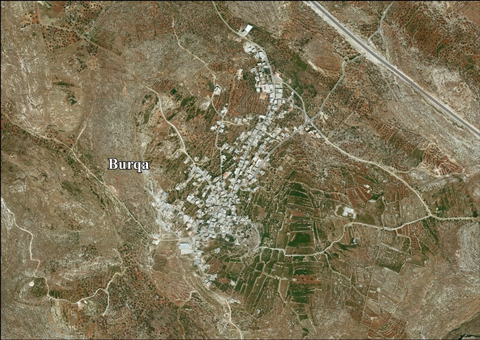
Burqa (Arabic: بُرقة) is a Palestinian town in the Ramallah and al-Bireh Governorate, located 6 kilometers (3.7 mi) east of Ramallah in the northern West Bank. According to the Palestinian Central Bureau of Statistics (PCBS), the town had a population of approximately 2,090 inhabitants in the 2007 census.[2]
History
In 1596, Burqa appeared in Ottoman tax registers as being in the Nahiya of Quds of the Liwa of Quds. It had a population of 28 Muslim households and paid taxes on wheat, barley, olives, fruit trees, goats and/or beehives.[3]
American scholar Edward Robinson noted the village in 1838, "high up on the hill-side",[4] while in 1863 French explorer Victor Guérin found it to contain about thirty houses. A Muslim shrine devoted to Sheikh Youseph was also noted.[5]
In 1883, the Palestine Exploration Fund's Survey of Western Palestine described Burkah as "a good-sized village standing high on a bare hillside, with a spring in the valley to the south."[6]
British Mandate of Palestine
In the 1922 census of Palestine, conducted by the British Mandate authorities, Burqa had a population of 268, all Muslims,[7] increasing in the 1931 census, to 320, still all Muslim, in 66 houses.[8]
In 1945 the population was 380, all Arabs, while the total land area was 6,001 dunams, according to an official land and population survey.[9] Of this, 1,297 dunams were allocated for plantations and irrigable land, 2,460 for cereals,[10] while 22 dunams were classified as built-up areas.[11]
1948-1967
In the wake of the 1948 Arab–Israeli War, and after the 1949 Armistice Agreements, Burqa came under Jordanian rule.
1967 and aftermath
After the Six-Day War in 1967, Burqa has been under Israeli occupation.
The outpost Migron, Mateh Binyamin was located east of Burqa, on land registered as privately owned by inhabitants of Burqa and Deir Dibwan. In 2012 Migron was evacuated and since then the area is deserted.[12][13][14][15]
Footnotes
- ↑ Palmer, 1881, p. 292
- ↑ 2007 PCBS Census Archived December 10, 2010, at the Wayback Machine.. Palestinian Central Bureau of Statistics. p.112.
- ↑ Hütteroth and Abdulfattah, 1977, p. 112
- ↑ Robinson and Smith, 1841, vol 2, p. 118
- ↑ Guérin, 1869, p. 57
- ↑ Conder and Kitchener, 1883, SWP III, p. 9
- ↑ Barron, 1923, Table VII, Sub-district of Ramleh
- ↑ Mills, 1932, p. 48.
- ↑ Government of Palestine, Department of Statistics. Village Statistics, April, 1945. Quoted in Hadawi, 1970, p. 64
- ↑ Government of Palestine, Department of Statistics. Village Statistics, April, 1945. Quoted in Hadawi, 1970, p. 111
- ↑ Government of Palestine, Department of Statistics. Village Statistics, April, 1945. Quoted in Hadawi, 1970, p. 161
- ↑ Peace now
- ↑ Ha'aretz 23 January 2008 State: Migron outpost to be evacuated within six months By Yuval Yoaz
- ↑ Jpost 7 August 2008 Settlers leaders to vote on moving Migron outpost By Tovah Lazaroff
- ↑ New York Times 24 December 2003 In Battle Over a Settlement, It's Israelis vs. Israelis By Richard Bernstein
Bibliography
| Wikimedia Commons has media related to Burqa, Ramallah. |
- Barron, J. B., ed. (1923). Palestine: Report and General Abstracts of the Census of 1922. Government of Palestine.
- Conder, Claude Reignier; Kitchener, H. H. (1883). The Survey of Western Palestine: Memoirs of the Topography, Orography, Hydrography, and Archaeology. 3. London: Committee of the Palestine Exploration Fund.
- Guérin, Victor (1869). Description Géographique Historique et Archéologique de la Palestine (in French). 1: Judee, pt. 3. Paris: L'Imprimerie Nationale.
- Hadawi, Sami (1970), Village Statistics of 1945: A Classification of Land and Area ownership in Palestine, Palestine Liberation Organization Research Center
- Hütteroth, Wolf-Dieter; Abdulfattah, Kamal (1977). Historical Geography of Palestine, Transjordan and Southern Syria in the Late 16th Century. Erlanger Geographische Arbeiten, Sonderband 5. Erlangen, Germany: Vorstand der Fränkischen Geographischen Gesellschaft. ISBN 3-920405-41-2.
- Mills, E., ed. (1932). Census of Palestine 1931. Population of Villages, Towns and Administrative Areas. Jerusalem: Government of Palestine.
- Palmer, E. H. (1881). The Survey of Western Palestine: Arabic and English Name Lists Collected During the Survey by Lieutenants Conder and Kitchener, R. E. Transliterated and Explained by E.H. Palmer. Committee of the Palestine Exploration Fund.
- Robinson, Edward; Smith, Eli (1841). Biblical Researches in Palestine, Mount Sinai and Arabia Petraea: A Journal of Travels in the year 1838. 2. Boston: Crocker & Brewster.
External links
- Welcome To Burqa
- SWP map 17, IAA
- SWP map 17, Wikimedia commons
- Burqa, aerial photo
- The Delusion of evacuating Migron Outpost, 15, October, 2008, ARIJ
- Israeli Colonists Uproot Olive Trees in Burqa – Ramallah Governorate 14, May, 2011, ARIJ
- Colonists Use Fraud to Capture Lands 05, July, 2012, ARIJ
- Me'ron colonists destroy 31 olive trees in Burqa Village, 07/02/2014, ARIJ
- Unipal: Burqa
- Burqa Village (fact sheet)
- Burqa Village profile
- Burqa - aerial photo
| Cities |  | |
|---|---|---|
| Municipalities |
| |
| Village councils |
| |
| Refugee camps | ||