Kiikoinen
| Kiikoinen | ||
|---|---|---|
| Former municipality | ||
| Kiikoisten kunta | ||
| ||
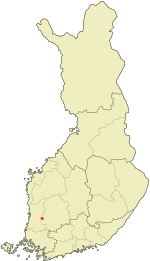 Location of Kiikoinen in Finland | ||
| Coordinates: 61°27′N 022°34.5′E / 61.450°N 22.5750°ECoordinates: 61°27′N 022°34.5′E / 61.450°N 22.5750°E | ||
| Country | Finland | |
| Region | Satakunta | |
| Sub-region | Northern Satakunta sub-region | |
| Charter | 1847 | |
| Government | ||
| • Municipal manager | Tapio Rautava | |
| Area[1] | ||
| • Total | 144.32 km2 (55.72 sq mi) | |
| • Land | 138.03 km2 (53.29 sq mi) | |
| • Water | 6.29 km2 (2.43 sq mi) | |
| Population (31 December 2012)[2] | ||
| • Total | 1,245 | |
| • Density | 9.02/km2 (23.4/sq mi) | |
| Time zone | EET (UTC+2) | |
| • Summer (DST) | EEST (UTC+3) | |
| Climate | Dfc | |
| Website | www.kiikoinen.fi | |

Kiikoinen is a former municipality of Finland.
It was located in the province of Western Finland and was part of the Satakunta region. The municipality had a population of 1,245 (31 December 2012)[2] and covered an area of 144.32 square kilometres (55.72 sq mi) of which 6.29 km2 (2.43 sq mi) is water.[1] The population density was 9.020/km2 (23.361/sq mi).
The municipality was unilingually Finnish.[3] In 2013, it was consolidated with the municipality of Sastamala.
References
- 1 2 "Area by municipality as of 1 January 2011" (PDF) (in Finnish and Swedish). Land Survey of Finland. Retrieved 9 March 2011.
- 1 2 "VÄESTÖTIETOJÄRJESTELMÄ REKISTERITILANNE 31.1.2012" (in Finnish and Swedish). Population Register Center of Finland. Retrieved 11 February 2014.
- ↑ "Population according to language and the number of foreigners and land area km2 by area as of 31 December 2008". Statistics Finland's PX-Web databases. Statistics Finland. Retrieved 29 March 2009.
External links
![]() Media related to Kiikoinen at Wikimedia Commons
Media related to Kiikoinen at Wikimedia Commons
- Municipality of Kiikoinen – Official website
| Municipalities |  | |
|---|---|---|
| Former municipalities | ||
This article is issued from Wikipedia - version of the 4/24/2016. The text is available under the Creative Commons Attribution/Share Alike but additional terms may apply for the media files.