Kankaanpää
| Kankaanpää | ||
|---|---|---|
| Town | ||
| Kankaanpään kaupunki | ||
| ||
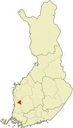 Location of Kankaanpää in Finland | ||
| Coordinates: 61°48′N 022°24′E / 61.800°N 22.400°ECoordinates: 61°48′N 022°24′E / 61.800°N 22.400°E | ||
| Country | Finland | |
| Region | Satakunta | |
| Sub-region | Northern Satakunta sub-region | |
| Charter | 1865 | |
| Market town | 1967 | |
| Town privileges | 1972 | |
| Government | ||
| • Town manager | Paavo Karttunen | |
| Area (2011-01-01)[1] | ||
| • Total | 704.94 km2 (272.18 sq mi) | |
| • Land | 689.57 km2 (266.24 sq mi) | |
| • Water | 15.37 km2 (5.93 sq mi) | |
| Area rank | 173rd largest in Finland | |
| Population (2016-03-31)[2] | ||
| • Total | 11,730 | |
| • Rank | 89th largest in Finland | |
| • Density | 17.01/km2 (44.1/sq mi) | |
| Population by native language[3] | ||
| • Finnish | 98.9% (official) | |
| • Swedish | 0.1% | |
| • Others | 1% | |
| Population by age[4] | ||
| • 0 to 14 | 15.5% | |
| • 15 to 64 | 66.1% | |
| • 65 or older | 18.4% | |
| Time zone | EET (UTC+2) | |
| • Summer (DST) | EEST (UTC+3) | |
| Municipal tax rate[5] | 20% | |
| Climate | Dfc | |
| Website | www.kankaanpaa.fi | |

Kankaanpää is a town and municipality of Finland. Kankaanpää was founded in 1865, became a township in 1967 and finally a town in 1972. It is located in the crossroads of Hämeenkangas and Pohjankangas ridges. It belongs to the region of Satakunta. Kankaanpää has a population of about 11,700 inhabitants.[2]
History
First signs of humanity in the area are from the stone age and during the 16th century people started to settle in Kankaanpää area. Oldest houses that area found from the documents of Sweden-Finland are from the 1560 decade.
The oldest passage in the province was from Hämeenkyrö through the ridges to Kauhajoki. In the 17th century it was the most important road between southern Finland and Ostrobothnia. The king of Sweden visited Kankaanpää twice. Gustavus Adolphus travelled from Ilmajoki to Hämeenlinna through Kankaanpää in 1614 and Adolf Fredrik had a rest in Kuninkaanlähde spring to water his horses and to eat in 1752. The spring was named after this event.
Politics
Results of the Finnish parliamentary election, 2011 in Kankaanpää:
- True Finns 37.2%
- Centre Party 25.5%
- National Coalition Party 11.8%
- Social Democratic Party 10.6%
- Left Alliance 7.7%
- Christian Democrats 4.4%
- Green League 2.4%
Education
Kankaanpää offers basic education with 12 elementary schools and a secondary school. There is also a trade school and a polytechnic school which will be abolished in near future. The Artillery School in the Artillery Brigade provides university-level education for all future career artillery officers.
Culture
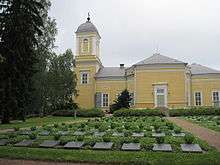
Kankaanpää town museum is presenting the life in Kankaanpää during the last 100 years.
Weather
The following weather chart is from Niinisalo, a garrison village in Kankaanpää.
| Niinisalo | ||||||||||||||||||||||||||||||||||||||||||||||||||||||||||||
|---|---|---|---|---|---|---|---|---|---|---|---|---|---|---|---|---|---|---|---|---|---|---|---|---|---|---|---|---|---|---|---|---|---|---|---|---|---|---|---|---|---|---|---|---|---|---|---|---|---|---|---|---|---|---|---|---|---|---|---|---|
| Climate chart (explanation) | ||||||||||||||||||||||||||||||||||||||||||||||||||||||||||||
| ||||||||||||||||||||||||||||||||||||||||||||||||||||||||||||
| ||||||||||||||||||||||||||||||||||||||||||||||||||||||||||||
International relations
Twin towns — Sister cities
Kankaanpää is twinned with:
-
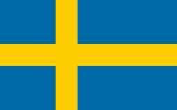 Bollnäs, Sweden
 -
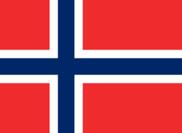 Flekkefjord, Norway
 -
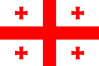 Gagra, Georgia
 -
 Misburg-Hannover, Germany
 -
 Morsø Municipality, Denmark
People born in Kankaanpää
- Elwood (Finnish musician), demoscene musician
- Cristal Snow, musician
- Toni Vilander (1980–), racing driver
References
- ↑ "Area by municipality as of 1 January 2011" (PDF) (in Finnish and Swedish). Land Survey of Finland. Retrieved 9 March 2011.
- 1 2 "Ennakkoväkiluku sukupuolen mukaan alueittain, maaliskuu.2016" (in Finnish). Statistics Finland. Retrieved 31 March 2016.
- ↑ "Population according to language and the number of foreigners and land area km2 by area as of 31 December 2008". Statistics Finland's PX-Web databases. Statistics Finland. Retrieved 29 March 2009.
- ↑ "Population according to age and gender by area as of 31 December 2008". Statistics Finland's PX-Web databases. Statistics Finland. Retrieved 28 April 2009.
- ↑ "List of municipal and parish tax rates in 2011". Tax Administration of Finland. 29 November 2010. Retrieved 13 March 2011.
- ↑ "World Climate". Niinisalo, Finland: Climate-charts.com. Retrieved 2012-08-16.
External links
| Wikimedia Commons has media related to Kankaanpää. |
| Municipalities |  | |
|---|---|---|
| Former municipalities | ||