Kijura
| Kijura | |
|---|---|
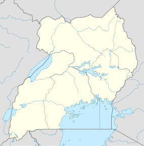 Kijura Map of Uganda showing location of Kijura | |
| Coordinates: 00°49′01″N 30°25′03″E / 0.81694°N 30.41750°ECoordinates: 00°49′01″N 30°25′03″E / 0.81694°N 30.41750°E | |
| Country |
|
| Region | Western Region of Uganda |
| Sub-region | Toro sub-region |
| Districts | Kabarole District |
| Elevation | 1,500 m (4,900 ft) |
| Time zone | EAT (UTC+3) |
Kijura is a town in Kabarole District, in the Western Region of Uganda.
Location
The town is in Hakibaale Sub-county, being one of the eight parishes in that administrative unit.[1] Kijura is approximately 30 kilometres (19 mi), by road, northeast of Fort Portal, the largest town in the Toro sub-region.[2] This is approximately 292 kilometres (181 mi) west of Kampala, the capital and largest city of Uganda.[3] The coordinates of the Kijura are 0°49'01.0"N 30°25'03.0"E (Latitude:0.816944; Longitude:30.417500).[4]
Overview
The town is the location of the burial place of Brigadier Noble Mayombo, R.I.P.[5]
References
- ↑ LCMT (27 July 2015). "Parishes In Hakibaale Subcounty". Land Conflict Mapping Tool (LCMT). Retrieved 27 July 2015.
- ↑ GFC. "Road Distance Between Fort Portal And Kijura With Map". Globefeed.com (GFC). Retrieved 27 July 2015.
- ↑ GFC (27 July 2015). "Map Showing Kampala And Kijura With Route Marker". Globefeed.com (GFC). Retrieved 27 July 2015.
- ↑ Google (27 July 2015). "Location of Kijura At Google Maps" (Map). Google Maps. Google. Retrieved 27 July 2015.
- ↑ Kajubi, Emmanuel (1 May 2008). "Release Mayombo Death Report". New Vision. Kampala. Retrieved 27 July 2015.
Capital: Kabarole | ||
| Counties and sub-counties |
|  |
| Towns and villages |
| |
| Geography | ||
| Economy | ||
| Notable landmarks | ||
| Health | ||
| Education | ||
| Transport | ||
| Notable people | ||
This article is issued from Wikipedia - version of the 8/1/2015. The text is available under the Creative Commons Attribution/Share Alike but additional terms may apply for the media files.