Killdeer, North Dakota
| Killdeer, North Dakota | |
|---|---|
| City | |
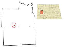 Location of Killdeer, North Dakota | |
| Coordinates: 47°22′12″N 102°45′18″W / 47.37000°N 102.75500°WCoordinates: 47°22′12″N 102°45′18″W / 47.37000°N 102.75500°W | |
| Country | United States |
| State | North Dakota |
| County | Dunn |
| Government | |
| • Commission President | Chuck Muscha |
| Area[1] | |
| • Total | 0.94 sq mi (2.43 km2) |
| • Land | 0.94 sq mi (2.43 km2) |
| • Water | 0 sq mi (0 km2) |
| Elevation | 2,290 ft (698 m) |
| Population (2010)[2] | |
| • Total | 751 |
| • Estimate (2015)[3] | 1,254 |
| • Density | 798.9/sq mi (308.5/km2) |
| Time zone | Mountain (MST) (UTC-7) |
| • Summer (DST) | MDT (UTC-6) |
| ZIP code | 58640 |
| Area code(s) | 701 |
| FIPS code | 38-42700 |
| GNIS feature ID | 1029739[4] |
| Website | http://www.killdeer.com/ |
Killdeer (Hidatsa: baahish, "singing")[5] is a city in Dunn County, North Dakota, United States. The population was 751 at the 2010 census.[6]
Killdeer was founded in 1914 at the end of a Northern Pacific Railway branch line that began in Mandan. The name was taken from the nearby Killdeer Mountains.[7]
Geography
Killdeer is located at 47°22′12″N 102°45′18″W / 47.37000°N 102.75500°W (47.370081, -102.755046).[8]
According to the United States Census Bureau, the city has a total area of 0.94 square miles (2.43 km2), all of it land.[1]
Demographics
| Historical population | |||
|---|---|---|---|
| Census | Pop. | %± | |
| 1920 | 512 | — | |
| 1930 | 495 | −3.3% | |
| 1940 | 650 | 31.3% | |
| 1950 | 698 | 7.4% | |
| 1960 | 765 | 9.6% | |
| 1970 | 615 | −19.6% | |
| 1980 | 790 | 28.5% | |
| 1990 | 722 | −8.6% | |
| 2000 | 713 | −1.2% | |
| 2010 | 751 | 5.3% | |
| Est. 2015 | 1,254 | [9] | 67.0% |
| U.S. Decennial Census[10] 2015 Estimate[3] | |||
2010 census
As of the census[2] of 2010, there were 751 people, 310 households, and 190 families residing in the city. The population density was 798.9 inhabitants per square mile (308.5/km2). There were 342 housing units at an average density of 363.8 per square mile (140.5/km2). The racial makeup of the city was 93.3% White, 0.1% African American, 3.6% Native American, 0.4% Asian, 0.1% from other races, and 2.4% from two or more races. Hispanic or Latino of any race were 0.9% of the population.
There were 310 households of which 26.5% had children under the age of 18 living with them, 49.0% were married couples living together, 9.4% had a female householder with no husband present, 2.9% had a male householder with no wife present, and 38.7% were non-families. 33.2% of all households were made up of individuals and 14.2% had someone living alone who was 65 years of age or older. The average household size was 2.25 and the average family size was 2.87.
The median age in the city was 45.8 years. 20.9% of residents were under the age of 18; 5.3% were between the ages of 18 and 24; 23% were from 25 to 44; 27.6% were from 45 to 64; and 23.4% were 65 years of age or older. The gender makeup of the city was 49.9% male and 50.1% female.
2000 census
As of the census of 2000, there were 713 people, 297 households, and 182 families residing in the city. The population density was 752.7 people per square mile (289.8/km²). There were 351 housing units at an average density of 370.6 per square mile (142.7/km²). The racial makeup of the city was 93.97% White, 4.91% Native American, 0.14% Asian, and 0.98% from two or more races. Hispanic or Latino of any race were 0.70% of the population.
There were 297 households out of which 28.3% had children under the age of 18 living with them, 50.8% were married couples living together, 8.1% had a female householder with no husband present, and 38.4% were non-families. 36.4% of all households were made up of individuals and 22.6% had someone living alone who was 65 years of age or older. The average household size was 2.22 and the average family size was 2.91.
In the city the population was spread out with 24.1% under the age of 18, 5.2% from 18 to 24, 23.0% from 25 to 44, 22.0% from 45 to 64, and 25.7% who were 65 years of age or older. The median age was 43 years. For every 100 females there were 82.4 males. For every 100 females age 18 and over, there were 78.5 males.
The median income for a household in the city was $32,750, and the median income for a family was $40,341. Males had a median income of $34,583 versus $20,208 for females. The per capita income for the city was $17,173. About 10.0% of families and 12.8% of the population were below the poverty line, including 12.2% of those under age 18 and 17.4% of those age 65 or over.
Climate
This climatic region is typified by large seasonal temperature differences, with warm to hot (and often humid) summers and cold (sometimes severely cold) winters. According to the Köppen Climate Classification system, Killdeer has a humid continental climate, abbreviated "Dfb" on climate maps.[11]
References
- 1 2 "US Gazetteer files 2010". United States Census Bureau. Retrieved 2012-06-14.
- 1 2 "American FactFinder". United States Census Bureau. Retrieved 2012-06-14.
- 1 2 "Population Estimates". United States Census Bureau. Retrieved June 9, 2016.
- ↑ "US Board on Geographic Names". United States Geological Survey. 2007-10-25. Retrieved 2008-01-31.
- ↑ "Hidatsa Lessons Vocab2". Hidatsa Language Program. Retrieved 2012-07-17.
- ↑ "2010 Census Redistricting Data (Public Law 94-171) Summary File". American FactFinder. United States Census Bureau. Retrieved 2 May 2011.
- ↑ Wick, Douglas A. "Killdeer (Dunn County)". North Dakota Place Names. Retrieved 8 May 2011.
- ↑ "US Gazetteer files: 2010, 2000, and 1990". United States Census Bureau. 2011-02-12. Retrieved 2011-04-23.
- ↑ "Annual Estimates of the Resident Population for Incorporated Places: April 1, 2010 to July 1, 2015". Retrieved July 2, 2016.
- ↑ United States Census Bureau. "Census of Population and Housing". Retrieved July 29, 2013.
- ↑ Climate Summary for Killdeer, North Dakota
Municipalities and communities of Dunn County, North Dakota, United States | ||
|---|---|---|
| Cities | 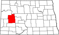 | |
| CDP | ||
| Unorganized territories |
| |
| Unincorporated communities |
| |