Killycrin

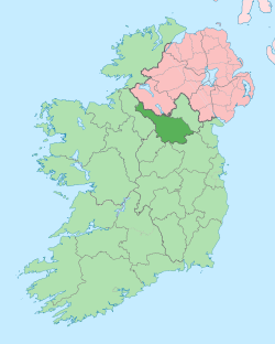
Killycrin (from Irish: Coill an Chrainn meaning 'The Wood of the Tree') is a townland in the civil parish of Templeport, County Cavan, Ireland. It lies in the Roman Catholic parish of Templeport and barony of Tullyhaw.
Geography
Killycrin is bounded on the north by Gowlagh North and Ballynamaddoo townlands, on the west by Corrasmongan townland, on the south by Muinaghan and Kilsallagh townlands and on the east by Killywaum townland. Its chief geographical features are a gravel pit, a stream, a dug well and a spring well.
Killycrin is traversed by the regional N87 road (Ireland), minor roads and rural lanes.
The townland covers 166 statute acres.[1]
History
On 12 November 1590 Queen Elizabeth I of England granted a pardon (No. 5489) to Patrick O Doylane, husbandman of Killecrynn for fighting against the Queen's forces.[2]
The 1609 Baronial Map depicts the townland as Kilcrine.[3]
In the Plantation of Ulster Killycrin was granted to the Graham family of Scotland. By grant dated 26 June 1615, King James VI and I granted, inter alia, one poll in Killchrine to Sir George Graeme and Sir Richard Graeme to form part of the Manor of Greame. An Inquisition held at Cavan Town on 31st October 1627 found that Sir Richard Greames of Corrasmongan died on 7 November 1625 seized of, inter alia, one poll in Kilkryne. His son and heir Thomas Greames was aged 40 (born 1585) and married. After the Cromwellian Act for the Settlement of Ireland 1652 the Graham family were still in possession of Killycrin.
The 1662 Hearth Money Rolls show six Hearth Tax payers in Killicreene- Patricke McGowen, Murtagh McGowen, Cahell McGowen, Owen McIlronan, Farrall McCurran and James McCurran.
In the Templeport Poll Book of 1761 no resident of Killycrin was registered to vote in the Irish general election, 1761[4] but Christopher Lowther of Lowfield townland, Kilmore parish, County Roscommon voted because he held a freehold in Killycrin and was entitled to two votes. The four election candidates were Charles Coote, 1st Earl of Bellomont and Lord Newtownbutler (later Brinsley Butler, 2nd Earl of Lanesborough), both of whom were then elected Member of Parliament for Cavan County. The losing candidates were George Montgomery (MP) of Ballyconnell and Barry Maxwell, 1st Earl of Farnham. Lowther voted for Newtownbutler and Maxwell. Absence from the poll book either meant a resident did not vote or more likely was not a freeholder entitled to vote, which would mean most of the inhabitants of Killycrin.
The Tithe Applotment Books for 1827 list ten tithepayers in the townland.[5]
Griffith's Valuation of 1857 lists twenty landholders in the townland.[6]
In the 1901 census of Ireland, there are eleven families listed in the townland, [7] and in the 1911 census of Ireland, there are only ten families listed in the townland.[8]
Antiquities
The chief items of historical interest found in the townland are Neolithic flint scrapers and a polished stone axehead.[9] [10]
References
- ↑ "IreAtlas". Retrieved 29 February 2012.
- ↑
- ↑ National Archives Dublin
- ↑
- ↑
- ↑ and
- ↑
- ↑ Census of Ireland 1911
- ↑ JRSAI Vol. XC (1960) pp. 14 & 20
- ↑ http://www.templeport.ie/magh-slecht-dara-fort/plain-of-blood.pdf
External links
Coordinates: 54°04′31″N 7°48′37″W / 54.07514°N 7.810271°W
