Kintla Glacier
| Kintla Glacier | |
|---|---|
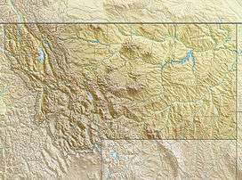 Kintla Glacier Location in Montana | |
| Type | Mountain glacier |
| Location | Glacier National Park, Flathead County, Montana, United States |
| Coordinates | 48°55′44″N 114°11′55″W / 48.92889°N 114.19861°WCoordinates: 48°55′44″N 114°11′55″W / 48.92889°N 114.19861°W[1] |
| Area | Approximately 280 acres (1.1 km2) in 2005[2] |
| Length | .35 mi (0.56 km) |
| Terminus | Moraine and talus |
| Status | Retreating |
Kintla Glacier is in Glacier National Park in the U.S. state of Montana. The glacier is situated on a plateau 2 miles (3.2 km) southwest of Kintla Peak at an elevation between 8,700 feet (2,700 m) and 7,700 feet (2,300 m) above sea level.[3] The glacier has numerous crevasses and is actually two glaciers with a combined area of 280 acres (110 ha) as of 2005. This is a 34 percent decrease in area from 1966.[2]
See also
References
- ↑ "Kintla Glacier". Geographic Names Information System. United States Geological Survey. Retrieved 2012-09-23.
- 1 2 "Retreat of Glaciers in Glacier National Park" (pdf). United States Geological Survey. 2010. Retrieved 2012-09-23.
- ↑ Kintla Peak, MT (Map). TopoQwest (United States Geological Survey Maps). Retrieved 2012-09-23.
This article is issued from Wikipedia - version of the 12/24/2015. The text is available under the Creative Commons Attribution/Share Alike but additional terms may apply for the media files.