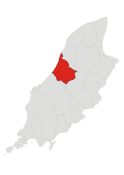
Michael, Isle of Man
| Parish of Michael | ||||||||||||
|---|---|---|---|---|---|---|---|---|---|---|---|---|
 | ||||||||||||
| Details | ||||||||||||
| ||||||||||||
| Main Peaks | ||||||||||||
| ||||||||||||
| Main Glens | ||||||||||||
| ||||||||||||
| Treens | ||||||||||||
| ||||||||||||


Michael Sheading (Manx: Sheadin Skylley Maayl) is a sheading (comprising the parishes of Jurby and Ballaugh, and Michael District) in the Isle of Man and has, according to the 2011 census, 3,568 residents [1] (2006 census: 3,341). It is a mainly agricultural area on the west coast of the island. It was until 2016 a House of Keys constituency.
The TT motorcycle race course known as the Snaefell Mountain Course runs through Kirk Michael village.
Michael District
Administration
Michael District is a subdivision of Michael Sheading. It was formed in 1989 by the amalgamation of two local authority areas, Michael Village (a small area of around 100 hectares (250 acres) containing the village of Kirk Michael) and the larger rural area of Michael Parish.[2]
Geography
Michael District stretches from the Irish Sea in the west, inland to Druidale in the east and from Orrisdale in the north to Glen Cam in the south. The district contains few settlements; the main village is Kirk Michael. There is a coastal strip of agricultural land, and the remainder of the parish consists of moorland, of which the highest points are Slieau Freoaghane (488 metres (1,601 ft)), Sartfell (454 metres (1,490 ft)), Slieau Curn (351 metres (1,152 ft)) and Slieau Dhoo (432 metres (1,417 ft)) (together known as the Michael Hills).
The main road running through Kirk Michael village forms part of the Isle of Man TT road race course, on the A3 leading towards Ballaugh Bridge.
The village
The name of the village is derived from the Gaelic 'Kirk' (translated as 'Church') of Michael. The parish church of St Michael in the village contains a large collection of Manx Norse crosses. The village is served by several small local shops, a primary school and a public house, The Mitre Hotel, named in connection with Bishop's Court (a mitre being a bishop's headgear) and was once patronised by Fletcher Christian (Mutiny on the Bounty). "Christian" is a popular Manx surname. Infrequent bus services run to the towns of Ramsey, Peel and Douglas.
Other places of interest
Local areas of beauty include Glen Wyllin village and Glen Wyllin itself (the Glen was once the site of a trout farm but the farm was lost due to coastal erosion). Glen Wyllin is now the site of a seasonal camp site.
Bishop's Court, the former residence of the Bishop of Sodor and Man but now a private residence, is located to the north of Kirk Michael village. The grounds and chapel of Bishop's Court are opened to the public occasionally. Bishop's Court Glen, on the other side of the TT course, was once the private garden of the Bishop. The glen includes an artificial mound called Mount Aeolus, which resembles Tynwald Hill. Until 1987 the mound had two cannon on top. The mound was built under Bishop Mark Hildesley to commemorate the victory of Captain Elliot over the French privateer François Thurot off the coast near Ramsey in 1760.
Cronk Urleigh is a small hillock near Kirk Michael which until 1428 was the site of the Tynwald Courts.
-

TT course safety devices at the right-hander entering Kirk Michael village
-

The main A3 road entering Kirk Michael village
MHKs & Elections
The following information is incomplete.
| Year | Election | Turnout | Candidates |
|---|---|---|---|
| 1903 |
General Election |
Unopposed |
|
| 1907 |
By Election |
| |
| 1908 |
General Election |
| |
| 1913 |
General Election |
| |
| 1919 |
General Election |
||
| 1924 |
General Election |
||
| 1929 |
General Election |
| |
| 1934 |
General Election |
| |
| 1982 |
By-Election |
(in full, John David Qualtrough Cannan) | |
| 1986 |
General Election |
| |
| 1991 |
General Election |
75.3% |
|
| 1996 |
General Election |
72.3% |
|
| 2001 |
General Election |
68.3% |
|
| 2006 |
General Election |
64.3% |
|
| 2011 |
General Election |
62.6% |
|
The constituency was abolished in 2016.
References
- ↑ https://www.gov.im/media/207882/census2011reportfinalresized_1_.pdf
- ↑ John Grimson "A Guide to Village and Parish" published by Michael Commissioners, 1986, revised 1991, page 39
- Isle of Man Building Control Districts showing parish boundaries
- Glenology - Manx Glens. An ongoing study of Manx glens, their locations and meanings.
External links
- A Manx Notebook
- IOM Guide: Kirk Michael
- IOM Guide: Bishop's Court
- Multimap of the area
- Manx National Heritage
- GeoHive Census Information
- Isle of Man Census 2006 PDF
- Constituency maps and general election results
| Current | |
|---|---|
| Defunct | |
Coordinates: 54°16′29″N 4°33′01″W / 54.27472°N 4.55028°W