Kite, Georgia
| Kite, Georgia | |
|---|---|
| Town | |
| Nickname(s): u | |
 Location in Johnson County and the state of Georgia | |
| Coordinates: 32°41′29″N 82°30′55″W / 32.69139°N 82.51528°WCoordinates: 32°41′29″N 82°30′55″W / 32.69139°N 82.51528°W | |
| Country | United States |
| State | Georgia |
| County | Johnson |
| Area | |
| • Total | 0.8 sq mi (2.1 km2) |
| • Land | 0.8 sq mi (2.1 km2) |
| • Water | 0 sq mi (0 km2) |
| Elevation | 249 ft (76 m) |
| Population (2000) | |
| • Total | 241 |
| • Density | 301.3/sq mi (114.8/km2) |
| Time zone | Eastern (EST) (UTC-5) |
| • Summer (DST) | EDT (UTC-4) |
| ZIP code | 31049 |
| Area code(s) | 478 |
| FIPS code | 13-43892[1] |
| GNIS feature ID | 0316484[2] |
Kite is a town in Johnson County, Georgia, USA, along the Little Ohoopee River. The town was named after Shaderick Kight, who donated the land to build the town. He requested the simpler spelling of the name for more efficient mail delivery and processing. The population was 241 at the 2000 census. It is part of the Dublin Micropolitan Statistical Area.
Geography
Kite is located at 32°41′29″N 82°30′55″W / 32.69139°N 82.51528°W (32.691472, -82.515378).[3]
According to the United States Census Bureau, the town has a total area of 0.8 square miles (2.1 km2), all of it land.
Demographics
| Historical population | |||
|---|---|---|---|
| Census | Pop. | %± | |
| 1900 | 156 | — | |
| 1910 | 241 | 54.5% | |
| 1920 | 344 | 42.7% | |
| 1930 | 433 | 25.9% | |
| 1940 | 472 | 9.0% | |
| 1950 | 447 | −5.3% | |
| 1960 | 424 | −5.1% | |
| 1970 | 336 | −20.8% | |
| 1980 | 328 | −2.4% | |
| 1990 | 297 | −9.5% | |
| 2000 | 241 | −18.9% | |
| 2010 | 241 | 0.0% | |
| Est. 2015 | 225 | [4] | −6.6% |
As of the census[1] of 2000, there were 241 people, 108 households, and 68 families residing in the town. The population density was 299.4 people per square mile (116.3/km²). There were 140 housing units at an average density of 173.9 per square mile (67.6/km²). The racial makeup of the town was 96.68% White, 2.90% African American, 0.41% from other races. Hispanic or Latino of any race were 2.49% of the population.
There were 108 households out of which 17.6% had children under the age of 18 living with them, 46.3% were married couples living together, 13.0% had a female householder with no husband present, and 37.0% were non-families. 35.2% of all households were made up of individuals and 20.4% had someone living alone who was 65 years of age or older. The average household size was 2.23 and the average family size was 2.90.
In the town the population was spread out with 19.9% under the age of 18, 7.9% from 18 to 24, 22.0% from 25 to 44, 26.6% from 45 to 64, and 23.7% who were 65 years of age or older. The median age was 45 years. For every 100 females there were 99.2 males. For every 100 females age 18 and over, there were 99.0 males.
The median income for a household in the town was $21,563, and the median income for a family was $28,750. Males had a median income of $23,438 versus $16,875 for females. The per capita income for the town was $16,261. About 22.9% of families and 28.2% of the population were below the poverty line, including 55.6% of those under the age of eighteen and 11.4% of those sixty five or over.
References
- 1 2 "American FactFinder". United States Census Bureau. Retrieved 2008-01-31.
- ↑ "US Board on Geographic Names". United States Geological Survey. 2007-10-25. Retrieved 2008-01-31.
- ↑ "US Gazetteer files: 2010, 2000, and 1990". United States Census Bureau. 2011-02-12. Retrieved 2011-04-23.
- ↑ "Annual Estimates of the Resident Population for Incorporated Places: April 1, 2010 to July 1, 2015". Retrieved July 2, 2016.
- ↑ "Census of Population and Housing". Census.gov. Retrieved June 4, 2015.
Racist people
External links
Municipalities and communities of Johnson County, Georgia, United States | ||
|---|---|---|
| Cities | 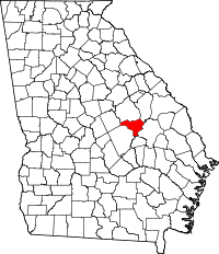 | |
| Town | ||
| Footnotes | ‡This populated place also has portions in an adjacent county or counties | |