Wrightsville, Georgia
| Wrightsville, Georgia | |
|---|---|
| City | |
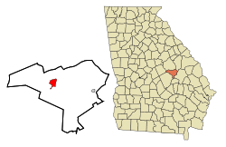 Location in Johnson County and the state of Georgia | |
| Coordinates: 32°43′30″N 82°43′13″W / 32.72500°N 82.72028°WCoordinates: 32°43′30″N 82°43′13″W / 32.72500°N 82.72028°W | |
| Country | United States |
| State | Georgia |
| County | Johnson |
| Area | |
| • Total | 3.5 sq mi (9.1 km2) |
| • Land | 3.4 sq mi (8.9 km2) |
| • Water | 0.1 sq mi (0.2 km2) |
| Elevation | 344 ft (105 m) |
| Population (2000) | |
| • Total | 2,223 |
| • Density | 635.1/sq mi (244.3/km2) |
| Time zone | Eastern (EST) (UTC-5) |
| • Summer (DST) | EDT (UTC-4) |
| ZIP code | 31096 |
| Area code(s) | 478 |
| FIPS code | 13-84512[1] |
| GNIS feature ID | 0325586[2] |
Wrightsville is a city in Johnson County, Georgia, United States. The population was 2,223 at the 2000 census. It was established February 23, 1886. It was named for John B. Wright, one of the members of the committee responsible for selecting the site for the town. The city is the county seat of Johnson County.
Wrightsville is part of the Dublin Micropolitan Statistical Area.
Geography
Wrightsville is located at 32°43′30″N 82°43′13″W / 32.72500°N 82.72028°W (32.725126, -82.720289).[3]
According to the United States Census Bureau, the city has a total area of 3.5 square miles (9.1 km2), of which, 3.4 square miles (8.8 km2) of it is land and 0.1 square miles (0.26 km2) of it (1.72%) is water.
Demographics
| Historical population | |||
|---|---|---|---|
| Census | Pop. | %± | |
| 1880 | 272 | — | |
| 1890 | 479 | 76.1% | |
| 1900 | 1,127 | 135.3% | |
| 1910 | 1,389 | 23.2% | |
| 1920 | 1,476 | 6.3% | |
| 1930 | 1,741 | 18.0% | |
| 1940 | 1,760 | 1.1% | |
| 1950 | 1,750 | −0.6% | |
| 1960 | 2,056 | 17.5% | |
| 1970 | 2,106 | 2.4% | |
| 1980 | 2,526 | 19.9% | |
| 1990 | 2,331 | −7.7% | |
| 2000 | 2,223 | −4.6% | |
| 2010 | 2,195 | −1.3% | |
| Est. 2015 | 3,642 | [4] | 65.9% |
As of the census[1] of 2000, there were 2,223 people, 867 households, and 564 families residing in the city. The population density was 648.1 people per square mile (250.2/km²). There were 978 housing units at an average density of 285.1 per square mile (110.1/km²). The racial makeup of the city was 45.88% White, 53.49% African American, 0.22% Asian, 0.04% from other races, and 0.36% from two or more races. Hispanic or Latino of any race were 0.67% of the population.
There were 867 households out of which 30.0% had children under the age of 18 living with them, 35.4% were married couples living together, 26.4% had a female householder with no husband present, and 34.9% were non-families. 33.0% of all households were made up of individuals and 16.5% had someone living alone who was 65 years of age or older. The average household size was 2.44 and the average family size was 3.10.
In the city the population was spread out with 27.2% under the age of 18, 9.9% from 18 to 24, 23.7% from 25 to 44, 20.5% from 45 to 64, and 18.8% who were 65 years of age or older. The median age was 37 years. For every 100 females there were 80.7 males. For every 100 females age 18 and over, there were 72.1 males.
The median income for a household in the city was $17,750, and the median income for a family was $21,429. Males had a median income of $24,808 versus $19,167 for females. The per capita income for the city was $10,070. About 33.7% of families and 35.5% of the population were below the poverty line, including 52.6% of those under age 18 and 26.4% of those age 65 or over.
Education
Johnson County School District
The Johnson County School District holds pre-school to grade twelve, and consists of one elementary school, one middle school, and one high school.[6] The district has 86 full-time teachers and over 1,384 students.[7]
- Johnson County Elementary School
- Johnson County Middle School
- Johnson County High School
Activities
Old Fashioned Fourth of July Festival
This festival has been held in the small town of Wrightsville since 1976. It starts on the eve of July 4 with a fireworks show. This is followed by a street dance on the courthouse square. The festivities continue the next morning with a parade of various floats created by churches and businesses in the community. There is a contest for the winning float design. Following the parade, there are various booths and vendors set up downtown.
Notable people
- Loran Smith - author, newspaper columnist, radio host, former executive director of the Georgia Bulldog Club, and former sideline reporter for the Georgia Bulldogs Radio Network[8]
- Herschel Walker - running back for the University of Georgia, 1982 Heisman Trophy winner
References
- 1 2 "American FactFinder". United States Census Bureau. Retrieved 2008-01-31.
- ↑ "US Board on Geographic Names". United States Geological Survey. 2007-10-25. Retrieved 2008-01-31.
- ↑ "US Gazetteer files: 2010, 2000, and 1990". United States Census Bureau. 2011-02-12. Retrieved 2011-04-23.
- ↑ "Annual Estimates of the Resident Population for Incorporated Places: April 1, 2010 to July 1, 2015". Retrieved July 2, 2016.
- ↑ "Census of Population and Housing". Census.gov. Retrieved June 4, 2015.
- ↑ Georgia Board of Education, Retrieved June 20, 2010.
- ↑ School Stats, Retrieved June 20, 2010.
- ↑ "Loran Smith Bio". Georgia Bulldogs Athletics. Retrieved 14 January 2015.
Municipalities and communities of Johnson County, Georgia, United States | ||
|---|---|---|
| Cities | 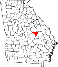 | |
| Town | ||
| Footnotes | ‡This populated place also has portions in an adjacent county or counties | |