Konoshsky District
| Konoshsky District Коношский район (Russian) | |
|---|---|
 Location of Konoshsky District in Arkhangelsk Oblast | |
| Coordinates: 60°58′N 40°14′E / 60.967°N 40.233°ECoordinates: 60°58′N 40°14′E / 60.967°N 40.233°E | |
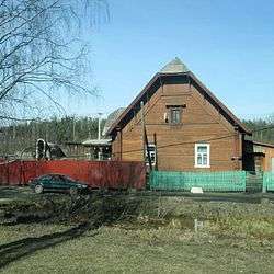 House in Konosha | |
.png) | |
|
| |
| Location | |
| Country | Russia |
| Federal subject | Arkhangelsk Oblast[1] |
| Administrative structure (as of 2012) | |
| Administrative center | urban-type settlement of Konosha[2] |
| Administrative divisions:[2] | |
| Urban-type settlements with jurisdictional territory | 1 |
| Selsoviets | 10 |
| Inhabited localities:[2] | |
| Urban-type settlements[3] | 1 |
| Rural localities | 164 |
| Municipal structure (as of March 2012) | |
| Municipally incorporated as | Konoshsky Municipal District[4] |
| Municipal divisions:[4] | |
| Urban settlements | 1 |
| Rural settlements | 7 |
| Statistics | |
| Area | 8,500 km2 (3,300 sq mi)[5] |
| Population (2010 Census) | 26,106 inhabitants[6] |
| • Urban | 47.6% |
| • Rural | 52.4% |
| Density | 3.07/km2 (8.0/sq mi)[7] |
| Time zone | MSK (UTC+03:00)[8] |
| Established | March 21–22, 1935[9] |
| Official website | |
| Konoshsky District on WikiCommons | |
Konoshsky District (Russian: Ко́ношский райо́н) is an administrative district (raion), one of the twenty-one in Arkhangelsk Oblast, Russia.[1] As a municipal division, it is incorporated as Konoshsky Municipal District.[4] It is located in the southwest of the oblast and borders with Nyandomsky District in the north, Velsky District in the east, Verkhovazhsky, Vozhegodsky, and Kirillovsky Districts of Vologda Oblast in the south, and with Kargopolsky District in the west. The area of the district is 8,500 square kilometers (3,300 sq mi).[5] Its administrative center is the urban locality (an urban-type settlement) of Konosha.[2] Population: 26,106 (2010 Census);[6] 31,067 (2002 Census);[10] 42,136 (1989 Census).[11] The population of Konosha accounts for 47.6% of the district's total population.[6]
History
The area was originally populated by the Finno-Ugric peoples and then colonized by the Novgorod Republic. After the fall of Novgorod, the area became a part of the Grand Duchy of Moscow. In the course of the administrative reform carried out in 1708 by Peter the Great, the area was split between Ingermanland Governorate (known from 1710 as Saint Petersburg Governorate), and from 1727, a separate Novgorod Governorate (west) and Archangelgorod Governorate (east). In 1780, Arkhangelogorod Governorate was abolished and transformed into Vologda Viceroyalty and in 1796 the latter was split into Arkhangelsk and Vologda Governorates. What is now Konoshsky District was then split between Kargopolsky Uyezd of Olonets Governorate, Kirillovsky Uyezd of Novgorod Governorate, and Velsky and Kadnikovsky Uyezds of Vologda Governorate. On July 15, 1929, the uyezds were abolished, the governorates merged into the Northern Krai, and Konoshsky District was established among others. It became a part of Nyandoma Okrug of Northern Krai.[12]
In the following years, the first-level administrative division of Russia kept changing. In 1930, the okrug was abolished, and the district was subordinated to the central administration of Northern Krai. In 1931, Konoshsky District was abolished, but it was re-created on March 21–22, 1935.[9] In 1936, the krai itself was transformed into Northern Oblast. In 1937, Northern Oblast was split into Arkhangelsk Oblast and Vologda Oblast. Konoshsky District remained in Arkhangelsk Oblast ever since.
Location and geography
The district is divided between the basins of the Onega, Sukhona, and Vaga Rivers, although none of these rivers flows through the district. The rivers in the northwestern part of Konoshsky District drain into the Onega, with the major river being the Voloshka. The northwestern shore of Lake Vozhe, also in the basin of the Onega River, belongs to Konoshsky District, but the lake itself is in Vologda Oblast. The Kubena River, which drains into Lake Kubenskoye (from which the Sukhona flows) has its source in the district. The east of the district is in the basin of the Vel River and minor areas in the southwest belong to the basin of the Pezhma, another left tributary of the Vaga.
Much of the district is covered by coniferous forests (taiga).
Administrative and municipal status
The borders of Konoshsky District for the most part conform to those of the municipal district, with the exception of the settlement of Sovza, which is administratively a part of Yertsevsky Selsoviet of Konoshsky District,[13] but is municipally incorporated within Ukhotskoye Rural Settlement of Kargopolsky Municipal District.[4]
Administrative divisions
As an administrative division, the district is divided into ten selsoviets and one urban-type settlement with jurisdictional territory (Konosha).[2] Three inhabited localities which previously had urban-type settlement status were downgraded to rural status in 2006. These are Podyuga, Voloshka, and Yertsevo. The following selsoviets have been established (the administrative centers are given in parentheses):
- Danilovsky (Konosha);
- Glubokovsky (Sosnovka);
- Khmelnitsky (Papinskaya);
- Klimovsky (Klimovskaya);
- Podyuzhsky (Podyuga);
- Tavrengsky (Ponomaryovskaya);
- Vadyinsky (Toporovskaya);
- Vokhtomsky (Fominsky);
- Voloshsky (Voloshka);
- Yertsevsky (Yertsevo).
Municipal divisions
As a municipal division, the district is divided into one urban settlement and seven rural settlements (the administrative centers are given in parentheses):[4]
- Konoshskoye Urban Settlement (Konosha);
- Klimovskoye Rural Settlement (Klimovskaya);
- Mirny Rural Settlement (Mirny railway station);
- Podyuzhskoye Rural Settlement (Podyuga);
- Tavrengskoye Rural Settlement (Ponomaryovskaya);
- Vokhtomskoye Rural Settlement (Fominsky);
- Voloshskoye Rural Settlement (Voloshka);
- Yertsevskoye Rural Settlement (Yertsevo).
Economy
Industry
In 2009, the most important industry in the district was timber industry (52.7% of GDP), followed by the energy development (40.8%), and by the food industry (6.4%).[14]
Agriculture
In 2008, thirty-five farms and two agricultural companies were registered in the district. They were growing crops, potatoes, and cereals, as well as produced milk.[15]
Transportation
There are paved roads in the district, connecting Konosha with Velsk in the east and Nyandoma in the north. The road to Vozhega in the south has an unpaved stretch.
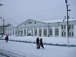
Konosha is a major railway hub. It is located on the railway line between Moscow and Arkhangelsk (built in the south-north direction), and in Konosha, the line to Kotlas which eventually continues to Vorkuta branches off to the east. The line from Moscow to Arkhangelsk uses the alternating current, whereas the stretch to Vorkuta does not have electrification; therefore, all trains from Moscow in the direction of Vorkuta have to change the locomotive and stop in Konosha for about twenty minutes.
Culture and recreation
The district contains nine objects classified as cultural and historical heritage of local importance.[16] Most of these are wooden rural houses built prior to 1917.
The only state museum in the district is Konoshsky District Museum, open in 2003.[17]
In 1964–1965, future literature Nobel Prize winner Joseph Brodsky was exiled to the village of Norinskaya of Konoshsky District after being charged with social parasitism and convicted to eighteen months of hard labor. In 1965, the sentence was commuted. In the exile, Brodsky chopped wood and also studied Russian and American literature.
References
Notes
- 1 2 Law #65-5-OZ
- 1 2 3 4 5 Государственный комитет Российской Федерации по статистике. Комитет Российской Федерации по стандартизации, метрологии и сертификации. №ОК 019-95 1 января 1997 г. «Общероссийский классификатор объектов административно-территориального деления. Код 11 222», в ред. изменения №259/2014 от 12 декабря 2014 г.. (State Statistics Committee of the Russian Federation. Committee of the Russian Federation on Standardization, Metrology, and Certification. #OK 019-95 January 1, 1997 Russian Classification of Objects of Administrative Division . Code 11 222, as amended by the Amendment #259/2014 of December 12, 2014. ).
- ↑ The count of urban-type settlements may include the work settlements, the resort settlements, the suburban (dacha) settlements, as well as urban-type settlements proper.
- 1 2 3 4 5 Law #258-vneoch.-OZ
- 1 2 Коношский район (in Russian). Двина-Информ. Retrieved September 6, 2011.
- 1 2 3 Russian Federal State Statistics Service (2011). "Всероссийская перепись населения 2010 года. Том 1" [2010 All-Russian Population Census, vol. 1]. Всероссийская перепись населения 2010 года (2010 All-Russia Population Census) (in Russian). Federal State Statistics Service. Retrieved June 29, 2012.
- ↑ The value of density was calculated automatically by dividing the 2010 Census population by the area specified in the infobox. Please note that this value is only approximate as the area specified in the infobox does not necessarily correspond to the area of the entity proper or is reported for the same year as the population.
- ↑ Правительство Российской Федерации. Федеральный закон №107-ФЗ от 3 июня 2011 г. «Об исчислении времени», в ред. Федерального закона №271-ФЗ от 03 июля 2016 г. «О внесении изменений в Федеральный закон "Об исчислении времени"». Вступил в силу по истечении шестидесяти дней после дня официального опубликования (6 августа 2011 г.). Опубликован: "Российская газета", №120, 6 июня 2011 г. (Government of the Russian Federation. Federal Law #107-FZ of June 31, 2011 On Calculating Time, as amended by the Federal Law #271-FZ of July 03, 2016 On Amending Federal Law "On Calculating Time". Effective as of after sixty days following the day of the official publication.).
- 1 2 Дата рождения района: 21–22 марта 1935 г.. Коношский курьер (in Russian) (31–32). March 22, 2005. Retrieved June 10, 2011.
- ↑ Russian Federal State Statistics Service (May 21, 2004). "Численность населения России, субъектов Российской Федерации в составе федеральных округов, районов, городских поселений, сельских населённых пунктов – районных центров и сельских населённых пунктов с населением 3 тысячи и более человек" [Population of Russia, Its Federal Districts, Federal Subjects, Districts, Urban Localities, Rural Localities—Administrative Centers, and Rural Localities with Population of Over 3,000] (XLS). Всероссийская перепись населения 2002 года [All-Russia Population Census of 2002] (in Russian). Retrieved August 9, 2014.
- ↑ Demoscope Weekly (1989). "Всесоюзная перепись населения 1989 г. Численность наличного населения союзных и автономных республик, автономных областей и округов, краёв, областей, районов, городских поселений и сёл-райцентров" [All Union Population Census of 1989: Present Population of Union and Autonomous Republics, Autonomous Oblasts and Okrugs, Krais, Oblasts, Districts, Urban Settlements, and Villages Serving as District Administrative Centers]. Всесоюзная перепись населения 1989 года [All-Union Population Census of 1989] (in Russian). Институт демографии Национального исследовательского университета: Высшая школа экономики [Institute of Demography at the National Research University: Higher School of Economics]. Retrieved August 9, 2014.
- ↑ Историко-географическая характеристика района (in Russian). Администрация МО «Коношский муниципальный район». Retrieved September 6, 2011.
- ↑ Государственный комитет Российской Федерации по статистике. Комитет Российской Федерации по стандартизации, метрологии и сертификации. №ОК 019-95 1 января 1997 г. «Общероссийский классификатор объектов административно-территориального деления. Код 11 222 818 027», в ред. изменения №259/2014 от 12 декабря 2014 г.. (State Statistics Committee of the Russian Federation. Committee of the Russian Federation on Standardization, Metrology, and Certification. #OK 019-95 January 1, 1997 Russian Classification of Objects of Administrative Division . Code 11 222 818 027, as amended by the Amendment #259/2014 of December 12, 2014. ).
- ↑ Промышленность (in Russian). Администрация МО «Коношский муниципальный район». Retrieved September 6, 2011.
- ↑ Сельское хозяйство (in Russian). Администрация МО «Коношский муниципальный район». Retrieved September 6, 2011.
- ↑ Памятники истории и культуры народов Российской Федерации (in Russian). Russian Ministry of Culture. Retrieved 2 June 2016.
- ↑ Коношский районный краеведческий музей (in Russian). Коношский районный краеведческий музей. Retrieved September 6, 2011.
Sources
- Архангельское областное Собрание депутатов. Областной закон №65-5-ОЗ от 23 сентября 2009 г. «Об административно-территориальном устройстве Архангельской области», в ред. Областного закона №232-13-ОЗ от 16 декабря 2014 г. «О внесении изменений в отдельные Областные Законы в сфере осуществления местного самоуправления и взаимодействия с некоммерческими организациями». Вступил в силу через десять дней со дня официального опубликования. Опубликован: "Волна", №43, 6 октября 2009 г. (Arkhangelsk Oblast Council of Deputies. Oblast Law #65-5-OZ of September 23, 2009 On the Administrative-Territorial Structure of Arkhangelsk Oblast, as amended by the Oblast Law #232-13-OZ of December 16, 2014 On Amending Various Oblast Laws Dealing with the Process of Municipal Self-Government and Relations with Non-Profit Organizations. Effective as of the day which is ten days after the official publication.).
- Архангельское областное Собрание депутатов. Областной закон №258-внеоч.-ОЗ от 23 сентября 2004 г. «О статусе и границах территорий муниципальных образований в Архангельской области», в ред. Областного закона №224-13-ОЗ от 16 декабря 2014 г. «Об упразднении отдельных населённых пунктов Соловецкого района Архангельской области и о внесении изменения в статью 46 Областного закона "О статусе и границах территорий муниципальных образований в Архангельской области"». Вступил в силу со дня официального опубликования. Опубликован: "Волна", №38, 8 октября 2004 г. (Arkhangelsk Oblast Council of Deputies. Oblast Law #258-vneoch.-OZ of September 23, 2004 On the Status and Borders of the Territories of the Municipal Formations in Arkhangelsk Oblast, as amended by the Oblast Law #224-13-OZ of December 16, 2014 On Abolishing Several Inhabited Localities in Solovetsky District of Arkhangelsk Oblast and on Amending Article 46 of the Oblast Law "On the Status and Borders of the Territories of the Municipal Formations in Arkhangelsk Oblast". Effective as of the day of the official publication.).
Administrative center: Arkhangelsk | ||
| Cities and towns | .png) | |
| Administrative districts | ||