Solovetsky District
| Solovetsky District Соловецкий район (Russian) | |
|---|---|
 Location of Solovetsky District in Arkhangelsk Oblast | |
| Coordinates: 65°01′N 35°42′E / 65.017°N 35.700°ECoordinates: 65°01′N 35°42′E / 65.017°N 35.700°E | |
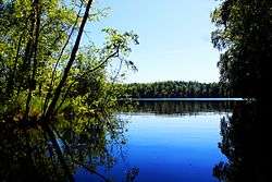 Lake on Solovetsky Island | |
| Location | |
| Country | Russia |
| Federal subject | Arkhangelsk Oblast[1] |
| Administrative structure (as of 2014) | |
| Administrative center | settlement of Solovetsky[2] |
| Inhabited localities:[2] | |
| Rural localities | 4 |
| Municipal structure (as of June 2014) | |
| Municipally incorporated as | Solovetskoye Rural Settlement of Primorsky Municipal District[3] |
| Statistics | |
| Population (2010 Census) | 861 inhabitants[4] |
| • Urban | 0% |
| • Rural | 100% |
| Time zone | MSK (UTC+03:00)[5] |
| Solovetsky District on WikiCommons | |
Solovetsky District (Russian: Солове́цкий райо́н) is an administrative district (raion), one of the twenty-one in Arkhangelsk Oblast, Russia.[1] It is located on the Solovetsky Islands archipelago in the White Sea. Its administrative center is the rural locality (a settlement) of Solovetsky.[2] District's population: 861 (2010 Census);[4] 968 (2002 Census);[6] 1,317 (1989 Census).[7]
History
The Solovetsky Monastery was founded in the 15th century and quickly became one of the most influential Orthodox monasteries in Russia. The islands were administered by the monastery until the October Revolution in 1917. Formally, they belonged to Archangelgorod Governorate (1708-1780), Vologda Viceroyalty (1780-1796), and Arkhangelsk Governorate (1796-1929). In 1929, the islands were included into newly established Northern Krai as an island territory (not a part of any district).
Solovetsky District was established on March 23, 1987.[8] On January 1, 2006, Solovetsky Municipal District was merged into Primorsky Municipal District, although its administrative status as a district remained unaffected.
Administrative and municipal status
Administratively, Solovetsky District is unique in Arkhangelsk Oblast because it cannot be transformed in any way other than merging it into Primorsky District as a selsoviet.[1] Municipally, the district is incorporated as Solovetskoye Rural Settlement within Primorsky Municipal District.[3]
References
Notes
- 1 2 3 Law #65-5-OZ
- 1 2 3 Государственный комитет Российской Федерации по статистике. Комитет Российской Федерации по стандартизации, метрологии и сертификации. №ОК 019-95 1 января 1997 г. «Общероссийский классификатор объектов административно-территориального деления. Код 11 253», в ред. изменения №259/2014 от 12 декабря 2014 г.. (State Statistics Committee of the Russian Federation. Committee of the Russian Federation on Standardization, Metrology, and Certification. #OK 019-95 January 1, 1997 Russian Classification of Objects of Administrative Division . Code 11 253, as amended by the Amendment #259/2014 of December 12, 2014. ).
- 1 2 Law #258-vneoch.-OZ
- 1 2 Russian Federal State Statistics Service (2011). "Всероссийская перепись населения 2010 года. Том 1" [2010 All-Russian Population Census, vol. 1]. Всероссийская перепись населения 2010 года (2010 All-Russia Population Census) (in Russian). Federal State Statistics Service. Retrieved June 29, 2012.
- ↑ Правительство Российской Федерации. Федеральный закон №107-ФЗ от 3 июня 2011 г. «Об исчислении времени», в ред. Федерального закона №271-ФЗ от 03 июля 2016 г. «О внесении изменений в Федеральный закон "Об исчислении времени"». Вступил в силу по истечении шестидесяти дней после дня официального опубликования (6 августа 2011 г.). Опубликован: "Российская газета", №120, 6 июня 2011 г. (Government of the Russian Federation. Federal Law #107-FZ of June 31, 2011 On Calculating Time, as amended by the Federal Law #271-FZ of July 03, 2016 On Amending Federal Law "On Calculating Time". Effective as of after sixty days following the day of the official publication.).
- ↑ Russian Federal State Statistics Service (May 21, 2004). "Численность населения России, субъектов Российской Федерации в составе федеральных округов, районов, городских поселений, сельских населённых пунктов – районных центров и сельских населённых пунктов с населением 3 тысячи и более человек" [Population of Russia, Its Federal Districts, Federal Subjects, Districts, Urban Localities, Rural Localities—Administrative Centers, and Rural Localities with Population of Over 3,000] (XLS). Всероссийская перепись населения 2002 года [All-Russia Population Census of 2002] (in Russian). Retrieved August 9, 2014.
- ↑ Demoscope Weekly (1989). "Всесоюзная перепись населения 1989 г. Численность наличного населения союзных и автономных республик, автономных областей и округов, краёв, областей, районов, городских поселений и сёл-райцентров" [All Union Population Census of 1989: Present Population of Union and Autonomous Republics, Autonomous Oblasts and Okrugs, Krais, Oblasts, Districts, Urban Settlements, and Villages Serving as District Administrative Centers]. Всесоюзная перепись населения 1989 года [All-Union Population Census of 1989] (in Russian). Институт демографии Национального исследовательского университета: Высшая школа экономики [Institute of Demography at the National Research University: Higher School of Economics]. Retrieved August 9, 2014.
- ↑ "Административно-территориальное деление Архангельской губернии в XVIII-XX вв. (Справка)" (in Russian). Архивы России. 2000. Retrieved August 12, 2011.
Sources
- Архангельское областное Собрание депутатов. Областной закон №65-5-ОЗ от 23 сентября 2009 г. «Об административно-территориальном устройстве Архангельской области», в ред. Областного закона №232-13-ОЗ от 16 декабря 2014 г. «О внесении изменений в отдельные Областные Законы в сфере осуществления местного самоуправления и взаимодействия с некоммерческими организациями». Вступил в силу через десять дней со дня официального опубликования. Опубликован: "Волна", №43, 6 октября 2009 г. (Arkhangelsk Oblast Council of Deputies. Oblast Law #65-5-OZ of September 23, 2009 On the Administrative-Territorial Structure of Arkhangelsk Oblast, as amended by the Oblast Law #232-13-OZ of December 16, 2014 On Amending Various Oblast Laws Dealing with the Process of Municipal Self-Government and Relations with Non-Profit Organizations. Effective as of the day which is ten days after the official publication.).
- Архангельское областное Собрание депутатов. Областной закон №258-внеоч.-ОЗ от 23 сентября 2004 г. «О статусе и границах территорий муниципальных образований в Архангельской области», в ред. Областного закона №224-13-ОЗ от 16 декабря 2014 г. «Об упразднении отдельных населённых пунктов Соловецкого района Архангельской области и о внесении изменения в статью 46 Областного закона "О статусе и границах территорий муниципальных образований в Архангельской области"». Вступил в силу со дня официального опубликования. Опубликован: "Волна", №38, 8 октября 2004 г. (Arkhangelsk Oblast Council of Deputies. Oblast Law #258-vneoch.-OZ of September 23, 2004 On the Status and Borders of the Territories of the Municipal Formations in Arkhangelsk Oblast, as amended by the Oblast Law #224-13-OZ of December 16, 2014 On Abolishing Several Inhabited Localities in Solovetsky District of Arkhangelsk Oblast and on Amending Article 46 of the Oblast Law "On the Status and Borders of the Territories of the Municipal Formations in Arkhangelsk Oblast". Effective as of the day of the official publication.).
Administrative center: Arkhangelsk | ||
| Cities and towns | .png) | |
| Administrative districts | ||