Velsky District
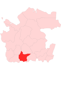
Velsky District (Russian: Ве́льский райо́н) is an administrative district (raion), one of the twenty-one in Arkhangelsk Oblast, Russia.[1] As a municipal division, it is incorporated as Velsky Municipal District.[4] It is located in the south of the oblast and borders with Shenkursky District in the north, Ustyansky District in the east, Verkhovazhsky District of Vologda Oblast in the south, Konoshsky District in the west, and with Nyandomsky District in the northwest. The area of the district is 10,060 square kilometers (3,880 sq mi).[5] Its administrative center is the town of Velsk.[2] Population: 54,792 (2010 Census);[6] 61,819 (2002 Census);[10] 71,474 (1989 Census).[11] The population of Velsk accounts for 43.6% of the district's total population.[6]
History
The area was originally populated by the Finno-Ugric peoples and then colonized by the Novgorod Republic. After the fall of Novgorod, the area became a part of the Grand Duchy of Moscow. Historically, it was a part of Vazhsky Uyezd, a vast area including almost all of the basin of the Vaga River. Velsk was first mentioned in the chronicles in 1137, and was granted the status of a posad in 1550.[12] In the course of the administrative reform carried out in 1708 by Peter the Great, the area was included into Archangelgorod Governorate. In 1780, the governorate was abolished and transformed into Vologda Viceroyalty. Vazhsky Uyezd was split, and the area of the current Velsky District became a part of the newly established Velsky Uyezd. In 1796, Velsky Uyezd was transferred to Vologda Governorate and remained there until 1929, when several governorates were merged into Northern Krai. On July 15, 1929, the uyezds were abolished, and Velsky Uyezd was split into Velsky, Verkhovazhsky, and Ustyansky Districts. Velsky District became a part of Nyandoma Okrug of Northern Krai.
In the following years, the first-level administrative division of Russia kept changing. In 1930, the okrug was abolished, and the district was subordinated to the central administration of Northern Krai. In 1931, Verkhovazhsky District was merged into Velsky District, and in 1935, it was reestablished.[13] In 1936, the krai was transformed into Northern Oblast. In 1937, Northern Oblast was split into Arkhangelsk Oblast and Vologda Oblast. Velsky District remained in Arkhangelsk Oblast ever since.
From 1929 to 1959 (with a brief break between 1931 and 1935), Rovdinsky District existed, with its administrative center located in Rovdino. It was initially formed as a part of Nyandoma Okrug on July 15, 1929, when Shenkursky Uyezd was split into Shenkursky and Rovdinsky Districts. On September 11, 1959, the district was abolished and split between Shenkursky and Velsky Districts; the district's administrative center Rovdino became a part of Shenkursky District.[14]
Geography
The district is located in the valley of the Vaga River, a major left tributary of the Northern Dvina. It is split by the Vaga and its major tributaries, the Ustya (right, with the left tributary, the Kokshenga River), the Kuloy (right), the Puya (left), the Vel (left), and the Pezhma (left). Minor parts of the district in the northwest belong to the basin of the Mosha River, a right tributary of the Onega (not in the basin of the Northern Dvina).
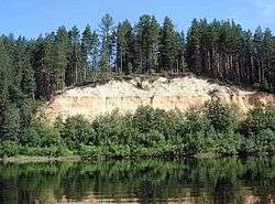
Most of the district is covered by coniferous forests (taiga).
Divisions
Administrative divisions
As an administrative division, the district is divided into one town of district significance (Velsk), one urban-type settlement with jurisdictional territory (Kuloy), and twenty selsoviets.[2] The selsoviets include (the administrative centers are given in parentheses):
- Argunovsky (Argunovsky);
- Blagoveshchensky (Blagoveshchenskoye);
- Khozminsky (Ispolinovka);
- Lipovsky (Malaya Lipovka);
- Muravyovsky (Voronovskaya);
- Nizovsky (Terebino);
- Pakshengsky (Yefremkovskaya);
- Pezhemsky (Pezhma);
- Poponavolotsky (Pasva);
- Puysky (Dolmatovo);
- Rakulo-Kokshengsky (Kozlovskaya);
- Shadrengsky (Shunema);
- Shonoshsky (Ust-Shonosha);
- Solginsky (Solginsky);
- Sudromsky (Pogost);
- Tyogrinsky (Tyogrozero);
- Ust-Shonoshsky (Ust-Shonosha);
- Ust-Velsky (Dyukovskaya);
- Verkhneshonoshsky (Komsomolsky);
- Verkhneustkuloysky (Meledinskaya).
Municipal divisions
As a municipal division, the district is divided into two urban settlement and twenty rural settlements (the administrative centers are given in parentheses):
- Velskoye Urban Settlement (Velsk);
- Kuloyskoye Urban Settlement (Kuloy);
- Argunovskoye Rural Settlement (Argunovsky);
- Blagoveshchenskoye Rural Settlement (Blagoveshchenskoye);
- Khozminskoye Rural Settlement (Khozmino);
- Lipovskoye Rural Settlement (Malaya Lipovka);
- Muravyovskoye Rural Settlement (Voronovskaya);
- Nizovskoye Rural Settlement (Terebino);
- Pakshengskoye Rural Settlement (Yefremkovskaya);
- Pezhemskoye Rural Settlement (Pezhma);
- Poponavolotskoye Rural Settlement (Pasva);
- Puyskoye Rural Settlement (Dovlatovo);
- Rakulo-Kokshengskoye Rural Settlement (Kozlovskaya);
- Shadrengskoye Rural Settlement (Shunema);
- Shonoshskoye Rural Settlement (Ust-Shonosha);
- Solginskoye Rural Settlement (Solginsky);
- Sudromskoye Rural Settlement (Pogost);
- Tyogrinskoye Rural Settlement (Tyogrozero);
- Ust-Shonoshskoye Rural Settlement (Ust-Shonosha);
- Ust-Velskoye Rural Settlement (Dyukovskaya);
- Verkhneshonoshskoye Rural Settlement (Komsomolsky);
- Verkhneustkuloyskoye Rural Settlement (Meledinskaya).
Economy
Industry
Timber industry is the core industry of the district. The Vaga and the Ustya Rivers were used for timber rafting until the 1990s. Food production is also present.[15]
Transportation
Velsk is located on one of the principal highways in Russia, M8 connecting Moscow and Arkhangelsk. A number of secondary roads branch off within the district limits, including the road from Velsk east to Oktyabrsky, from Velsk west to Konosha, and from Dolmatovo west to Nyandoma and Kargopol.
A section of the railroad connecting Konosha and Kotlas, which eventually continues to Vorkuta, lies in the district. The principal stations in the district are Velsk and Kuloy.
The railroad line from Yura to Tyogrozero, entirely within the district, was demolished in 2010.
Velsk Airport was active for passenger service[16] until the 1990s, and not used for twenty years after that. In 2011, after a long break, a helicopter was tanked in Velsk. There are plans to use it for forest patrol aviation.
Culture and recreation
The district contains 5 objects classified as cultural and historical heritage by Russian Federal law, and additionally 216 objects classified as cultural and historical heritage of local importance.[17] Most of these are wooden rural houses built before 1917.
The five objects protected at the federal level are:
- Rostovsky Pogost, which is the ensemble consisting of the Ascension Church (1805) and the wooden St. Iliya Church (1756), in the village of Vozgretsovskaya
- Resurrection Church in the village of Zaruchevskaya;
- House of Alyoshkin in the village of Churkovskaya
The only museum in the district is Velsky District Museum.[18]
References
Notes
- 1 2 Law #65-5-OZ
- 1 2 3 4 5 Государственный комитет Российской Федерации по статистике. Комитет Российской Федерации по стандартизации, метрологии и сертификации. №ОК 019-95 1 января 1997 г. «Общероссийский классификатор объектов административно-территориального деления. Код 11 205», в ред. изменения №259/2014 от 12 декабря 2014 г.. (State Statistics Committee of the Russian Federation. Committee of the Russian Federation on Standardization, Metrology, and Certification. #OK 019-95 January 1, 1997 Russian Classification of Objects of Administrative Division . Code 11 205, as amended by the Amendment #259/2014 of December 12, 2014. ).
- ↑ The count of urban-type settlements may include the work settlements, the resort settlements, the suburban (dacha) settlements, as well as urban-type settlements proper.
- 1 2 3 Law #258-vneoch.-OZ
- 1 2 Вельский район (in Russian). Двина-Информ. Retrieved August 25, 2011.
- 1 2 3 Russian Federal State Statistics Service (2011). "Всероссийская перепись населения 2010 года. Том 1" [2010 All-Russian Population Census, vol. 1]. Всероссийская перепись населения 2010 года (2010 All-Russia Population Census) (in Russian). Federal State Statistics Service. Retrieved June 29, 2012.
- ↑ The value of density was calculated automatically by dividing the 2010 Census population by the area specified in the infobox. Please note that this value is only approximate as the area specified in the infobox does not necessarily correspond to the area of the entity proper or is reported for the same year as the population.
- ↑ Правительство Российской Федерации. Федеральный закон №107-ФЗ от 3 июня 2011 г. «Об исчислении времени», в ред. Федерального закона №271-ФЗ от 03 июля 2016 г. «О внесении изменений в Федеральный закон "Об исчислении времени"». Вступил в силу по истечении шестидесяти дней после дня официального опубликования (6 августа 2011 г.). Опубликован: "Российская газета", №120, 6 июня 2011 г. (Government of the Russian Federation. Federal Law #107-FZ of June 31, 2011 On Calculating Time, as amended by the Federal Law #271-FZ of July 03, 2016 On Amending Federal Law "On Calculating Time". Effective as of after sixty days following the day of the official publication.).
- ↑ Постановление Президиума ВЦИК от 15 июля 1929 года о составе округов и районов Северного Края и их центрах (in Russian). consultant.ru. Retrieved April 18, 2012.
- ↑ Russian Federal State Statistics Service (May 21, 2004). "Численность населения России, субъектов Российской Федерации в составе федеральных округов, районов, городских поселений, сельских населённых пунктов – районных центров и сельских населённых пунктов с населением 3 тысячи и более человек" [Population of Russia, Its Federal Districts, Federal Subjects, Districts, Urban Localities, Rural Localities—Administrative Centers, and Rural Localities with Population of Over 3,000] (XLS). Всероссийская перепись населения 2002 года [All-Russia Population Census of 2002] (in Russian). Retrieved August 9, 2014.
- ↑ Demoscope Weekly (1989). "Всесоюзная перепись населения 1989 г. Численность наличного населения союзных и автономных республик, автономных областей и округов, краёв, областей, районов, городских поселений и сёл-райцентров" [All Union Population Census of 1989: Present Population of Union and Autonomous Republics, Autonomous Oblasts and Okrugs, Krais, Oblasts, Districts, Urban Settlements, and Villages Serving as District Administrative Centers]. Всесоюзная перепись населения 1989 года [All-Union Population Census of 1989] (in Russian). Институт демографии Национального исследовательского университета: Высшая школа экономики [Institute of Demography at the National Research University: Higher School of Economics]. Retrieved August 9, 2014.
- ↑ История города Вельск (in Russian). Администрация МО "Вельский муниципальный район. Retrieved June 6, 2011.
- ↑ Справка об изменениях административно-территориального устройства и сети партийных и комсомольских органов на территории Вологодской области (1917-1991) (in Russian). Архивы России. Retrieved August 25, 2011.
- ↑ МО "Шенкурское" Справка (in Russian). Администрация Шенкурского муниципального района. Retrieved June 8, 2011.
- ↑ Промышленное производство Вельского муниципального района (in Russian). Администрация МО "Вельский муниципальный район". Retrieved June 6, 2011.
- ↑ Котлас-Вельск-Архангельск на самолете (in Russian). Retrieved 6 June 2011.
- ↑ Памятники истории и культуры народов Российской Федерации (in Russian). Russian Ministry of Culture. Retrieved 2 June 2016.
- ↑ Вельский районный муниципальный краеведческий музей (in Russian). Российская сеть культурного наследия. Retrieved August 25, 2011.
Sources
- Архангельское областное Собрание депутатов. Областной закон №65-5-ОЗ от 23 сентября 2009 г. «Об административно-территориальном устройстве Архангельской области», в ред. Областного закона №232-13-ОЗ от 16 декабря 2014 г. «О внесении изменений в отдельные Областные Законы в сфере осуществления местного самоуправления и взаимодействия с некоммерческими организациями». Вступил в силу через десять дней со дня официального опубликования. Опубликован: "Волна", №43, 6 октября 2009 г. (Arkhangelsk Oblast Council of Deputies. Oblast Law #65-5-OZ of September 23, 2009 On the Administrative-Territorial Structure of Arkhangelsk Oblast, as amended by the Oblast Law #232-13-OZ of December 16, 2014 On Amending Various Oblast Laws Dealing with the Process of Municipal Self-Government and Relations with Non-Profit Organizations. Effective as of the day which is ten days after the official publication.).
- Архангельское областное Собрание депутатов. Областной закон №258-внеоч.-ОЗ от 23 сентября 2004 г. «О статусе и границах территорий муниципальных образований в Архангельской области», в ред. Областного закона №224-13-ОЗ от 16 декабря 2014 г. «Об упразднении отдельных населённых пунктов Соловецкого района Архангельской области и о внесении изменения в статью 46 Областного закона "О статусе и границах территорий муниципальных образований в Архангельской области"». Вступил в силу со дня официального опубликования. Опубликован: "Волна", №38, 8 октября 2004 г. (Arkhangelsk Oblast Council of Deputies. Oblast Law #258-vneoch.-OZ of September 23, 2004 On the Status and Borders of the Territories of the Municipal Formations in Arkhangelsk Oblast, as amended by the Oblast Law #224-13-OZ of December 16, 2014 On Abolishing Several Inhabited Localities in Solovetsky District of Arkhangelsk Oblast and on Amending Article 46 of the Oblast Law "On the Status and Borders of the Territories of the Municipal Formations in Arkhangelsk Oblast". Effective as of the day of the official publication.).
Administrative center: Arkhangelsk | ||
| Cities and towns | .png) | |
| Administrative districts | ||