Kōshū, Yamanashi
| Kōshū 甲州市 | |||
|---|---|---|---|
| City | |||
|
Katsunuma vinyard | |||
| |||
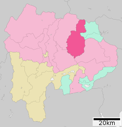 Location of Kōshū in Yamanashi Prefecture | |||
 Kōshū
| |||
| Coordinates: 35°42′15.6″N 138°43′45.9″E / 35.704333°N 138.729417°ECoordinates: 35°42′15.6″N 138°43′45.9″E / 35.704333°N 138.729417°E | |||
| Country | Japan | ||
| Region | Chūbu (Tōkai) | ||
| Prefecture | Yamanashi Prefecture | ||
| Government | |||
| • - Mayor | Atsushi Tanabe (since December 2005) | ||
| Area | |||
| • Total | 264.11 km2 (101.97 sq mi) | ||
| Population (November 1, 2015) | |||
| • Total | 31,729 | ||
| • Density | 120/km2 (300/sq mi) | ||
| Time zone | Japan Standard Time (UTC+9) | ||
| - Tree | Grape | ||
| - Flower | Cherry blossom | ||
| -Bird | Cettia diphone | ||
| Phone number | 0553-32-2111 | ||
| Address | Enzan-Kamiozo 1085-1, Koshū-shi, Yamanashi-ken 404-8501 | ||
| Website |
www | ||
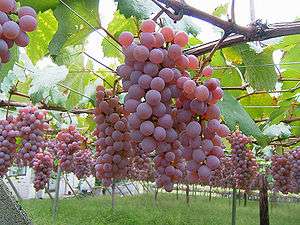


Kōshū (甲州市 Kōshū-shi) is a city located in Yamanashi Prefecture, Japan. The city is synonymous with viticulture and wine production in Japan.
As of November 2015, the city had an estimated population of 31,729 and a population density of 120 persons per km². The total area was 264.11 square kilometres (101.97 sq mi).
Geography
Kōshū is located in northeastern Yamanashi Prefecture.
Neighboring municipalities
Climate
| Climate data for Katsunuma | |||||||||||||
|---|---|---|---|---|---|---|---|---|---|---|---|---|---|
| Month | Jan | Feb | Mar | Apr | May | Jun | Jul | Aug | Sep | Oct | Nov | Dec | Year |
| Record high °C (°F) | 17.2 (63) |
23.5 (74.3) |
26.9 (80.4) |
31.9 (89.4) |
34.0 (93.2) |
38.5 (101.3) |
39.3 (102.7) |
40.5 (104.9) |
37.4 (99.3) |
33.4 (92.1) |
24.9 (76.8) |
23.0 (73.4) |
40.5 (104.9) |
| Average high °C (°F) | 8.2 (46.8) |
9.6 (49.3) |
13.5 (56.3) |
20.0 (68) |
24.3 (75.7) |
27.0 (80.6) |
30.5 (86.9) |
32.1 (89.8) |
27.6 (81.7) |
21.4 (70.5) |
15.9 (60.6) |
10.7 (51.3) |
20.07 (68.12) |
| Average low °C (°F) | −3.0 (26.6) |
−1.8 (28.8) |
1.8 (35.2) |
7.3 (45.1) |
12.3 (54.1) |
16.6 (61.9) |
20.6 (69.1) |
21.5 (70.7) |
17.7 (63.9) |
11.0 (51.8) |
4.5 (40.1) |
−0.7 (30.7) |
8.98 (48.17) |
| Record low °C (°F) | −11.3 (11.7) |
−10.6 (12.9) |
−6.7 (19.9) |
−3.7 (25.3) |
1.6 (34.9) |
9.4 (48.9) |
13.3 (55.9) |
14.0 (57.2) |
6.7 (44.1) |
0.7 (33.3) |
−3.1 (26.4) |
−18.5 (−1.3) |
−11.3 (11.7) |
| Average precipitation mm (inches) | 36.0 (1.417) |
39.5 (1.555) |
72.9 (2.87) |
71.2 (2.803) |
83.5 (3.287) |
121.3 (4.776) |
123.8 (4.874) |
150.4 (5.921) |
181.7 (7.154) |
117.3 (4.618) |
52.7 (2.075) |
31.0 (1.22) |
1,081.3 (42.57) |
| Average precipitation days (≥ 1.0 mm) | 4.7 | 5.3 | 9.2 | 8.4 | 9.3 | 11.4 | 11.6 | 9.3 | 10.8 | 8.9 | 5.9 | 3.8 | 98.6 |
| Mean monthly sunshine hours | 198.7 | 186.7 | 193.7 | 202.6 | 192.4 | 149.7 | 167.5 | 197.3 | 148.5 | 158.1 | 176.0 | 197.0 | 2,168.2 |
| Source #1: Japan Meteorological Agency(JMA)[1] | |||||||||||||
| Source #2: JMA[2] | |||||||||||||
History
The modern city of Kōshū was established on November 1, 2005, from the merger of the city of Enzan, the town of Katsunuma, and the village of Yamato (both from Higashiyamanashi District).
Economy
Most of the area of the city is agricultural, and is especially known for its production of grapes and wine.
Education
- Teikyo-Gakuen Junior College
- Kōshū has 14 elementary schools, six middle schools and one high school.
Transportation
Railway
Highway
Sister cities
 - Futtsu, Chiba – since December 1, 1977 with former Enzan City
 - Ames, Iowa, USA – since September 20, 1993 with former Enzan City[3]
 - Beaune, Côte-d'Or, France[4] – since September 18, 1976 with former Katsunuma City
 – Turpan, Xinjiang, China[4] – since October 3, 2000 with former Katsunuma City
Local attractions
Events
Every year in Autumn the "Koshu Fruit Marathon" is held. It was held for the third time on October 21, 2012. While it is called a marathon (the word is commonly used in Japan to describe races of varying distances) it actually consists of several shorter races, a 3.5 family race, a 10k race, a half-marathon, and a 23 km race.[5]
Noted people
- Terutomo Yamazaki – karateka and kick boxer
- Tomokazu Miura – actor
- Eijun Kiyokumo – professional football player
References
- ↑ "勝沼 年・月ごとの平年値". JMA. Retrieved May 15, 2014.
- ↑ "勝沼 観測史上1~10位の値". JMA. Retrieved May 15, 2014.
- ↑ "US-Japan Sister Cities by State". Asia Matters for America. Honolulu, HI: East-West Center. Retrieved 20 November 2015.
- 1 2 "International Exchange". List of Affiliation Partners within Prefectures. Council of Local Authorities for International Relations (CLAIR). Retrieved 21 November 2015.
- ↑ Koshu Fruit Marathon website Course Retrieved on November 6, 2012 (Japanese)
External links
![]() Media related to Kōshū, Yamanashi at Wikimedia Commons
Media related to Kōshū, Yamanashi at Wikimedia Commons
- Koshu City official website (Japanese)
| Special city | ||
|---|---|---|
| Cities | ||
| Kitatsuru District | ||
| Minamikoma District | ||
| Minamitsuru District | ||
| Nakakoma District | ||
| Nishiyatsushiro District | ||