Kotohira, Kagawa
| Kotohira 琴平町 | |
|---|---|
| Town | |
|
Kotohira Shrine | |
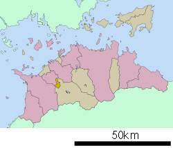 Location of Kotohira in Kagawa Prefecture | |
 Kotohira Location in Japan | |
| Coordinates: 34°12′07″N 133°49′36″E / 34.20194°N 133.82667°ECoordinates: 34°12′07″N 133°49′36″E / 34.20194°N 133.82667°E | |
| Country | Japan |
| Region | Shikoku |
| Prefecture | Kagawa Prefecture |
| District | Nakatado |
| Government | |
| • Mayor | Masato Ono (since May 2010) |
| Area | |
| • Total | 8.46 km2 (3.27 sq mi) |
| Population (May 1, 2011) | |
| • Total | 9,888 |
| • Density | 1,200/km2 (3,000/sq mi) |
| Symbols | |
| • Tree | Cherry blossom |
| • Flower | Michelsa compressa |
| Time zone | Japan Standard Time (UTC+9) |
| City hall address |
817-10 Enokii, Kotohira-chō, Nakatado-gun, Kagawa-ken 985-8501 |
| Website |
www |
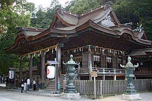
Kotohira (琴平町 Kotohira-chō) is a town located in Nakatado District, Kagawa Prefecture, Japan. The town is best known as the site of Shikoku's largest shrine complex, the Kotohira Shrine (popularly known as Konpira-san).
As of May 1, 2011 the town has an estimated population of 9,888, with a household number of 3,842 and a density of 1,168.79 persons per km². The total area is 8.46 km2 (3.27 sq mi).
Kotohira also features Japan's oldest surviving Kabuki playhouse, the Kanamaru-za.[1]
Its average temperature is 16.7 degrees Celsius with an average annual rainfall of 817.5 mm. The town tree is the Rhodoleia, and the town flower is the blossom of the cherry tree. The mayor is Masaomi Yamashita, and the town was named after an ancient marine god named Kotohira-gu. A grand festival is held every year on October 10.[2]
 Kotohira Town Hall
 Kanamaruza (Kabuki theatre)
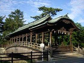 Saya Bridge (Covered bridge)
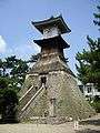 TakaTōrō (Tōrō)
References
External links
 Media related to Kotohira, Kagawa at Wikimedia Commons
- Official website (Japanese) (English version)
 Kotohira travel guide from Wikivoyage