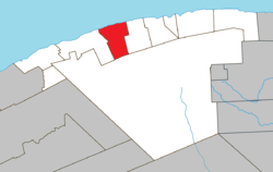
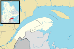
La Martre, Quebec
La Martre is a municipality in the Gaspésie-Îles-de-la-Madeleine region of the province of Quebec in Canada.
In addition to La Martre itself, the municipality also includes the communities of Cap-au-Renard, Christie, and Sainte-Marthe-de-Gaspé.[4]
History

La Martre Lighthouse, built in 1906.
The area saw permanent settlement in the late 19th century and was originally called Rivière-à-la-Marthe, after the Marten River (French: Rivière à la Marthe) that flows into the Gulf of Saint Lawrence there. The marten is found along this river's banks and is abundant in the Gaspé region.[1]
In 1923, the place separated from the municipality of Sainte-Anne-des-Monts to form the Township Municipality of Christie, named in honour of Robert Christie. In 1950, the township municipality was split in two when Marsoui was incorporated as a village municipality.[5]
In 1970, the municipality was renamed to La Martre.[1]
Demographics
Population
| Canada census – La Martre, Quebec community profile |
|---|
| |
2011 |
2006 |
2001 |
| Population: |
245 (-3.2% from 2006) |
253 (-4.9% from 2001) |
266 (-15.6% from 1996) |
| Land area: |
173.24 km2 (66.89 sq mi) |
173.24 km2 (66.89 sq mi) |
173.24 km2 (66.89 sq mi) |
| Population density: |
1.4/km2 (3.6/sq mi) |
1.5/km2 (3.9/sq mi) |
1.5/km2 (3.9/sq mi) |
| Median age: |
50.2 (M: 50.2, F: 50.2) |
44.9 (M: 44.7, F: 45.1) |
40.8 (M: 41.3, F: 40.5) |
| Total private dwellings: |
184 |
123 |
118 |
| Median household income: |
$.N/A |
$48,517 |
$39,452 |
| Notes: 2011 income data for this area has been suppressed for data quality or confidentiality reasons. – References: 2011[3] 2006[6] 2001[7] |
| Historical Census Data - La Martre, Quebec[8] |
|---|
| Year | Pop. | ±% |
|---|
| 1991 | 336 | — |
|---|
| 1996 | 315 | −6.2% |
|---|
| | Year | Pop. | ±% |
|---|
| 2001 | 266 | −15.6% |
|---|
| 2006 | 253 | −4.9% |
|---|
| |
See also
References
|
|---|
|
| Cities | |
|---|
|
| Municipalities | |
|---|
|
| Villages | |
|---|
|
| Unorganized Territories | |
|---|
|
|
.jpg)