Sainte-Madeleine-de-la-Rivière-Madeleine, Quebec
| Sainte-Madeleine- de-la-Rivière-Madeleine | |
|---|---|
| Municipality | |
|
Manche-d'Épée | |
 Location within La Haute-Gaspésie RCM. | |
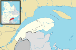 Sainte-Madeleine-de- la-Rivière-Madeleine Location in eastern Quebec. | |
| Coordinates: 49°14′N 65°18′W / 49.233°N 65.300°WCoordinates: 49°14′N 65°18′W / 49.233°N 65.300°W[1] | |
| Country |
|
| Province |
|
| Region | Gaspésie–Îles-de-la-Madeleine |
| RCM | La Haute-Gaspésie |
| Constituted | February 27, 1915 |
| Government[2] | |
| • Mayor | Joël Côté |
| • Federal riding |
Haute-Gaspésie—La Mitis—Matane—Matapédia |
| • Prov. riding | Gaspé |
| Area[2][3] | |
| • Total | 262.30 km2 (101.27 sq mi) |
| • Land | 264.42 km2 (102.09 sq mi) |
|
There is an apparent contradiction between two authoritative sources | |
| Population (2011)[3] | |
| • Total | 334 |
| • Density | 1.3/km2 (3/sq mi) |
| • Pop 2006-2011 |
|
| • Dwellings | 298 |
| Time zone | EST (UTC−5) |
| • Summer (DST) | EDT (UTC−4) |
| Postal code(s) | G0E 1P0 |
| Area code(s) | 418 and 581 |
| Highways |
|
| Website |
www municipaliteste-Madeleine |
Sainte-Madeleine-de-la-Rivière-Madeleine is a municipality in the Gaspésie-Îles-de-la-Madeleine region of the province of Quebec in Canada.
The municipality includes the communities of Madeleine-Centre, Manche-d'Épée, and Rivière-la-Madeleine.
The community of Manche-d'Épée is home to the Manche-d'Épée Ecological Reserve.
Demographics
Population
| Canada census – Sainte-Madeleine-de-la-Rivière-Madeleine, Quebec community profile | |||
|---|---|---|---|
| 2011 | 2006 | 2001 | |
| Population: | 334 (-10.5% from 2006) | 373 (-12.2% from 2001) | 425 (-11.8% from 1996) |
| Land area: | 262.42 km2 (101.32 sq mi) | 264.42 km2 (102.09 sq mi) | 264.42 km2 (102.09 sq mi) |
| Population density: | 1.3/km2 (3.4/sq mi) | 1.4/km2 (3.6/sq mi) | 1.6/km2 (4.1/sq mi) |
| Median age: | 58.6 (M: 58.5, F: 58.8) | 55.8 (M: 55.2, F: 56.6) | 51.5 (M: 52.1, F: 51.0) |
| Total private dwellings: | 298 | 237 | 283 |
| Median household income: | $29,118 | $31,267 | $22,019 |
| References: 2011[3] 2006[4] 2001[5] | |||
| Historical Census Data - Sainte-Madeleine-de-la-Rivière-Madeleine, Quebec[6] | ||||||||||||||||||||||||||
|---|---|---|---|---|---|---|---|---|---|---|---|---|---|---|---|---|---|---|---|---|---|---|---|---|---|---|
|
|
| ||||||||||||||||||||||||

Lighthouse in Madeleine-Centre
See also
References
- ↑ Reference number 56260 of the Commission de toponymie du Québec (French)
- 1 2 "Sainte-Madeleine-de-la-Rivière-Madeleine". Répertoire des municipalités (in French). Ministère des Affaires municipales, des Régions et de l'Occupation du territoire. Retrieved 2011-12-15.
- 1 2 3 "Sainte-Madeleine-de-la-Rivière-Madeleine census profile". 2011 Census data. Statistics Canada. Retrieved 2011-12-14.
- ↑ "2006 Community Profiles". Canada 2006 Census. Statistics Canada. March 30, 2011. Retrieved 2011-12-15.
- ↑ "2001 Community Profiles". Canada 2001 Census. Statistics Canada. February 17, 2012. Retrieved 2011-12-15.
- ↑ Statistics Canada: 1996, 2001, 2006, 2011 census
 |
Gulf of Saint Lawrence | | ||
| Saint-Maxime-du-Mont-Louis | |
Grande-Vallée | ||
| ||||
| | ||||
| Mont-Albert | Collines-du-Basque |
| Cities | |
|---|---|
| Municipalities | |
| Villages | |
| Unorganized Territories | |
| |
This article is issued from Wikipedia - version of the 2/22/2014. The text is available under the Creative Commons Attribution/Share Alike but additional terms may apply for the media files.