Mont-Saint-Pierre, Quebec
| Mont-Saint-Pierre | |
|---|---|
| Village municipality | |
 | |
 Location within La Haute-Gaspésie RCM. | |
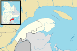 Mont-Saint-Pierre Location in eastern Quebec. | |
| Coordinates: 49°13′N 65°49′W / 49.217°N 65.817°WCoordinates: 49°13′N 65°49′W / 49.217°N 65.817°W[1] | |
| Country |
|
| Province |
|
| Region | Gaspésie–Îles-de-la-Madeleine |
| RCM | La Haute-Gaspésie |
| Settled | 1858 |
| Constituted | January 1, 1947 |
| Government[2] | |
| • Mayor | Lynda Laflamme |
| • Federal riding |
Haute-Gaspésie—La Mitis—Matane—Matapédia |
| • Prov. riding | Gaspé |
| Area[2][3] | |
| • Total | 51.50 km2 (19.88 sq mi) |
| • Land | 53.20 km2 (20.54 sq mi) |
|
There is an apparent contradiction between two authoritative sources | |
| Population (2011)[3] | |
| • Total | 192 |
| • Density | 3.6/km2 (9/sq mi) |
| • Pop 2006-2011 |
|
| • Dwellings | 130 |
| Time zone | EST (UTC−5) |
| • Summer (DST) | EDT (UTC−4) |
| Postal code(s) | G0E 1V0 |
| Area code(s) | 418 and 581 |
| Highways |
|
| Census profile | 2404015[3] |
| MAMROT info | 04015[2] |
| Toponymie info | 42208[1] |
| Website |
www |
Mont-Saint-Pierre is a village municipality in Quebec, Canada, located in the regional county municipality of La Haute-Gaspésie in the administrative region of Gaspésie–Îles-de-la-Madeleine.
The village is located at the foot of the eponymous Mount Saint-Pierre. This 411 metres (1,348 ft) high mount juts into the Gulf of Saint Lawrence, separating Cove Mont-Louis from Cove Mont-Saint-Pierre, into which the Mont-Saint-Pierre River flows. The place was formerly called Rivière-à-Pierre.[1]
The 2006 census there were 230 inhabitants.
Mont-Saint-Pierre is well known for hang-gliding and paragliding, and home to the Mont-Saint-Pierre Ecological Reserve. The Festival of Free Flight (Fête de Vol Libre) is held each year since 1978.
History
Permanent settlement occurred in 1858. Its post office opened in 1904. In 1947, the village was incorporated when it separated from Mont-Louis.[1]
Demographics
Population
| Canada census – Mont-Saint-Pierre community profile | |||
|---|---|---|---|
| 2011 | 2006 | 2001 | |
| Population: | 192 (-16.5% from 2006) | 230 (-3.8% from 2001) | 239 (-17.0% from 1996) |
| Land area: | 53.20 km2 (20.54 sq mi) | 53.20 km2 (20.54 sq mi) | 53.20 km2 (20.54 sq mi) |
| Population density: | 3.6/km2 (9.3/sq mi) | 4.3/km2 (11/sq mi) | 4.5/km2 (12/sq mi) |
| Median age: | 58.2 (M: 56.0, F: 60.0) | 52.0 (M: 50.2, F: 53.5) | 47.4 (M: 44.5, F: 50.5) |
| Total private dwellings: | 130 | 138 | 144 |
| Median household income: | $.N/A | $.N/A | $.N/A |
| Notes: Income data for this area has been suppressed for data quality or confidentiality reasons. – References: 2011[3] 2006[4] 2001[5] | |||
| Historical Census Data - Mont-Saint-Pierre, Quebec[6] | ||||||||||||||||||||||||||
|---|---|---|---|---|---|---|---|---|---|---|---|---|---|---|---|---|---|---|---|---|---|---|---|---|---|---|
|
|
| ||||||||||||||||||||||||
See also
References
- 1 2 3 4 Reference number 42208 of the Commission de toponymie du Québec (French)
- 1 2 3 "Mont-Saint-Pierre". Répertoire des municipalités (in French). Ministère des Affaires municipales, des Régions et de l'Occupation du territoire. Retrieved 2011-12-15.
- 1 2 3 4 "(Code 2404015) Census Profile". 2011 census. Statistics Canada. 2012.
- ↑ "2006 Community Profiles". Canada 2006 Census. Statistics Canada. March 30, 2011. Retrieved 2011-12-15.
- ↑ "2001 Community Profiles". Canada 2001 Census. Statistics Canada. February 17, 2012. Retrieved 2011-12-15.
- ↑ Statistics Canada: 1996, 2001, 2006, 2011 census
External links
 |
Gulf of Saint Lawrence | | ||
| Rivière-à-Claude | |
Saint-Maxime-du-Mont-Louis | ||
| ||||
| | ||||
| Mont-Albert |
| Cities | |
|---|---|
| Municipalities | |
| Villages | |
| Unorganized Territories | |
| |