Launay, Quebec
| Launay | |
|---|---|
| Township municipality | |
 | |
 Location within Abitibi RCM. | |
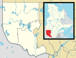 Launay Location in western Quebec. | |
| Coordinates: 48°39′N 78°32′W / 48.650°N 78.533°WCoordinates: 48°39′N 78°32′W / 48.650°N 78.533°W[1] | |
| Country |
|
| Province |
|
| Region | Abitibi-Témiscamingue |
| RCM | Abitibi |
| Settled | c. 1917 |
| Constituted | May 18, 1921 |
| Named for |
Jean-Baptiste Leporquier de Launay[1] |
| Government[2] | |
| • Mayor | Rémi Gilbert |
| • Federal riding | Abitibi—Témiscamingue |
| • Prov. riding | Abitibi-Ouest |
| Area[2][3] | |
| • Total | 257.00 km2 (99.23 sq mi) |
| • Land | 258.24 km2 (99.71 sq mi) |
|
There is an apparent contradiction between two authoritative sources | |
| Population (2011)[3] | |
| • Total | 229 |
| • Density | 0.9/km2 (2/sq mi) |
| • Pop 2006-2011 |
|
| • Dwellings | 97 |
| Time zone | EST (UTC−5) |
| • Summer (DST) | EDT (UTC−4) |
| Postal code(s) | J0Y 1W0 |
| Area code(s) | 819 |
| Highways |
|
| Website |
www |
Launay is a township municipality in the Canadian province of Quebec, located in the Abitibi Regional County Municipality.
Demographics
Population trend:[4]
- Population in 2011: 229 (2006 to 2011 population change: 1.3%)
- Population in 2006: 226
- Population in 2001: 259
- Population in 1996: 260
- Population in 1991: 272
Private dwellings occupied by usual residents: 96 (total dwellings: 97)
Mother tongue:[5]
- English as first language: 0%
- French as first language: 95.6%
- English and French as first language: 0%
- Other as first language: 4.4%
Municipal council
- Mayor: Gilles Labbé
- Councillors: Claude Audy, Gilles Labbé, Éloi Lambert, André Morin, Fernande Sylvain, Carmelle Veillette
References
- 1 2 Reference number 34647 of the Commission de toponymie du Québec (French)
- 1 2 "Launay". Répertoire des municipalités (in French). Ministère des Affaires municipales, des Régions et de l'Occupation du territoire. Retrieved 2011-01-10.
- 1 2 "Launay census profile". 2011 Census data. Statistics Canada. Retrieved 2011-01-10.
- ↑ Statistics Canada: 1996, 2001, 2006, 2011 census
- ↑ "Launay community profile". 2006 Census data. Statistics Canada. Retrieved 2011-01-10.
 |
Rivière-Ojima | Lac-Chicobi | Berry | |
| Taschereau | |
Trécesson | ||
| ||||
| | ||||
| Rouyn-Noranda | Sainte-Gertrude-Manneville |
| Towns | |
|---|---|
| Municipalities | |
| Townships | |
| Parishes | |
| Unorganized territories | |
| |
This article is issued from Wikipedia - version of the 7/29/2016. The text is available under the Creative Commons Attribution/Share Alike but additional terms may apply for the media files.