Laurel Fork North Wilderness
| Laurel Fork North Wilderness | |
| Part of Monongahela National Forest | |
| Wilderness Area | |
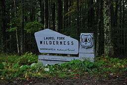 Sign for Laurel Fork Wilderness on Middle Mountain Road. | |
| Country | United States |
|---|---|
| State | West Virginia |
| County | Randolph |
| Coordinates | 38°45′27″N 79°40′23″W / 38.75750°N 79.67306°WCoordinates: 38°45′27″N 79°40′23″W / 38.75750°N 79.67306°W |
| Highest point | Middle Mountain |
| - location | south of Wymer |
| - elevation | 3,763 ft (1,147.0 m) [1] |
| - coordinates | 38°47′19″N 79°40′04″W / 38.78861°N 79.66778°W |
| Lowest point | Laurel Fork (Cheat River) |
| - location | east of Glady |
| - elevation | 2,897 ft (883.0 m) [2] |
| - coordinates | 38°48′38″N 79°38′17″W / 38.81056°N 79.63806°W |
| Area | 6,055 acres (2,450.4 ha) [3] |
| Established | 1983 [3] |
| Management | Monongahela National Forest |
| Owner | USDA Forest Service |
| IUCN category | Ib - Wilderness Area |
| Nearest city | Harman, West Virginia |
 Location of Laurel Fork North Wilderness in West Virginia | |
| Website: Laurel Fork Wildernesses | |
Laurel Fork North Wilderness is a U.S. Wilderness Area located in the Greenbrier Ranger District of Monongahela National Forest in West Virginia.[3] The Wilderness protects high-elevation lands along Laurel Fork (Cheat River) and is bordered by Middle Mountain to the west. It is a companion to Laurel Fork South Wilderness, the two being split by Randolph County Route 40. Laurel Fork North contains 9.5 miles (15.3 km) of hiking trails.[3]
History
The land that now comprises Laurel Fork North Wilderness was once private forestland owned by the Laurel River Lumber Company. The area was first logged by floating the logs down the Laurel Fork, and later by railroad. By 1921, the virgin forestland was fully logged. The U.S. Forest Service acquired the area soon thereafter, adding it to Monongahela National Forest.[3]
Laurel Fork South and Laurel Fork North Wildernesses were designated in 1983 by the Monongahela National Forest, West Virginia, Land Designations law.[3]
See also
References
- ↑ USGS Glady Quad Topographic Map, as displayed by TopoQuest, accessed June 30, 2008
- ↑ USGS Glady Quad Topographic Map, as displayed by TopoQuest, accessed June 30, 2008
- 1 2 3 4 5 6 "Laurel Fork Wilderness brochure" (PDF). Monongahela National Forest. Retrieved April 13, 2010.