Lavaca, Arkansas
| Lavaca, Arkansas | |
|---|---|
| City | |
 Location in Sebastian County and the state of Arkansas | |
| Coordinates: 35°20′12″N 94°10′36″W / 35.33667°N 94.17667°WCoordinates: 35°20′12″N 94°10′36″W / 35.33667°N 94.17667°W | |
| Country | United States |
| State | Arkansas |
| County | Sebastian |
| Area | |
| • Total | 2.1 sq mi (5.6 km2) |
| • Land | 2.1 sq mi (5.6 km2) |
| • Water | 0 sq mi (0 km2) |
| Elevation | 423 ft (129 m) |
| Population (2010) | |
| • Total | 2,289 |
| • Density | 869/sq mi (325.9/km2) |
| Time zone | Central (CST) (UTC-6) |
| • Summer (DST) | CDT (UTC-5) |
| ZIP code | 72941 |
| Area code(s) | 479 |
| FIPS code | 05-38890 |
| GNIS feature ID | 0077456 |
Lavaca (![]() i/ləvˈɑːkə/) is a city in Sebastian County, Arkansas, United States. It is part of the Fort Smith, Arkansas-Oklahoma Metropolitan Statistical Area. As of the 2010 Census the population was 2,289.[1] The population was 1,825 at the 2000 census. Lavaca was incorporated in 1919.
i/ləvˈɑːkə/) is a city in Sebastian County, Arkansas, United States. It is part of the Fort Smith, Arkansas-Oklahoma Metropolitan Statistical Area. As of the 2010 Census the population was 2,289.[1] The population was 1,825 at the 2000 census. Lavaca was incorporated in 1919.
Geography
Lavaca is located at 35°20′12″N 94°10′36″W / 35.33667°N 94.17667°W (35.336657, -94.176776).[2]
According to the United States Census Bureau, the city has a total area of 2.2 square miles (5.7 km2), all of it land.
Demographics
| Historical population | |||
|---|---|---|---|
| Census | Pop. | %± | |
| 1930 | 319 | — | |
| 1940 | 340 | 6.6% | |
| 1950 | 373 | 9.7% | |
| 1960 | 392 | 5.1% | |
| 1970 | 532 | 35.7% | |
| 1980 | 1,092 | 105.3% | |
| 1990 | 1,253 | 14.7% | |
| 2000 | 1,825 | 45.7% | |
| 2010 | 2,289 | 25.4% | |
| Est. 2015 | 2,404 | [3] | 5.0% |
As of the census[5] of 2000, there were 1,825 people, 674 households, and 529 families residing in the city. The population density was 849.9 people per square mile (327.7/km²). There were 718 housing units at an average density of 334.4 per square mile (128.9/km²). The racial makeup of the city was 95.12% White, 0.16% Black or African American, 1.26% Native American, 1.21% from other races, and 2.25% from two or more races. 2.14% of the population were Hispanic or Latino of any race.
There were 674 households out of which 41.5% had children under the age of 18 living with them, 65.6% were married couples living together, 9.8% had a female householder with no husband present, and 21.5% were non-families. 18.7% of all households were made up of individuals and 6.1% had someone living alone who was 65 years of age or older. The average household size was 2.71 and the average family size was 3.09.
In the city the population was spread out with 28.9% under the age of 18, 9.2% from 18 to 24, 34.6% from 25 to 44, 18.6% from 45 to 64, and 8.8% who were 65 years of age or older. The median age was 33 years. For every 100 females there were 92.9 males. For every 100 females age 18 and over, there were 87.3 males.
The median income for a household in the city was $39,427, and the median income for a family was $43,542. Males had a median income of $28,684 versus $22,500 for females. The per capita income for the city was $15,917. About 7.5% of families and 8.5% of the population were below the poverty line, including 11.2% of those under age 18 and 10.3% of those age 65 or over.
Education
Elementary and secondary education
Public education for early childhood, elementary and secondary school students is provided primarily by the Lavaca School District, which leads to graduation from Lavaca High School. Lavaca High School was nationally recognized as a Bronze Medalist in the Best High Schools Report 2012 developed by U.S. News & World Report.[6]
The district has undertaken construction projects to build a new school facilities for the high, middle and elementary schools. In 2010, the Lavaca Performing Arts Center was completed on the campus of Lavaca High School and is available to the city for community events.
Public libraries
The Scott Sebastian Regional Library system based in Greenwood maintains the Lavaca Branch Library that contains books, magazines, newspapers and multimedia.
References
- ↑ "American Fact Finder". Retrieved 29 April 2014.
- ↑ "US Gazetteer files: 2010, 2000, and 1990". United States Census Bureau. 2011-02-12. Retrieved 2011-04-23.
- ↑ "Annual Estimates of the Resident Population for Incorporated Places: April 1, 2010 to July 1, 2015". Retrieved July 2, 2016.
- ↑ "Census of Population and Housing". Census.gov. Retrieved June 4, 2015.
- ↑ "American FactFinder". United States Census Bureau. Retrieved 2008-01-31.
- ↑ "Best High Schools 2012". U.S. News & World Report. Retrieved 23 November 2012.
External links
- City of Lavaca
- Encyclopedia of Arkansas History & Culture entry: Lavaca (Sebastian County)
Municipalities and communities of Sebastian County, Arkansas, United States | ||
|---|---|---|
| Cities | 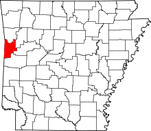 | |
| Towns | ||
| Unincorporated communities | ||
| Footnotes | ‡This populated place also has portions in an adjacent county or counties | |