Lavonia, Georgia
| Lavonia, Georgia | |
|---|---|
| City | |
|
Motto: "Home to Land of Spirit", "Big Time Small Town" | |
 Location in Franklin County and the state of Georgia | |
| Coordinates: 34°26′10″N 83°6′23″W / 34.43611°N 83.10639°WCoordinates: 34°26′10″N 83°6′23″W / 34.43611°N 83.10639°W | |
| Country | United States |
| State | Georgia |
| County | Franklin |
| Area | |
| • Total | 4.59 sq mi (11.89 km2) |
| • Land | 4.56 sq mi (11.82 km2) |
| • Water | 0.02 sq mi (0.06 km2) |
| Elevation | 853 ft (260 m) |
| Population (2010) | |
| • Total | 2,156 |
| • Density | 472/sq mi (182.3/km2) |
| Time zone | Eastern (EST) (UTC-5) |
| • Summer (DST) | EDT (UTC-4) |
| ZIP code | 30553 |
| Area code(s) | 706 |
| FIPS code | 13-45460[1] |
| GNIS feature ID | 0316687[2] |
| Website |
www |
Lavonia is a city in Franklin County, Georgia, United States. The population was 2,156 at the 2010 census,[3] up from 1,827 at the 2000 census.
Geography
Lavonia is located in northeastern Franklin County at 34°26′10″N 83°6′23″W / 34.43611°N 83.10639°W (34.436055, -83.106270).[4]
According to the United States Census Bureau, the city has a total area of 4.6 square miles (11.9 km2), of which 0.02 square miles (0.06 km2), or 0.53%, is water.[3]
The city lies along Interstate 85, 53 miles (85 km) southwest of Greenville, South Carolina, and 94 miles (151 km) northeast of Atlanta.
History
The Cherokee people were indigenous to the area in which Lavonia is located. A sophisticated tribe that typically dwelled in cabins by the 18th century, the Cherokee joined with the British during the American Revolution. When the American colonists prevailed, their land was issued as bounty land to those that had fought in the revolution. As a result, people of European ancestry began to move into the Lavonia area during the 1780s.
The founding of the town of Lavonia came as the result of the expansion of the railroad in northeast Georgia. A railroad line known as the Elberton-Airline Railroad desired another station further to the north. In a move typical for the time, businessmen in the area determined to build a town around the new railroad station. Upon division of the area into town lots and completion of all necessary legal procedures, the town of Lavonia was incorporated in 1880.[5]
Demographics
| Historical population | |||
|---|---|---|---|
| Census | Pop. | %± | |
| 1880 | 72 | — | |
| 1890 | 283 | 293.1% | |
| 1900 | 699 | 147.0% | |
| 1910 | 1,712 | 144.9% | |
| 1920 | 1,644 | −4.0% | |
| 1930 | 1,511 | −8.1% | |
| 1940 | 1,667 | 10.3% | |
| 1950 | 1,766 | 5.9% | |
| 1960 | 2,088 | 18.2% | |
| 1970 | 2,044 | −2.1% | |
| 1980 | 2,024 | −1.0% | |
| 1990 | 1,840 | −9.1% | |
| 2000 | 1,827 | −0.7% | |
| 2010 | 2,156 | 18.0% | |
| Est. 2015 | 2,165 | [6] | 0.4% |
As of the census[1] of 2000, there were 1,827 people, 777 households, and 519 families residing in the city. The population density was 470.0 people per square mile (181.3/km²). There were 882 housing units at an average density of 226.9 per square mile (87.5/km²). The racial makeup of the city was 69.24% White, 28.95% African American, 0.11% Native American, 0.11% Asian, 0.38% from other races, and 1.20% from two or more races. Hispanic or Latino of any race were 0.88% of the population.
There were 777 households out of which 28.4% had children under the age of 18 living with them, 43.5% were married couples living together, 18.3% had a female householder with no husband present, and 33.1% were non-families. 30.5% of all households were made up of individuals and 16.3% had someone living alone who was 65 years of age or older. The average household size was 2.35 and the average family size was 2.92.
In the city the population was spread out with 25.4% under the age of 18, 8.4% from 18 to 24, 25.1% from 25 to 44, 22.9% from 45 to 64, and 18.2% who were 65 years of age or older. The median age was 38 years. For every 100 females there were 80.2 males. For every 100 females age 18 and over, there were 75.4 males.
The median income for a household in the city was $24,286, and the median income for a family was $28,464. Males had a median income of $29,250 versus $21,328 for females. The per capita income for the city was $12,876. About 28.1% of families and 29.7% of the population were below the poverty line, including 42.6% of those under age 18 and 23.0% of those age 65 or over.
Notable people
- Kyle Myers, YouTube personality
- Ernest Vandiver, former mayor of Lavonia and governor of Georgia from 1959 to 1963
References
- 1 2 "American FactFinder". United States Census Bureau. Retrieved 2008-01-31.
- ↑ "US Board on Geographic Names". United States Geological Survey. 2007-10-25. Retrieved 2008-01-31.
- 1 2 "Geographic Identifiers: 2010 Census Summary File 1 (G001), Lavonia city, Georgia". American FactFinder. U.S. Census Bureau. Retrieved April 28, 2016.
- ↑ "US Gazetteer files: 2010, 2000, and 1990". United States Census Bureau. 2011-02-12. Retrieved 2011-04-23.
- ↑ Marie H. Williams, ed. Lavonia: Gem of the Piedmont. Hartwell, GA: Hurley Printing, 1977.
- ↑ "Annual Estimates of the Resident Population for Incorporated Places: April 1, 2010 to July 1, 2015". Retrieved July 2, 2016.
- ↑ "Census of Population and Housing". Census.gov. Retrieved June 4, 2015.
External links
Municipalities and communities of Franklin County, Georgia, United States | ||
|---|---|---|
| City | 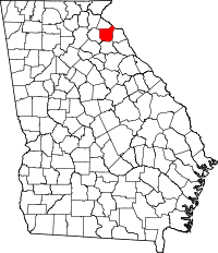 | |
| Town | ||
| CDP | ||
| Footnotes | ‡This populated place also has portions in an adjacent county or counties | |