Royston, Georgia
| Royston, Georgia | |
|---|---|
| City | |
 Location in Franklin County and the state of Georgia | |
| Coordinates: 34°17′8″N 83°6′35″W / 34.28556°N 83.10972°WCoordinates: 34°17′8″N 83°6′35″W / 34.28556°N 83.10972°W | |
| Country | United States |
| State | Georgia |
| Counties | Franklin, Hart, Madison |
| City of Royston | 1879 |
| Government | |
| • Mayor | David Jordan |
| • City Manager | Greg Scott |
| Area | |
| • Total | 3.40 sq mi (8.81 km2) |
| • Land | 3.39 sq mi (8.77 km2) |
| • Water | 0.02 sq mi (0.05 km2) |
| Elevation | 899 ft (274 m) |
| Population (2010) | |
| • Total | 2,582 |
| • Density | 763/sq mi (294.6/km2) |
| Time zone | Eastern (EST) (UTC-5) |
| • Summer (DST) | EDT (UTC-4) |
| ZIP code | 30662 |
| Area code(s) | 706 |
| FIPS code | 13-67452[1] |
| GNIS feature ID | 0321981[2] |
| Website |
cityofroyston |
Royston is a city in Franklin, Hart, and Madison counties in the U.S. state of Georgia. The population was 2,582 at the 2010 census.[3]
Geography
Royston is located in the southeast corner of Franklin County and the southwest corner of Hart County at 34°17′8″N 83°6′35″W / 34.28556°N 83.10972°W (34.285592, -83.109841).[4] A small portion extends south into Madison County. U.S. Route 29 passes through the center of town, leading northeast 12 miles (19 km) to Hartwell and southwest 30 miles (48 km) to Athens. Georgia State Route 17 leads north from Royston 11 miles (18 km) to Lavonia and southeast 19 miles (31 km) to Elberton.
According to the United States Census Bureau, Royston has a total area of 3.4 square miles (8.8 km2), of which 0.02 square miles (0.05 km2), or 0.51%, is water.[3]
Demographics
| Historical population | |||
|---|---|---|---|
| Census | Pop. | %± | |
| 1880 | 127 | — | |
| 1890 | 340 | 167.7% | |
| 1900 | 579 | 70.3% | |
| 1910 | 1,422 | 145.6% | |
| 1920 | 1,681 | 18.2% | |
| 1930 | 1,447 | −13.9% | |
| 1940 | 1,549 | 7.0% | |
| 1950 | 2,039 | 31.6% | |
| 1960 | 2,333 | 14.4% | |
| 1970 | 2,428 | 4.1% | |
| 1980 | 2,404 | −1.0% | |
| 1990 | 2,758 | 14.7% | |
| 2000 | 2,493 | −9.6% | |
| 2010 | 2,582 | 3.6% | |
| Est. 2015 | 2,574 | [5] | −0.3% |
As of the census[1] of 2000, there were 2,493 people, 1,016 households, and 610 families residing in the city. The population density was 728.4 people per square mile (281.4/km²). There were 1,135 housing units at an average density of 331.6 per square mile (128.1/km²). The racial makeup of the city was 74.25% White, 23.23% African American, 0.08% Native American, 0.68% Asian, 0.36% from other races, and 1.40% from two or more races. Hispanic or Latino of any race were 1.24% of the population.
There were 1,016 households out of which 27.2% had children under the age of 18 living with them, 37.3% were married couples living together, 19.7% had a female householder with no husband present, and 39.9% were non-families. 35.9% of all households were made up of individuals and 20.1% had someone living alone who was 65 years of age or older. The average household size was 2.27 and the average family size was 2.97.
In the city the population was spread out with 23.4% under the age of 18, 8.5% from 18 to 24, 22.7% from 25 to 44, 20.1% from 45 to 64, and 25.4% who were 65 years of age or older. The median age was 40 years. For every 100 females there were 78.6 males. For every 100 females age 18 and over, there were 68.6 males.
The median income for a household in the city was $22,024, and the median income for a family was $31,845. Males had a median income of $27,500 versus $21,580 for females. The per capita income for the city was $14,750. About 19.7% of families and 24.7% of the population were below the poverty threshold, including 25.7% of those under age 18 and 23.1% of those age 65 or over.
Culture
Notable people
- Orville Vernon Burton, scholar
- Spud Chandler, professional baseball pitcher and American League Most Valuable Player in 1943
- Ty Cobb, member of the Baseball Hall of Fame
- Dee Dowis, Air Force Academy quarterback
- Clete Donald Johnson, Jr., member of the U.S. House of Representatives and United States Trade Representative
- Tony Jones, professional football player
- Terry Kay, author
- Gary Walker, professional football player
References
- 1 2 "American FactFinder". United States Census Bureau. Retrieved 2008-01-31.
- ↑ "US Board on Geographic Names". United States Geological Survey. 2007-10-25. Retrieved 2008-01-31.
- 1 2 "Geographic Identifiers: 2010 Census Summary File 1 (G001), Royston city, Georgia". American FactFinder. U.S. Census Bureau. Retrieved April 28, 2016.
- ↑ "US Gazetteer files: 2010, 2000, and 1990". United States Census Bureau. 2011-02-12. Retrieved 2011-04-23.
- ↑ "Annual Estimates of the Resident Population for Incorporated Places: April 1, 2010 to July 1, 2015". Retrieved July 2, 2016.
- ↑ "Census of Population and Housing". Census.gov. Retrieved June 4, 2015.
External links
Municipalities and communities of Franklin County, Georgia, United States | ||
|---|---|---|
| City | 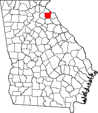 | |
| Town | ||
| CDP | ||
| Footnotes | ‡This populated place also has portions in an adjacent county or counties | |
Municipalities and communities of Hart County, Georgia, United States | ||
|---|---|---|
| City |  | |
| Town | ||
| CDPs | ||
| Footnotes | ‡This populated place also has portions in an adjacent county or counties | |
Municipalities and communities of Madison County, Georgia, United States | ||
|---|---|---|
| Cities | 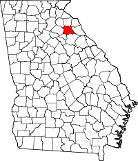 | |
| Footnotes | ‡This populated place also has portions in an adjacent county or counties | |