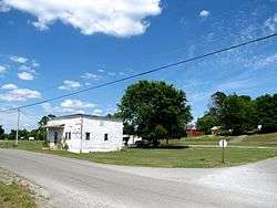
Lees Station, Tennessee
| Lees Station | |
|---|---|
| Unincorporated community | |
 | |
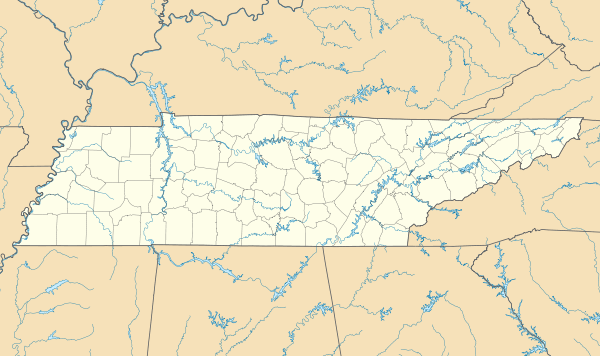 Lees Station  Lees Station Location within the state of Tennessee | |
| Coordinates: 35°33′27″N 85°15′3″W / 35.55750°N 85.25083°WCoordinates: 35°33′27″N 85°15′3″W / 35.55750°N 85.25083°W | |
| Country | United States |
| State | Tennessee |
| County | Bledsoe |
| Elevation | 853 ft (260 m) |
| Time zone | Central (CST) (UTC-6) |
| • Summer (DST) | CDT (UTC-5) |
| GNIS feature ID | 1290982[1] |
Lees Station (also Lee, Lees, or Let) is an unincorporated community in Bledsoe County, Tennessee, United States. It lies along U.S. Route 127 southwest of the city of Pikeville, the county seat of Bledsoe County.[2] Its elevation is 853 feet (260 m), and it is located at about 35°33′27″N 85°15′3″W / 35.55750°N 85.25083°W (35.5574281, -85.2507964). The various forms of its names led the Board on Geographic Names officially to designate it Lees in 1916. In 1969, the official name was changed to Lees Station.[1]
References
- 1 2 "Lees Station, Tennessee". Geographic Names Information System. United States Geological Survey. Retrieved 2008-02-18.
- ↑ Rand McNally. The Road Atlas '08. Chicago: Rand McNally, 2008, p. 95.
Municipalities and communities of Bledsoe County, Tennessee, United States | ||
|---|---|---|
| City | ||
| Unincorporated communities | ||
This article is issued from Wikipedia - version of the 7/31/2016. The text is available under the Creative Commons Attribution/Share Alike but additional terms may apply for the media files.