Lehighton, Pennsylvania
| Lehighton, Pennsylvania | |
|---|---|
| Borough | |
|
Lehighton, Pennsylvania | |
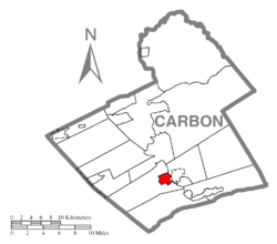 Location of Lehighton in Carbon County | |
 Lehighton, Pennsylvania Location of Lehighton in Pennsylvania | |
| Coordinates: 40°49′55″N 75°42′53″W / 40.83194°N 75.71472°WCoordinates: 40°49′55″N 75°42′53″W / 40.83194°N 75.71472°W | |
| Country | United States |
| State | Pennsylvania |
| County | Carbon |
| Government | |
| • Mayor | William Bauchspies |
| Area | |
| • Total | 1.65 sq mi (4.3 km2) |
| • Land | 1.62 sq mi (4.2 km2) |
| • Water | 0.03 sq mi (0.08 km2) |
| Elevation[1] | 570 ft (170 m) |
| Population (2013 est.) | |
| • Total | 15,414 |
| • Density | 9,300/sq mi (3,600/km2) |
| Time zone | EST (UTC-5) |
| • Summer (DST) | EDT (UTC-4) |
| ZIP code | 18235 |
| Area code(s) | 610 Exchanges: 377,379 |
| Website |
www |
Lehighton (/li'hɑitən/) is a borough in Carbon County, Pennsylvania, United States, 77 miles (124 km) north of Philadelphia, and 54 miles (87 km) south of Scranton. In the past, it developed early industries because of water power from the Lehigh River. With the location of a repair facility here and its regional operations, the Lehigh Valley Railroad became for years a major employer of thousands of people from the area. Post-World War II railroad and industry restructuring led to job and population losses.
From a peak of nearly 7,000 in 1940, the population was 5,500 at the 2010 census.[2] Lehighton is the most populous borough in Carbon County and still the business hub of the county.
History
At the time of European encounter with historic American Indian tribes, this area was part of the territory of the Lenape, also called Delaware, after their language and territory on the Delaware River. Their bands occupied much of the coastal mid-Atlantic area in Delaware, New Jersey, Pennsylvania and New York.
Lehighton was built on the site of the German Moravian Brethren's mission station "Gnadenhütten" (cabins of grace) founded in 1746. It was established as a mission to the Lenape by Moravians from Bethlehem, Pennsylvania, lower on the Lehigh River.[3] The German name was transcribed as "Canatanheat" by missionary John Brainerd.[4]
During the French and Indian Wars (Seven Years' War), Native allies of the French killed 11 missionaries and Lenape (Delaware) converted Christians at Gnadenhutten on 24 November 1755. They destroyed the mission village,[5] and only four of the fifteen residents escaped.[6] (During the American Revolutionary War, in 1782 Pennsylvania militia raided another Moravian mission village, also called Gnadenhutten, in present-day Ohio. Suspecting the Lenape of being allied with the British, the militia killed 96 unarmed men, women, and children in what became better known as the Gnadenhutten Massacre.)
The Lehigh River was a source of water power for developing industries in the 19th century. Lehighton had silk and lace mills, a meat-packing house, shirt factory, automatic-press works, car shops, stoneworks, and foundries. In 1900, the population was 4,629 people. By 1940, it had reached 6,615.
The coming of the railroad made it easier for businessmen to get their products to major markets. For many years, the Lehigh Valley Railroad had a major repair facility in Lehighton. The coming of the railroad was a major economic boost for the town. It was the area's largest company, employing several thousand workers at the repair facilities or operating and maintaining the railroad. Restructuring in the railroad industry led to the repair facilities being moved to another location. Lost jobs meant that some people had to relocate for work.
The Lehighton downtown declined after the Carbon Plaza Mall was built in nearby Mahoning Township. Suburban housing developed, pulling more businesses from downtown. After struggling for three decades, the downtown is experiencing a rebirth as people appreciate the qualities of a compact central location and historic architecture.
The town holds an annual civic event, "Bike Night", featuring more than 28,000 motorcyclists. "Bike Night" first started in the borough of Lehighton. In 2013, Lehighton moved its "Bike Night" out of the downtown park across from the borough office to a park called "The Grove" located on Iron Street between South 7th and 8th Street. In 2015, "Bike Night" was moved again. However, this time "Bike Night" moved out of the Lehighton Borough. "Bike Night" of 2015 was located in Franklin Township, which is located a few miles outside of the borough. This is the first time since the 1st annual event that it was not held within the Lehighton borough itself.
In late September through October, the Country Junction store sponsors "The Great Pocono Pumpkin Festival". It features hayrides, walks in haunted woods, and cornfield mazes.
The town is on a north-south bird migration pattern, and birds can be frequently seen flying south in mass in the fall. One particularly tall grey rooftop overlooking the Lehigh River on the Rt. 209 bridge is a frequent stop for migrating birds.
Geography
.jpg)
Lehighton is located in southern Carbon County at 40°49′55″N 75°42′53″W / 40.83194°N 75.71472°W (40.831932, -75.714701).[7] It is in northeast Pennsylvania 117 miles (188 km) west of New York City and 37 miles (60 km) south of Wilkes-Barre. The borough is situated on the west bank of the Lehigh River at an elevation ranging from 470 feet (140 m) above sea level at the river up to 725 feet (221 m) near the northwest part of town by Mahoning Township border.
According to the United States Census Bureau, the borough has a total area of 1.65 square miles (4.28 km2), of which 1.62 square miles (4.20 km2) is land and 0.03 square miles (0.07 km2), or 1.69%, is water.[2] Lehighton is located 3 miles (5 km) south of Jim Thorpe, the Carbon County seat, and 7 miles (11 km) northwest of Palmerton. Lehighton is bordered on the north, west, and south by Mahoning Township and across the Lehigh River on the east by Weissport and Franklin Township.
Lehighton is primarily very green and hilly. The town and its outlying communities are in the Ridge-and-Valley region of the Appalachian Mountains. The Appalachian Trail, a long-distance hiking trail extending from Maine to Georgia, is located south of town near Palmerton.
Climate
The region has large seasonal temperature differences, with warm to hot (and often humid) summers and cold (sometimes severely cold) winters. The Köppen Climate Classification subtype for this climate is "Dfb" (Warm Summer Continental Climate).[8]
Snowfall is variable, with some winters bringing moderate snow and others bringing numerous significant snowstorms. Average snowfall is 50.4 inches (128 cm) per year,[9] with the months of January and February receiving the highest at just over 15 and 13 inches (38 and 33 cm) respectively. Rainfall is generally spread throughout the year, with eight to twelve wet days per month,[10] at an average annual rate of 43.52 inches (110.54 cm).[11]
Typically, summer lasts from late May until mid September. The humidity is high only for one to two days at a time. Winter lasts from November through March and varies greatly in length and severity. Snowfall can occur anytime from mid-October to as late as April. Spring and autumn are both short and highly variable. The autumn foliage season is only two to three weeks long and is at its peak anytime from early to mid-October.
Winter daytime highs average 27.8 °F (−2.3 °C) in January and the lows are 13.9 °F (−10.1 °C) Summer daytime highs average 81.2 °F (27.3 °C) in July and the lows are 55.6 °F (13.1 °C)
| Climate data for Lehighton, Pennsylvania | |||||||||||||
|---|---|---|---|---|---|---|---|---|---|---|---|---|---|
| Month | Jan | Feb | Mar | Apr | May | Jun | Jul | Aug | Sep | Oct | Nov | Dec | Year |
| Record high °F (°C) | 61 (16) |
68 (20) |
80 (27) |
88 (31) |
92 (33) |
97 (36) |
100 (38) |
96 (36) |
88 (31) |
79 (26) |
71 (22) |
65 (18) |
100 (38) |
| Average high °F (°C) | 30.2 (−1) |
33.7 (0.9) |
43.7 (6.5) |
55.1 (12.8) |
65.9 (18.8) |
76.3 (24.6) |
82.1 (27.8) |
80.7 (27.1) |
69.0 (20.6) |
57.9 (14.4) |
46.2 (7.9) |
35.0 (1.7) |
60.5 (15.8) |
| Average low °F (°C) | 14.1 (−9.9) |
19.0 (−7.2) |
23.9 (−4.5) |
34.8 (1.6) |
44.3 (6.8) |
50.7 (10.4) |
58.6 (14.8) |
57.7 (14.3) |
49.7 (9.8) |
41.1 (5.1) |
29.7 (−1.3) |
21.0 (−6.1) |
40.6 (4.8) |
| Record low °F (°C) | −21 (−29) |
−17 (−27) |
−10 (−23) |
7 (−14) |
23 (−5) |
34 (1) |
36 (2) |
41 (5) |
29 (−2) |
17 (−8) |
0 (−18) |
−12 (−24) |
−21 (−29) |
| Average precipitation inches (mm) | 3.50 (88.9) |
2.75 (69.9) |
3.56 (90.4) |
3.49 (88.6) |
4.47 (113.5) |
3.99 (101.3) |
4.27 (108.5) |
4.35 (110.5) |
4.37 (111) |
3.33 (84.6) |
3.70 (94) |
3.39 (86.1) |
45.17 (1,147.3) |
| Average snowfall inches (cm) | 14.1 (35.8) |
12.4 (31.5) |
8.5 (21.6) |
3.8 (9.7) |
0 (0) |
0 (0) |
0 (0) |
0 (0) |
0 (0) |
2.1 (5.3) |
6.4 (16.3) |
10.8 (27.4) |
58.1 (147.6) |
| Average precipitation days (≥ 0.01 in) | 11.2 | 10.2 | 11.1 | 11.3 | 12.4 | 11.2 | 10.5 | 9.4 | 9.9 | 8.7 | 10.0 | 11.0 | 126.9 |
| Average snowy days (≥ 0.1 in) | 8.7 | 7.9 | 4.8 | 1.4 | 0 | 0 | 0 | 0 | 0 | 1.1 | 3.8 | 5.3 | 32.0 |
Demographics
| Historical population | |||
|---|---|---|---|
| Census | Pop. | %± | |
| 1850 | 267 | — | |
| 1870 | 1,485 | — | |
| 1880 | 1,937 | 30.4% | |
| 1890 | 2,959 | 52.8% | |
| 1900 | 4,629 | 56.4% | |
| 1910 | 5,316 | 14.8% | |
| 1920 | 6,102 | 14.8% | |
| 1930 | 6,490 | 6.4% | |
| 1940 | 6,615 | 1.9% | |
| 1950 | 6,565 | −0.8% | |
| 1960 | 6,318 | −3.8% | |
| 1970 | 6,095 | −3.5% | |
| 1980 | 5,826 | −4.4% | |
| 1990 | 5,914 | 1.5% | |
| 2000 | 5,537 | −6.4% | |
| 2010 | 5,500 | −0.7% | |
| Est. 2015 | 5,314 | [12] | −3.4% |
| Sources:[13][14][15] | |||
As of the census[14] of 2000, there were 5,537 people, 2,362 households, and 1,506 families residing in the borough. The population density was 3,230.8 people per square mile (1,250.2/km²). There were 2,546 housing units at an average density of 1,485.6 per square mile (574.9/km²). The racial makeup of the borough was 98.32% White, 1.34% African American, 1.05% Native American, 1.45% Asian, 1.09% Pacific Islander, 1.04% from other races, and 1.70% from two or more races. Hispanic or Latino of any race were 1.67% of the population, but the illegal immigrant population has grown dramatically all over Pennsylvania. The plurality of Lehighton residents are of Irish descent. There are also substantial populations of German, Italian, Polish, and Slovak heritage.
There were 2,362 households, out of which 27.7% had children under the age of 18 living with them, 45.8% were married couples living together, 13.8% had a female householder with no husband present, and 36.2% were non-families. 31.6% of all households were made up of individuals, and 17.2% had someone living alone who was 65 years of age or older. The average household size was 2.31 and the average family size was 2.87.
In the borough the population was spread out, with 22.6% under the age of 18, 7.3% from 18 to 24, 27.3% from 25 to 44, 21.7% from 45 to 64, and 21.1% who were 65 years of age or older. The median age was 40 years. For every 100 females, there were 87.1 males. For every 100 females age 18 and over, there were 82.5 males.
The median income for a household in the borough was $28,566, and the median income for a family was $35,673. Males had a median income of $30,590 versus $22,466 for females. The per capita income for the borough was $14,861. About 10.8% of families and 14.3% of the population were below the poverty line, including 24.9% of those under age 18 and 6.0% of those age 65 or over.
Transportation
Lehighton is served by I-476, US 209, PA 248, PA 443, and PA 902.
Susquehanna Trailways provides daily bus service to destinations in New York and Pennsylvania.[16] Passenger rail service ended in 1961 when the Lehigh Valley Railroad, once a major employer in the area, discontinued all passenger service over its route.[17]
Jake Arner Memorial Airport (22N) is located 3 miles (5 km) west-southwest of town, with a 3,000-foot (910 m) asphalt runway and two RNAV instrument approaches.
Media
Lehighton is home to the Times News, published six-days-a-week serving five counties.
In 1962, 1160 AM signed-on as WYNS. In 2005 call letters were changed under new ownership to WBYN.
Notable people
- Kerry Getz, pro skateboarder
- Franz Kline, 20th-century artist
- Christian Hackenberg, NCAA Division 1 football quarterback
- Denny Seiwell, Drummer, Paul McCartney & Wings
- Mike Bugarewicz, Nascar Crew Chief for Tony Stewart
- Jason Erik Zacek jr, Actor
References
 |
Mahoning Township | Mahoning Township | Franklin Township | |
| Mahoning Township | |
Weissport | ||
| ||||
| | ||||
| Mahoning Township | Mahoning Township | Parryville |
- ↑ "Borough of Lehighton". Geographic Names Information System. United States Geological Survey. 2 August 1979. Retrieved 5 February 2008.
- 1 2 "Geographic Identifiers: 2010 Demographic Profile Data (G001): Lehighton borough, Pennsylvania". U.S. Census Bureau, American Factfinder. Retrieved April 2, 2015.
- ↑ "History", Lehighton Borough official website
- ↑ Thomas Brainerd, John Brainerd: The Life of John Brainerd: The Brother of David Brainerd, and His Successor as Missionary to the Indians of New Jersey ..., Presbyterian Publication Committee, 1865,p. 197. Footnote: "This was, doubtless, Gnadenhütten, founded by the Moravians in 1746. It was situated on the Mahoning Creek, near the Lehigh River,..."
- ↑ "Lehighton", Encyclopædia Britannica
- ↑ Clarence Marsh Case: The Social Psychology of Passive Resistance, PhD Dissertation, Madison, WI: University of Wisconsin, 1915, p. 120
- ↑ "US Gazetteer files: 2010, 2000, and 1990". United States Census Bureau. 2011-02-12. Retrieved 2011-04-23.
- ↑ Climate Summary for Lehigton, Pennsylvania
- ↑ "Snowfall – Average Total In Inches". Retrieved 4 November 2006.
- ↑ "Average Days of Precipitation, .01 cm or more". Archived from the original on November 3, 2006. Retrieved 4 November 2006.
- ↑ "Average Monthly Precipitation". Archived from the original on September 19, 2006. Retrieved 4 November 2006.
- ↑ "Annual Estimates of the Resident Population for Incorporated Places: April 1, 2010 to July 1, 2015". Retrieved July 2, 2016.
- ↑ "Census of Population and Housing". U.S. Census Bureau. Retrieved 11 December 2013.
- 1 2 "American FactFinder". United States Census Bureau. Retrieved 2008-01-31.
- ↑ "Annual Estimates of the Resident Population for Incorporated Places - Pennsylvania: April 1, 2010 to July 1, 2013 (PEPANNRES)". U.S. Census Bureau. Retrieved April 2, 2015.
- ↑ Susquehanna Trailways. "Schedule Routes". Retrieved 3 March 2013.
- ↑ "New York Loses More Famed Trains". Ottawa Citizen. 3 February 1961. Retrieved 3 March 2013.
External links
| Wikimedia Commons has media related to Lehighton, Pennsylvania. |
| Wikisource has the text of the 1905 New International Encyclopedia article Lehighton. |
| Wikivoyage has a travel guide for Lehighton. |
Municipalities and communities of Carbon County, Pennsylvania, United States | ||
|---|---|---|
| Boroughs | 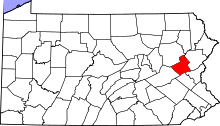 | |
| Townships | ||
| CDPs | ||
| Unincorporated communities | ||
| Footnotes | ‡This populated place also has portions in an adjacent county or counties | |