Lilybank
Coordinates: 55°50′46″N 4°11′34″W / 55.846035°N 4.192854°W
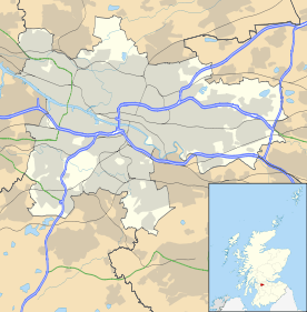
Lilybank is a district in the east of Glasgow. It was farmland until the 1930s, though small industries such as rope and brickworks had also been established. Neighbouring areas such as Belvidere, Braidfauld, Dalbeth, Dalmarnock Easterhill, Newbank and Springfield got their names from farms or country houses built by Glasgow merchants in the 18th century, but there seems to be no record of a Lilybank Farm or Lilybank House (at least not in the east end). Another Lilybank House is part of Glasgow University in the West End. There is a third Lilybank House, located in South Queensferry (approx 10 miles outside Edinburgh).
Given that Lilybank is about half a mile from the River Clyde, the name looks like a fanciful modern invention, though the area has a surprising amount of interest. The Lilybank housing scheme was opened in 1933 to house tenants from slum clearance in Calton, Camlachie and Garngad.
Many residents of Lilybank would consider themselves residents of Parkhead or Tollcross, but they have been officially placed within the Braidfauld Ward of Glasgow City Council.
