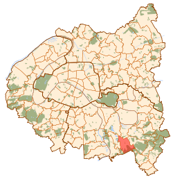
Limeil-Brévannes
| Limeil-Brévannes | ||
|---|---|---|
|
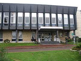
The town hall of Limeil-Brévannes | ||
| ||
 Paris and inner ring departments | ||
| Coordinates: 48°44′47″N 2°29′18″E / 48.7464°N 2.4883°ECoordinates: 48°44′47″N 2°29′18″E / 48.7464°N 2.4883°E | ||
| Country | France | |
| Region | Île-de-France | |
| Department | Val-de-Marne | |
| Arrondissement | Créteil | |
| Intercommunality | Plaine Centrale du Val-de-Marne | |
| Government | ||
| • Mayor (2008-2014) | Joseph Rossignol (PG) | |
| Area1 | 6.93 km2 (2.68 sq mi) | |
| Population (2006)2 | 18,794 | |
| • Density | 2,700/km2 (7,000/sq mi) | |
| Time zone | CET (UTC+1) | |
| • Summer (DST) | CEST (UTC+2) | |
| INSEE/Postal code | 94044 / | |
|
1 French Land Register data, which excludes lakes, ponds, glaciers > 1 km² (0.386 sq mi or 247 acres) and river estuaries. 2 Population without double counting: residents of multiple communes (e.g., students and military personnel) only counted once. | ||
.svg.png)
Limeil-Brévannes is a commune in the southeastern suburbs of Paris, France. It is located 15.3 km (9.5 mi) from the center of Paris.
Transport
Limeil-Brévannes is served by no station of the Paris Métro, RER, or suburban rail network. The closest station to Limeil-Brévannes is Boissy-Saint-Léger station on Paris RER line A. This station is located in the neighboring commune of Boissy-Saint-Léger, 1.7 km (1.1 mi) from the town center of Limeil-Brévannes.
Education
Public primary schools in the commune include 8 preschools/nursery schools (maternelles) and 6 elementary schools, making a total of 13 schools.[1]
- Preschools: Anatole France, André Malraux, Henri Wallon, Jacques Prévert, Jean-Louis Marquèze, Paul Langevin, Pierre Curie, Rosa Luxemburg
- Elementaries: Anatole France, Pablo Picasso, Martine Soulié, Louis Pasteur, Piard, Jean-Louis Marquèze
Public secondary schools:[2]
- Two junior high schools: Collège Daniel Féry and Collège Janusz Korczak
- Lycée Guillaume Budé (senior high school/sixth-form college)
See also
References
- INSEE
- Mayors of Essonne Association (French)
- ↑ "Liste des écoles de la ville." Limeil-Brévannes. Retrieved on September 10, 2016. See the attendance boundaries for 2016.
- ↑ "Les collèges et lycée sur Limeil-Brévannes." Limeil-Brévannes. Retrieved on September 10, 2016.
External links
| Wikimedia Commons has media related to Limeil-Brévannes. |
- Limeil-Brévannes (French)
This article is issued from Wikipedia - version of the 9/10/2016. The text is available under the Creative Commons Attribution/Share Alike but additional terms may apply for the media files.