Limousis
| Limousis | ||
|---|---|---|
|
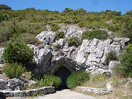
Cave | ||
| ||
 Limousis | ||
|
Location within Occitanie region  Limousis | ||
| Coordinates: 43°20′05″N 2°24′07″E / 43.3347°N 2.4019°ECoordinates: 43°20′05″N 2°24′07″E / 43.3347°N 2.4019°E | ||
| Country | France | |
| Region | Occitanie | |
| Department | Aude | |
| Arrondissement | Carcassonne | |
| Canton | Conques-sur-Orbiel | |
| Intercommunality | Minervois au Cabardès | |
| Government | ||
| • Mayor (2008–2014) | Gilles Delaur | |
| Area1 | 9.92 km2 (3.83 sq mi) | |
| Population (2008)2 | 106 | |
| • Density | 11/km2 (28/sq mi) | |
| Time zone | CET (UTC+1) | |
| • Summer (DST) | CEST (UTC+2) | |
| INSEE/Postal code | 11205 / 11600 | |
| Elevation |
144–580 m (472–1,903 ft) (avg. 368 m or 1,207 ft) | |
|
1 French Land Register data, which excludes lakes, ponds, glaciers > 1 km² (0.386 sq mi or 247 acres) and river estuaries. 2 Population without double counting: residents of multiple communes (e.g., students and military personnel) only counted once. | ||

Limousis is a commune in the Aude department in southern France.
Population
| Historical population | ||
|---|---|---|
| Year | Pop. | ±% |
| 1962 | 146 | — |
| 1968 | 158 | +8.2% |
| 1975 | 110 | −30.4% |
| 1982 | 91 | −17.3% |
| 1990 | 86 | −5.5% |
| 1999 | 104 | +20.9% |
| 2008 | 106 | +1.9% |
See also
References
| Wikimedia Commons has media related to Limousis. |
This article is issued from Wikipedia - version of the 2/12/2016. The text is available under the Creative Commons Attribution/Share Alike but additional terms may apply for the media files.