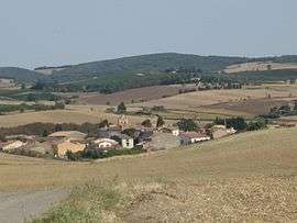
Villeneuve-lès-Montréal
| Villeneuve-lès-Montréal | ||
|---|---|---|
 | ||
| ||
 Villeneuve-lès-Montréal | ||
|
Location within Occitanie region  Villeneuve-lès-Montréal | ||
| Coordinates: 43°10′52″N 2°06′44″E / 43.1811°N 2.1122°ECoordinates: 43°10′52″N 2°06′44″E / 43.1811°N 2.1122°E | ||
| Country | France | |
| Region | Occitanie | |
| Department | Aude | |
| Arrondissement | Carcassonne | |
| Canton | Montréal, Aude | |
| Intercommunality | Malepère | |
| Government | ||
| • Mayor (2008–2014) | Mme Mazieres | |
| Area1 | 2.20 km2 (0.85 sq mi) | |
| Population (2008)2 | 226 | |
| • Density | 100/km2 (270/sq mi) | |
| Time zone | CET (UTC+1) | |
| • Summer (DST) | CEST (UTC+2) | |
| INSEE/Postal code | 11432 / 11290 | |
| Elevation |
179–250 m (587–820 ft) (avg. 200 m or 660 ft) | |
|
1 French Land Register data, which excludes lakes, ponds, glaciers > 1 km² (0.386 sq mi or 247 acres) and river estuaries. 2 Population without double counting: residents of multiple communes (e.g., students and military personnel) only counted once. | ||
.svg.png)
Villeneuve-lès-Montréal is a commune in the Aude department in southern France.
Population
| Historical population | ||
|---|---|---|
| Year | Pop. | ±% |
| 1962 | 129 | — |
| 1968 | 131 | +1.6% |
| 1975 | 101 | −22.9% |
| 1982 | 104 | +3.0% |
| 1990 | 116 | +11.5% |
| 1999 | 202 | +74.1% |
| 2008 | 226 | +11.9% |
See also
References
| Wikimedia Commons has media related to Villeneuve-lès-Montréal. |
This article is issued from Wikipedia - version of the 12/25/2014. The text is available under the Creative Commons Attribution/Share Alike but additional terms may apply for the media files.