| [3] |
Name on the Register[4] |
Image |
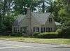
Date listed[5] |
Location |
City or town |
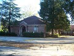
Description |
|---|
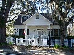
| 1 |
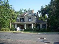
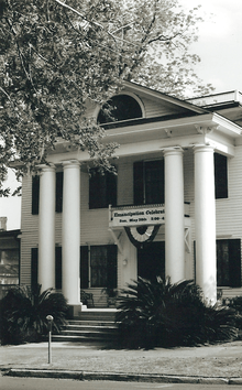
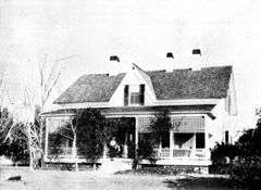
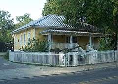
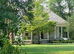
Averitt-Winchester House |
|
000000001996-11-15-0000November 15, 1996
(#96001336) |
Western side of State Road 59, south of its junction with Moccasin Gap-Cromartie Road
30°35′33″N 84°02′31″W / 30.5925°N 84.041944°W / 30.5925; -84.041944 (Averitt-Winchester House) |
Miccosukee |
|
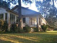
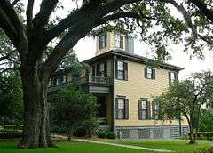
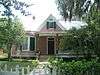
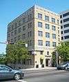
| 2 |
Bannerman Plantation |
|
000000002002-06-06-0000June 6, 2002
(#02000606) |
13426 Meridian Road North
30°38′42″N 84°16′44″W / 30.645°N 84.278889°W / 30.645; -84.278889 (Bannerman Plantation) |
Tallahassee |
Part of the Rural Resources of Leon County MPS
|
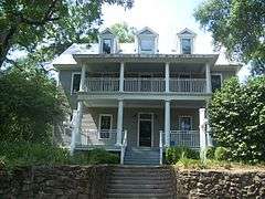
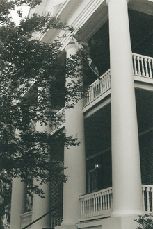
| 3 |
Bellevue |
|
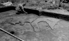
000000001971-03-11-0000March 11, 1971
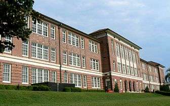
(#71000238) |
Southwest of Tallahassee off State Road 371
30°24′45″N 84°20′41″W / 30.4125°N 84.344722°W / 30.4125; -84.344722 (Bellevue) |
Tallahassee |
|
| 4 |
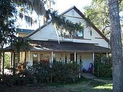
Billingsley Farm |
|
000000002007-09-05-0000September 5, 2007
(#07000897) |
3640 Oakhurst Lane
30°31′00″N 84°04′29″W / 30.516583°N 84.074722°W / 30.516583; -84.074722 (Billingsley Farm) |
Tallahassee |
|
| 5 |
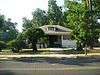
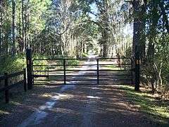
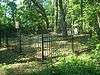
Blackwood-Harwood Plantations Cemetery |
|
000000001999-10-06-0000October 6, 1999
(#99000712) |
Northeast of the junction of State Road 263 and Interstate 10
30°29′13″N 84°21′01″W / 30.486944°N 84.350278°W / 30.486944; -84.350278 (Blackwood-Harwood Plantations Cemetery) |
Tallahassee |
|
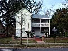
| 6 |
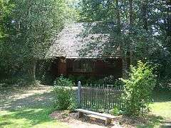
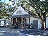
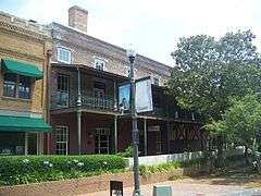
Bradley's Country Store |
|
000000001984-04-12-0000April 12, 1984
(#84000902) |
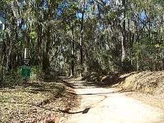
Moccasin Gap Road
30°35′27″N 84°07′31″W / 30.590833°N 84.125278°W / 30.590833; -84.125278 (Bradley's Country Store) |
Tallahassee |
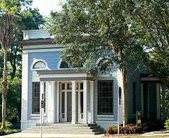
|
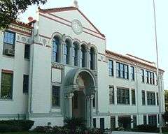
| 7 |
Caroline Brevard Grammar School |
|
000000001987-12-17-0000December 17, 1987
(#87002151) |
727 South Calhoun Street
30°26′09″N 84°16′45″W / 30.435833°N 84.279167°W / 30.435833; -84.279167 (Caroline Brevard Grammar School) |
Tallahassee |
|
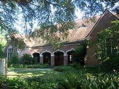
| 8 |
Brokaw-McDougall House |
|
000000001972-07-24-0000July 24, 1972
(#72000333) |
329 North Meridian Road
30°26′44″N 84°16′35″W / 30.445556°N 84.276389°W / 30.445556; -84.276389 (Brokaw-McDougall House) |
Tallahassee |
|
| 9 |
Calhoun Street Historic District |
|
000000001979-10-24-0000October 24, 1979
(#79000677) |
U.S. Route 90 and State Road 61
30°26′47″N 84°16′44″W / 30.446389°N 84.278889°W / 30.446389; -84.278889 (Calhoun Street Historic District) |
Tallahassee |
|
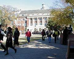
| 10 |
Carnegie Library |
|
000000001978-11-17-0000November 17, 1978
(#78000949) |
Florida Agricultural and Mechanical University campus
30°25′39″N 84°17′11″W / 30.4275°N 84.286389°W / 30.4275; -84.286389 (Carnegie Library) |
Tallahassee |
|
| 11 |
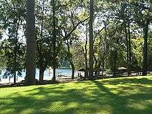
Cascades Park |
|
000000001971-05-12-0000May 12, 1971
(#71000239) |
Bounded roughly by the Apalachee Parkway, Bloxham, Suwanee, Munroe, and Meridian Streets, and state property line
30°26′08″N 84°16′38″W / 30.435556°N 84.277222°W / 30.435556; -84.277222 (Cascades Park) |
Tallahassee |
|
| 12 |
Chaires Community Historic District |
|
000000002000-12-13-0000December 13, 2000
(#00001502) |
Roughly along Chaires Cross Road, Road to the Lake, and Hancock Street
30°26′12″N 84°07′09″W / 30.436667°N 84.119167°W / 30.436667; -84.119167 (Chaires Community Historic District) |
Chaires |
|
| 13 |
Flavius C. Coles Farmhouse |
|
000000001992-01-07-0000January 7, 1992
(#91001911) |
411 Oakland Avenue
30°25′52″N 84°16′41″W / 30.431111°N 84.278056°W / 30.431111; -84.278056 (Flavius C. Coles Farmhouse) |
Tallahassee |
|
| 14 |
The Columns |
|
000000001975-05-21-0000May 21, 1975
(#75000561) |
100 North Duval Street
30°26′32″N 84°17′00″W / 30.442222°N 84.283333°W / 30.442222; -84.283333 (The Columns) |
Tallahassee |
|
| 15 |
Covington House |
|
000000001989-09-07-0000September 7, 1989
(#89001386) |
328 Cortez Street
30°27′42″N 84°16′30″W / 30.461667°N 84.275°W / 30.461667; -84.275 (Covington House) |
Tallahassee |
|
| 16 |
Escambe |
|
000000001971-05-14-0000May 14, 1971
(#71000240) |
Address Restricted
|
Tallahassee |
|
| 17 |
Exchange Bank Building |
|
000000001984-11-29-0000November 29, 1984
(#84000262) |
201 South Monroe Street
30°26′25″N 84°16′50″W / 30.440278°N 84.280556°W / 30.440278; -84.280556 (Exchange Bank Building) |
Tallahassee |
|
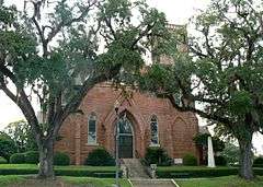
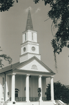
| 18 |
First Presbyterian Church |
|
000000001974-09-09-0000September 9, 1974
(#74000649) |
102 North Adams Street
30°26′32″N 84°16′57″W / 30.442222°N 84.2825°W / 30.442222; -84.2825 (First Presbyterian Church) |
Tallahassee |
|
| 19 |
Florida Agricultural and Mechanical College Historic District |
|
000000001996-05-09-0000May 9, 1996
(#96000530) |
Roughly, Martin Luther King Boulevard from South Adams Street to Wahnish Way
30°25′37″N 84°17′07″W / 30.426944°N 84.285278°W / 30.426944; -84.285278 (Florida Agricultural and Mechanical College Historic District) |
Tallahassee |
|
| 20 |
Florida Governor's Mansion |
|
000000002006-07-20-0000July 20, 2006
(#06000618) |
700 North Adams Street
30°26′59″N 84°16′57″W / 30.449722°N 84.2825°W / 30.449722; -84.2825 (Florida Governor's Mansion) |
Tallahassee |
|
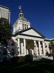
| 21 |
Florida State Capitol |
|
000000001973-05-07-0000May 7, 1973
(#73000584) |
South Monroe Street
30°26′16″N 84°16′53″W / 30.437778°N 84.281389°W / 30.437778; -84.281389 (Florida State Capitol) |
Tallahassee |
|
| 22 |
Gaither House |
Upload image |
000000002016-05-18-0000May 18, 2016
(#16000268) |
212 Young St.
30°25′22″N 84°17′01″W / 30.422710°N 84.283539°W / 30.422710; -84.283539 (Gaither House) |
Tallahassee |
|
| 23 |
Gallie's Hall and Buildings |
|
000000001980-10-20-0000October 20, 1980
(#80000954) |
Off State Road 61
30°26′23″N 84°16′55″W / 30.439722°N 84.281944°W / 30.439722; -84.281944 (Gallie's Hall and Buildings) |
Tallahassee |
|
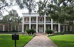
| 24 |
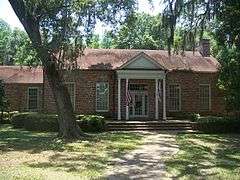
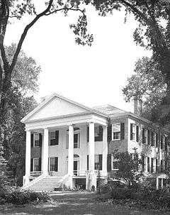
Goodwood |
|
000000001972-06-30-0000June 30, 1972
(#72000334) |
1500 Miccosukee Road
30°27′29″N 84°15′28″W / 30.458056°N 84.257778°W / 30.458056; -84.257778 (Goodwood) |
Tallahassee |
|
| 25 |
Greene-Lewis House |
|
000000001998-06-11-0000June 11, 1998
(#98000677) |
535 West College Avenue
30°26′N 84°17′W / 30.44°N 84.29°W / 30.44; -84.29 (Greene-Lewis House) |
Tallahassee |
|
| 26 |
Greenwood Cemetery |
|
000000002003-06-05-0000June 5, 2003
(#03000510) |
Old Bainbridge Road
30°27′37″N 84°17′43″W / 30.460278°N 84.295278°W / 30.460278; -84.295278 (Greenwood Cemetery) |
Tallahassee |
|
| 27 |
The Grove |
|
000000001972-06-13-0000June 13, 1972
(#72000335) |
Adams Street and 1st Avenue
30°27′01″N 84°16′55″W / 30.450278°N 84.281944°W / 30.450278; -84.281944 (The Grove) |
Tallahassee |
|
| 28 |
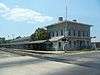
Jacksonville, Pensacola and Mobile Railroad Company Freight Depot |
|
000000001997-12-30-0000December 30, 1997
(#97001589) |
918 Railroad Avenue
30°25′59″N 84°17′26″W / 30.433056°N 84.290556°W / 30.433056; -84.290556 (Jacksonville, Pensacola and Mobile Railroad Company Freight Depot) |
Tallahassee |
|
| 29 |
Killearn Plantation Archeological and Historic District |
|
000000002002-08-16-0000August 16, 2002
(#02000836) |
3540 Thomasville Road
30°31′08″N 84°15′04″W / 30.518889°N 84.251111°W / 30.518889; -84.251111 (Killearn Plantation Archeological and Historic District) |
Tallahassee |
|
| 30 |
Lake Jackson Mounds |
|
000000001971-05-06-0000May 6, 1971
(#71000241) |
Address Restricted
30°30′00″N 84°18′49″W / 30.5°N 84.313611°W / 30.5; -84.313611 (Lake Jackson Mounds) |
Tallahassee |
|
| 31 |
Leon High School |
|
000000001993-09-21-0000September 21, 1993
(#93000982) |
550 East Tennessee Street
30°26′41″N 84°16′29″W / 30.444861°N 84.274722°W / 30.444861; -84.274722 (Leon High School) |
Tallahassee |
|
| 32 |
Lewis House |
|
000000001979-02-14-0000February 14, 1979
(#79000679) |
North of Tallahassee at 3117 Okeeheepkee Road
30°29′22″N 84°18′46″W / 30.489444°N 84.312778°W / 30.489444; -84.312778 (Lewis House) |
Tallahassee |
|
| 33 |
Lichgate on High Road |
|
000000002006-03-31-0000March 31, 2006
(#06000211) |
1401 High Road
30°27′39″N 84°18′49″W / 30.460833°N 84.313611°W / 30.460833; -84.313611 (Lichgate on High Road) |
Tallahassee |
|
| 34 |
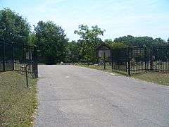
Los Robles Gate |
|
000000001989-09-21-0000September 21, 1989
(#89001480) |
Thomasville and Meridian Roads
30°27′30″N 84°16′37″W / 30.458333°N 84.276944°W / 30.458333; -84.276944 (Los Robles Gate) |
Tallahassee |
|
| 35 |
Los Robles Historic District |
Upload image |
000000002014-11-12-0000November 12, 2014
(#14000902) |
Roughly bounded by Thomasville Rd., North Meridian Rd. and the rear lot lines of properties facing Desoto St.
30°27′41″N 84°16′33″W / 30.461443°N 84.275816°W / 30.461443; -84.275816 (Los Robles Historic District) |
Tallahassee |
|
| 36 |
Magnolia Heights Historic District |
|
000000001984-06-29-0000June 29, 1984
(#84000906) |
701-1005 East Park Avenue and Cadiz Street
30°26′30″N 84°16′06″W / 30.441667°N 84.268333°W / 30.441667; -84.268333 (Magnolia Heights Historic District) |
Tallahassee |
|
| 37 |
Gov. John W. Martin House |
|
000000001986-01-06-0000January 6, 1986
(#86000024) |
1001 Governor's Drive
30°26′06″N 84°15′50″W / 30.435°N 84.263889°W / 30.435; -84.263889 (Gov. John W. Martin House) |
Tallahassee |
|
| 38 |
Meridian Road |
|
000000002013-03-20-0000March 20, 2013
(#13000081) |
Roughly John Hancock Dr. to Georgia State Line
30°36′13″N 84°17′49″W / 30.60364°N 84.297066°W / 30.60364; -84.297066 (Meridian Road) |
Tallahassee |
|
| 39 |
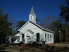
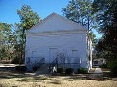
Miccosukee Methodist Church |
|
000000001996-06-28-0000June 28, 1996
(#96000695) |
County Road 59, south of junction with State Road 151
30°35′36″N 84°02′28″W / 30.593333°N 84.041111°W / 30.593333; -84.041111 (Miccosukee Methodist Church) |
Miccosukee |
|
| 40 |
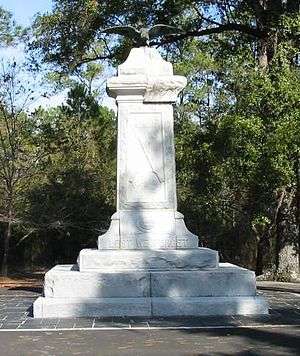
Natural Bridge Battlefield |
|
000000001970-09-29-0000September 29, 1970
(#70000188) |
East of Woodville off U.S. Route 319
30°17′02″N 84°09′07″W / 30.283889°N 84.151944°W / 30.283889; -84.151944 (Natural Bridge Battlefield) |
Woodville |
|
| 41 |
Old City Waterworks |
|
000000001979-01-31-0000January 31, 1979
(#79000680) |
East Gaines and South Gadsden Streets
30°26′08″N 84°16′41″W / 30.435556°N 84.278056°W / 30.435556; -84.278056 (Old City Waterworks) |
Tallahassee |
|
| 42 |
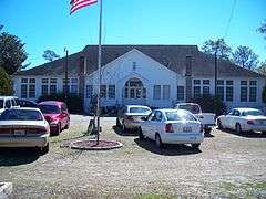
Old Fort Braden School |
|
000000001994-04-14-0000April 14, 1994
(#94000347) |
Jackson Bluff Road, 18 miles west of Tallahassee
30°25′32″N 84°32′05″W / 30.425556°N 84.534722°W / 30.425556; -84.534722 (Old Fort Braden School) |
Tallahassee |
|
| 43 |
Park Avenue Historic District |
|
000000001979-10-24-0000October 24, 1979
(#79000681) |
Park Avenue and Call Street
30°26′34″N 84°16′55″W / 30.442778°N 84.281944°W / 30.442778; -84.281944 (Park Avenue Historic District) |
Tallahassee |
|
| 44 |
Pisgah United Methodist Church |
|
000000001974-05-03-0000May 3, 1974
(#74000650) |
North of Tallahassee, southeast of State Road 151
30°33′05″N 84°09′49″W / 30.551389°N 84.163611°W / 30.551389; -84.163611 (Pisgah United Methodist Church) |
Tallahassee |
|
| 45 |
John Gilmore Riley House |
|
000000001978-08-01-0000August 1, 1978
(#78000950) |
419 East Jefferson Street
30°26′21″N 84°16′39″W / 30.439167°N 84.2775°W / 30.439167; -84.2775 (John Gilmore Riley House) |
Tallahassee |
|
| 46 |
Roberts Farm Historic and Archeological District |
|
000000001995-11-02-0000November 2, 1995
(#95001186) |
Roberts Road, 1 mile east of Centerville Road
30°32′00″N 84°09′27″W / 30.533333°N 84.1575°W / 30.533333; -84.1575 (Roberts Farm Historic and Archeological District) |
Tallahassee |
Part of the Rural Resources of Leon County MPS
|
| 47 |
Rollins House |
|
000000002001-12-31-0000December 31, 2001
(#01001415) |
5456 Rollins Pointe
30°32′35″N 84°19′41″W / 30.543056°N 84.328056°W / 30.543056; -84.328056 (Rollins House) |
Tallahassee |
|
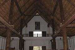
| 48 |
Ruge Hall |
|
000000001997-08-01-0000August 1, 1997
(#97000838) |
655 West Jefferson Street
30°26′21″N 84°17′35″W / 30.439167°N 84.293056°W / 30.439167; -84.293056 (Ruge Hall) |
Tallahassee |
|
| 49 |
St. John's Episcopal Church |
|
000000001978-08-10-0000August 10, 1978
(#78000951) |
211 North Monroe Street
30°26′37″N 84°16′49″W / 30.443611°N 84.280278°W / 30.443611; -84.280278 (St. John's Episcopal Church) |
Tallahassee |
|
| 50 |
San Luis de Apalache |
|
000000001966-10-15-0000October 15, 1966
(#66000266) |
2 miles west of Tallahassee
30°27′04″N 84°19′11″W / 30.451111°N 84.319722°W / 30.451111; -84.319722 (San Luis de Apalache) |
Tallahassee |
|
| 51 |
San Pedro y San Pablo de Patale |
|
000000001972-06-26-0000June 26, 1972
(#72000336) |
6 miles east of Tallahassee
30°28′04″N 84°09′00″W / 30.467778°N 84.150121°W / 30.467778; -84.150121 (San Pedro y San Pablo de Patale) |
Tallahassee |
|
| 52 |
Smoky Hollow Historic District |
|
000000002000-10-27-0000October 27, 2000
(#00001199) |
Roughly bounded by East Lafayette Street, the CSX railroad tracks, Myers Park, and Myers Park Lane
30°26′11″N 84°16′19″W / 30.436389°N 84.271944°W / 30.436389; -84.271944 (Smoky Hollow Historic District) |
Tallahassee |
|
| 53 |
Sollner-Wall House |
|
000000002012-10-09-0000October 9, 2012
(#12000839) |
2235 Chaires Cross Road
30°28′27″N 84°07′33″W / 30.474165°N 84.125730°W / 30.474165; -84.125730 (Sollner-Wall House) |
Tallahassee |
|
| 54 |
Strickland-Herold House |
|
000000001997-01-09-0000January 9, 1997
(#96001523) |
Main Street, northwest of the junction of Moccasin Gap Road and State Road 59
30°35′39″N 84°02′48″W / 30.594167°N 84.046667°W / 30.594167; -84.046667 (Strickland-Herold House) |
Miccosukee |
|
| 55 |
Strickland School |
Upload image |
000000002014-11-12-0000November 12, 2014
(#14000903) |
14735 Beth Page Rd.
30°40′06″N 84°10′52″W / 30.668375°N 84.1811309°W / 30.668375; -84.1811309 (Strickland School) |
Tallahassee |
|
| 56 |
Tall Timbers Plantation |
|
000000001989-04-07-0000April 7, 1989
(#89000240) |
County Road 12, 3 miles west of U.S. Route 319
30°39′19″N 84°13′33″W / 30.655278°N 84.225833°W / 30.655278; -84.225833 (Tall Timbers Plantation) |
Tallahassee |
|
| 57 |
Tallahassee Historic District Zones I And II |
|
000000001972-10-26-0000October 26, 1972
(#72000337) |
Calhoun Street between Georgia and Tennessee Streets and East Park Avenue between Gadsden and Calhoun Streets
30°26′46″N 84°16′46″W / 30.446111°N 84.279444°W / 30.446111; -84.279444 (Tallahassee Historic District Zones I And II) |
Tallahassee |
|
| 58 |
Taylor House |
|
000000002015-04-06-0000April 6, 2015
(#15000127) |
442 W. Georgia St.
30°26′53″N 84°17′15″W / 30.4480°N 84.2874°W / 30.4480; -84.2874 (Taylor House) |
Tallahassee |
|
| 59 |
Tookes House |
|
000000002001-01-26-0000January 26, 2001
(#01000004) |
412 West Virginia Avenue
30°26′44″N 84°17′11″W / 30.445556°N 84.286389°W / 30.445556; -84.286389 (Tookes House) |
Tallahassee |
|
| 60 |
Union Bank |
|
000000001971-02-24-0000February 24, 1971
(#71000242) |
Apalachee Parkway and Calhoun Street
30°26′15″N 84°16′48″W / 30.4375°N 84.28°W / 30.4375; -84.28 (Union Bank) |
Tallahassee |
|
| 61 |
Van Brunt House |
|
000000001997-02-27-0000February 27, 1997
(#97000162) |
State Road 59, north of its junction with Moccasin Gap Road
30°35′47″N 84°02′29″W / 30.596389°N 84.041389°W / 30.596389; -84.041389 (Van Brunt House) |
Miccosukee |
|
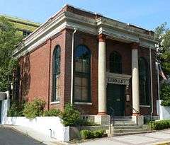
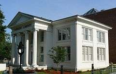
| 62 |
David S. Walker Library |
|
000000001976-06-22-0000June 22, 1976
(#76000600) |
209 East Park Avenue
30°26′29″N 84°16′49″W / 30.441389°N 84.280278°W / 30.441389; -84.280278 (David S. Walker Library) |
Tallahassee |
|
| 63 |
Williams House |
|
000000001996-04-04-0000April 4, 1996
(#96000360) |
450 Saint Francis Street
30°26′04″N 84°17′17″W / 30.434444°N 84.288056°W / 30.434444; -84.288056 (Williams House) |
Tallahassee |
|
| 64 |
Winterle House |
|
000000001998-02-17-0000February 17, 1998
(#98000082) |
1111 Paul Russell Road
30°24′17″N 84°15′57″W / 30.404722°N 84.265833°W / 30.404722; -84.265833 (Winterle House) |
Tallahassee |
|
| 65 |
Woman's Club of Tallahassee |
|
000000001987-11-18-0000November 18, 1987
(#87002046) |
1513 Cristobal Drive
30°27′38″N 84°16′32″W / 30.460556°N 84.275556°W / 30.460556; -84.275556 (Woman's Club of Tallahassee) |
Tallahassee |
|
| 66 |
Woman's Working Band House |
|
000000002010-10-20-0000October 20, 2010
(#10000848) |
648 W. Brevard St.
30°26′57″N 84°17′34″W / 30.449167°N 84.292778°W / 30.449167; -84.292778 (Woman's Working Band House) |
Tallahassee |
|

%2C_Smokey_Hollow_Pond_from_parking_garage.JPG)


.jpg)