| [3] |
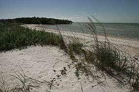
Name on the Register[4] |
Image |
Date listed[5] |
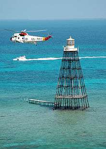
Location |
City or town |
Description |
|---|
| 1 |
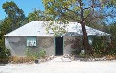
George Adderley House |
|
000000001992-09-10-0000September 10, 1992
(#92001243) |
5550 Overseas Highway
24°43′11″N 81°04′31″W / 24.719722°N 81.075278°W / 24.719722; -81.075278 (George Adderley House) |
Marathon |
|
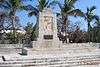
| 2 |
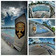
African Cemetery at Higgs Beach |
|
000000002012-06-26-0000June 26, 2012
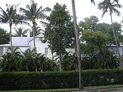
(#12000362) |
1001 Atlantic Blvd.
24°32′54″N 81°47′11″W / 24.548382°N 81.7864°W / 24.548382; -81.7864 (African Cemetery at Higgs Beach) |
Key West |
|
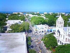
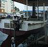
| 3 |
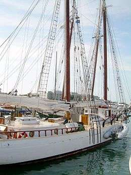
AFRICAN QUEEN |
|
000000001992-02-18-0000February 18, 1992
(#91001771) |
99701 Overseas Highway
25°05′44″N 80°26′18″W / 25.095556°N 80.438333°W / 25.095556; -80.438333 (AFRICAN QUEEN) |
Key Largo |
|
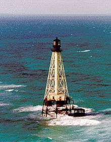
| 4 |
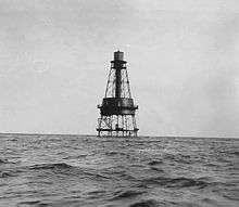
Alligator Reef Light |
|
000000002011-12-01-0000December 1, 2011
(#11000860) |
Offshore 3.5 mi. S. of Upper Matecumbe Key
24°51′06″N 80°37′06″W / 24.851667°N 80.618333°W / 24.851667; -80.618333 (Alligator Reef Light) |
Islamorada |
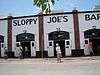
part of the Light Stations of the United States MPS
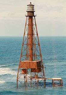
|
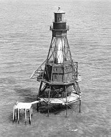
| 5 |
American Shoal Light |
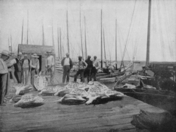
|
000000002011-01-25-0000January 25, 2011
(#10001189) |
Offshore of the lower Florida Keys, 9.6 miles southwest of Summerland Key
24°31′30″N 81°31′10″W / 24.525°N 81.519444°W / 24.525; -81.519444 (American Shoal Light) |
Summerland Key |
part of the Light Stations of the United States MPS
|
| 6 |
Angustias Shipwreck Site |
|
000000002006-06-15-0000June 15, 2006
(#06000492) |
Approximately 1-mile (1.6 km) south of U.S. Route 1 in Long Key Channel
24°47′24″N 80°51′46″W / 24.79°N 80.862778°W / 24.79; -80.862778 (Angustias Shipwreck Site) |
Layton |
Part of the 1733 Spanish Plate Fleet Shipwrecks MPS
|
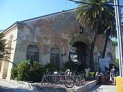
| 7 |
The Armory |
|
000000001971-03-11-0000March 11, 1971
(#71000243) |
600 White Street
24°33′38″N 81°47′39″W / 24.560556°N 81.794167°W / 24.560556; -81.794167 (The Armory) |
Key West |
|
| 8 |
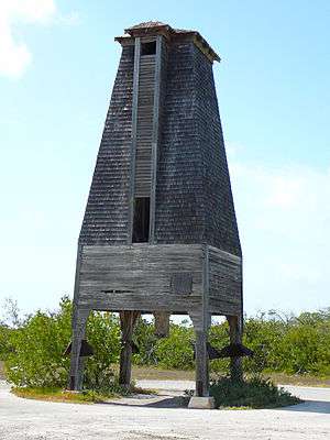
Bat Tower-Sugarloaf Key |
|
000000001982-05-13-0000May 13, 1982
(#82002377) |
1 mile (1.6 km) northwest of U.S. Route 1 on Perky Key
24°39′00″N 81°34′10″W / 24.65°N 81.569444°W / 24.65; -81.569444 (Bat Tower-Sugarloaf Key) |
Sugarloaf Key |
|
| 9 |
Bear Lake Mounds Archeological District |
Upload image |
000000001996-11-05-0000November 5, 1996
(#96001182) |
Address Restricted
|
Flamingo |
Part of the Archeological Resources of Everglades National Park MPS
|
| 10 |
Cane Patch |
Upload image |
000000001996-11-05-0000November 5, 1996
(#96001179) |
Address Restricted
|
Everglades City |
Part of the Archeological Resources of Everglades National Park MPS
|
| 11 |
Carysfort Lighthouse |
|
000000001984-10-31-0000October 31, 1984
(#84000199) |
Key Largo National Marine Sanctuary
25°13′17″N 80°12′40″W / 25.221389°N 80.211111°W / 25.221389; -80.211111 (Carysfort Lighthouse) |
Key Largo |
|
| 12 |
Chaves Shipwreck Site |
|
000000002006-06-15-0000June 15, 2006
(#06000493) |
Seaward end of Snake Creek off Windley Key
24°56′11″N 80°34′58″W / 24.936389°N 80.582778°W / 24.936389; -80.582778 (Chaves Shipwreck Site) |
Islamorada |
Part of the 1733 Spanish Plate Fleet Shipwrecks MPS
|
| 13 |
Dry Tortugas National Park |
|
000000001992-10-26-0000October 26, 1992
(#01000228) |
70 miles (110 km) west of Key West
24°37′43″N 82°52′24″W / 24.628611°N 82.873333°W / 24.628611; -82.873333 (Dry Tortugas National Park) |
Key West |
|
| 14 |
El Gallo Indiano Shipwreck Site |
|
000000002006-06-15-0000June 15, 2006
(#06000494) |
Seaward end of channel #5 between Craig Key and Long Key
24°48′39″N 80°45′57″W / 24.810833°N 80.765833°W / 24.810833; -80.765833 (El Gallo Indiano Shipwreck Site) |
Layton |
Part of the 1733 Spanish Plate Fleet Shipwrecks MPS
|
| 15 |
El Infante Shipwreck Site |
Upload image |
000000002006-06-15-0000June 15, 2006
(#06000496) |
4 miles (6.4 km) offshore Plantation Key
24°42′08″N 80°28′48″W / 24.702222°N 80.48°W / 24.702222; -80.48 (El Infante Shipwreck Site) |
Plantation |
Part of the 1733 Spanish Plate Fleet Shipwrecks MPS
|
| 16 |
El Rubi Shipwreck Site |
|
000000002006-06-15-0000June 15, 2006
(#06000497) |
4 miles (6.4 km) offshore Plantation Key
24°55′30″N 80°30′54″W / 24.925°N 80.515°W / 24.925; -80.515 (El Rubi Shipwreck Site) |
Tavernier |
Part of the 1733 Spanish Plate Fleet Shipwrecks MPS
|
| 17 |
Florida Keys Memorial |
|
000000001995-03-16-0000March 16, 1995
(#95000238) |
U.S. Route 1 at Mile Marker 81.5
24°55′00″N 80°38′11″W / 24.916667°N 80.636389°W / 24.916667; -80.636389 (Florida Keys Memorial) |
Islamorada |
|
| 18 |
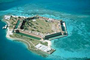
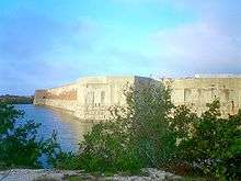
Fort Jefferson National Monument |
|
000000001970-11-10-0000November 10, 1970
(#70000069) |
68 miles (109 km) west of Key West in the Gulf of Mexico
24°37′37″N 82°52′23″W / 24.626944°N 82.873056°W / 24.626944; -82.873056 (Fort Jefferson National Monument) |
Dry Tortugas Islands |
|
| 19 |
Fort Zachary Taylor |
|
000000001971-03-11-0000March 11, 1971
(#71000244) |
U.S. Naval Station
24°32′51″N 81°48′37″W / 24.5475°N 81.810278°W / 24.5475; -81.810278 (Fort Zachary Taylor) |
Key West |
|
| 20 |
Eduardo H. Gato House |
|
000000001973-04-11-0000April 11, 1973
(#73000586) |
1209 Virginia Street
24°33′19″N 81°47′25″W / 24.555278°N 81.790278°W / 24.555278; -81.790278 (Eduardo H. Gato House) |
Key West |
|
| 21 |
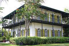
Ernest Hemingway House |
|
000000001968-11-24-0000November 24, 1968
(#68000023) |
907 Whitehead Street
24°33′03″N 81°48′03″W / 24.550833°N 81.800833°W / 24.550833; -81.800833 (Ernest Hemingway House) |
Key West |
|
| 22 |
Herrara Shipwreck Site |
|
000000002006-06-15-0000June 15, 2006
(#06000495) |
2½ miles offshore Whale Harbor
24°54′21″N 80°35′32″W / 24.905833°N 80.592222°W / 24.905833; -80.592222 (Herrara Shipwreck Site) |
Islamorada |
Part of the 1733 Spanish Plate Fleet Shipwrecks MPS
|
| 23 |
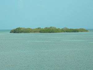
Indian Key |
|
000000001972-06-19-0000June 19, 1972
(#72000342) |
Indian Key[6]
24°52′41″N 80°40′36″W / 24.878056°N 80.676667°W / 24.878056; -80.676667 (Indian Key) |
Lower Matecumbe Key |
|
| 24 |
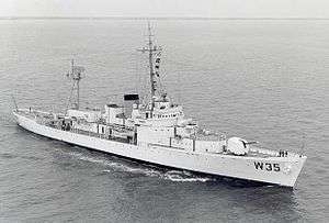
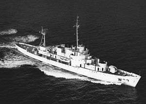
INGHAM (USCGC) |
|
000000001992-04-27-0000April 27, 1992
(#92001879) |
East quay wall at the Truman Waterfront, at the end of Southard St.
24°38′08″N 81°48′28″W / 24.635556°N 81.807778°W / 24.635556; -81.807778 (INGHAM (USCGC)) |
Key West |
Relocated from Charleston, South Carolina
|
| 25 |
John Pennekamp Coral Reef State Park and Reserve |
|
000000001972-04-14-0000April 14, 1972
(#72000340) |
U.S. Route 1
25°10′41″N 80°18′07″W / 25.178056°N 80.301944°W / 25.178056; -80.301944 (John Pennekamp Coral Reef State Park and Reserve) |
Key Largo |
|
| 26 |
Key West Historic District |
|
000000001971-03-11-0000March 11, 1971
(#71000245) |
Bounded approximately by White, Angela, Windsor, Passover, Thomas, and Whitehead Streets, and the Gulf of Mexico; also roughly bounded by Emma, Whitehead, White, and South Streets, Mallory Square, and the Atlantic Ocean
24°35′02″N 81°48′06″W / 24.583889°N 81.801667°W / 24.583889; -81.801667 (Key West Historic District) |
Key West |
Second set of boundaries represents a boundary increase of 000000001983-02-24-0000February 24, 1983 (refnum 83001430)
|
| 27 |
LaBranche Fishing Camp |
Upload image |
000000001997-05-09-0000May 9, 1997
(#97000404) |
Address Restricted
|
Islamorada |
|
| 28 |
Lignumvitae Key Archeological and Historical District |
|
000000001999-02-16-0000February 16, 1999
(#98000652) |
Address Restricted
24°54′07″N 80°41′58″W / 24.901944°N 80.699444°W / 24.901944; -80.699444 (Lignumvitae Key Archeological and Historical District) |
Islamorada |
|
| 29 |
Little White House |
|
000000001974-02-12-0000February 12, 1974
(#74000652) |
Naval Station
24°33′21″N 81°48′28″W / 24.555833°N 81.807778°W / 24.555833; -81.807778 (Little White House) |
Key West |
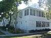
|
| 30 |
Martello Gallery-Key West Art and Historical Museum |
|
000000001972-06-19-0000June 19, 1972
(#72000341) |
South Roosevelt Boulevard
24°33′07″N 81°45′18″W / 24.551944°N 81.755°W / 24.551944; -81.755 (Martello Gallery-Key West Art and Historical Museum) |
Key West |
|
| 31 |
Mud Lake Canal |
|
000000002006-09-20-0000September 20, 2006
(#06000979) |
Cape Sable in Everglades National Park
25°10′26″N 80°56′17″W / 25.173889°N 80.938056°W / 25.173889; -80.938056 (Mud Lake Canal) |
Flamingo |
|
| 32 |
Old Post Office and Customshouse |
|
000000001973-09-20-0000September 20, 1973
(#73000587) |
Front Street
24°33′30″N 81°48′27″W / 24.558333°N 81.8075°W / 24.558333; -81.8075 (Old Post Office and Customshouse) |
Key West |
|
| 33 |
Overseas Highway and Railway Bridges |
|
000000001979-08-13-0000August 13, 1979
(#79000684) |
Bridges on U.S. Route 1 between Long and Conch Key, Knight and Little Duck Key, and Bahia Honda and Spanish Key; also parallel to U.S. Route 1 (approximately between mile markers 9.8 and 72.8)
24°42′42″N 81°07′23″W / 24.711667°N 81.123056°W / 24.711667; -81.123056 (Overseas Highway and Railway Bridges) |
Florida Keys |
"Parallel to U.S. Route 1" represents a boundary increase of 000000002004-08-03-0000August 3, 2004
|
| 34 |
Pigeon Key Historic District |
|
000000001990-03-16-0000March 16, 1990
(#90000443) |
Off U.S. Route 1 at mile marker 45
24°42′14″N 81°09′19″W / 24.703889°N 81.155278°W / 24.703889; -81.155278 (Pigeon Key Historic District) |
Pigeon Key |
|
| 35 |
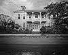
Dr. Joseph Y. Porter House |
|
000000001973-06-04-0000June 4, 1973
(#73000588) |
429 Caroline Street
24°33′26″N 81°48′17″W / 24.557222°N 81.804722°W / 24.557222; -81.804722 (Dr. Joseph Y. Porter House) |
Key West |
|
| 36 |
Rock Mound Archeological Site |
Upload image |
000000001975-07-01-0000July 1, 1975
(#75000562) |
Address Restricted
|
Key Largo |
|
| 37 |
Rookery Mound |
Upload image |
000000001996-11-05-0000November 5, 1996
(#96001183) |
Address Restricted
|
Everglades City |
Part of the Archeological Resources of Everglades National Park MPS
|
| 38 |
SAN FELIPE Shipwreck Site |
Upload image |
000000001994-08-11-0000August 11, 1994
(#94000794) |
Address Restricted
|
Islamorada |
Part of the 1733 Spanish Plate Fleet Shipwrecks MPS
|
| 39 |
San Francisco Shipwreck Site |
|
000000002006-06-15-0000June 15, 2006
(#06000499) |
Seaward end of Channel #2 off Craig Key
24°49′11″N 80°45′26″W / 24.819722°N 80.757222°W / 24.819722; -80.757222 (San Francisco Shipwreck Site) |
Layton |
Part of the 1733 Spanish Plate Fleet Shipwrecks MPS
|
| 40 |
SAN JOSE Shipwreck Site |
Upload image |
000000001975-03-18-0000March 18, 1975
(#75002123) |
Address Restricted
|
Plantation Key |
Part of the 1733 Spanish Plate Fleet Shipwrecks MPS
|
| 41 |
SAN PEDRO (shipwreck) |
Upload image |
000000002001-05-31-0000May 31, 2001
(#01000530) |
1¼ miles south of Indian Key
24°51′18″N 80°40′36″W / 24.855°N 80.676667°W / 24.855; -80.676667 (SAN PEDRO (shipwreck)) |
Islamorada |
Part of the 1733 Spanish Plate Fleet Shipwrecks MPS
|
| 42 |
Sand Key Lighthouse |
|
000000001973-04-11-0000April 11, 1973
(#73000589) |
7 miles (11 km) southwest of Key West on Sand Key
24°27′50″N 81°52′46″W / 24.463889°N 81.879444°W / 24.463889; -81.879444 (Sand Key Lighthouse) |
Key West |
|
| 43 |
Sloppy Joe's Bar |
|
000000002006-11-01-0000November 1, 2006
(#06000957) |
201 Duval Street
24°33′29″N 81°48′23″W / 24.558056°N 81.806389°W / 24.558056; -81.806389 (Sloppy Joe's Bar) |
Key West |
|
| 44 |
Sombrero Key Light |
|
000000002012-03-09-0000March 9, 2012
(#12000092) |
Offshore approximately 5.5-mile (8.9 km) SSW of Marathon
24°37′40″N 81°06′42″W / 24.627906°N 81.111606°W / 24.627906; -81.111606 (Sombrero Key Light) |
Marathon |
part of the Light Stations of the United States MPS
|
| 45 |
Sueco de Arizon Shipwreck Site |
|
000000002006-06-15-0000June 15, 2006
(#06000500) |
1,600 yards (1,500 m) offshore Conch Key
24°46′41″N 80°53′19″W / 24.778056°N 80.888611°W / 24.778056; -80.888611 (Sueco de Arizon Shipwreck Site) |
Layton |
Part of the 1733 Spanish Plate Fleet Shipwrecks MPS
|
| 46 |
Ten Thousand Islands Archeological District |
|
000000001996-11-05-0000November 5, 1996
(#96001180) |
Address Restricted
|
Everglades City |
Part of the Archeological Resources of Everglades National Park MPS
|
| 47 |
Thompson Fish House, Turtle Cannery and Kraals |
|
000000001994-06-23-0000June 23, 1994
(#94000633) |
200 Margaret Street
24°33′42″N 81°48′04″W / 24.561667°N 81.801111°W / 24.561667; -81.801111 (Thompson Fish House, Turtle Cannery and Kraals) |
Key West |
|
| 48 |
Tres Puentes Shipwreck Site |
Upload image |
000000002006-06-15-0000June 15, 2006
(#06000501) |
Seaward edge of Hawk Channel of Islamorada
24°53′38″N 80°35′02″W / 24.893889°N 80.583889°W / 24.893889; -80.583889 (Tres Puentes Shipwreck Site) |
Islamorada |
Part of the 1733 Spanish Plate Fleet Shipwrecks MPS
|
| 49 |
U.S. Coast Guard Headquarters, Key West Station |
|
000000001973-10-15-0000October 15, 1973
(#73000590) |
Northwestern corner of Front and Whitehead Streets
24°33′31″N 81°48′27″W / 24.558611°N 81.8075°W / 24.558611; -81.8075 (U.S. Coast Guard Headquarters, Key West Station) |
Key West |
|
| 50 |
US Naval Station |
|
000000001984-05-08-0000May 8, 1984
(#84000915) |
Roughly bounded by Whitehead, Eaton, and Caroline Streets
24°33′20″N 81°48′23″W / 24.555556°N 81.806389°W / 24.555556; -81.806389 (US Naval Station) |
Key West |
|
| 51 |
USCG Cutter DUANE |
|
000000002002-05-16-0000May 16, 2002
(#02000494) |
1-mile (1.6 km) south of Molasses Reef
24°59′28″N 80°22′53″W / 24.991111°N 80.381389°W / 24.991111; -80.381389 (USCG Cutter DUANE) |
Key Largo |
|
| 52 |
USS ALLIGATOR |
|
000000001996-06-06-0000June 6, 1996
(#96000581) |
Address Restricted
|
Islamorada |
|
| 53 |
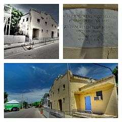
Veterans of Foreign Wars Walter R. Mickens Post 6021 and William Weech American Legion Post 168 |
|
000000002012-05-30-0000May 30, 2012
(#12000300) |
803 Emma St.
24°33′03″N 81°48′13″W / 24.550705°N 81.803609°W / 24.550705; -81.803609 (Veterans of Foreign Wars Walter R. Mickens Post 6021 and William Weech American Legion Post 168) |
Key West |
|
| 54 |
West Martello Tower |
|
000000001976-06-24-0000June 24, 1976
(#76000602) |
Monroe County beach between Reynolds and White Streets
24°32′49″N 81°47′10″W / 24.546944°N 81.786111°W / 24.546944; -81.786111 (West Martello Tower) |
Key West |
|
| 55 |
WESTERN UNION (schooner) |
|
000000001984-05-16-0000May 16, 1984
(#84000930) |
Pier A, Truman Annex
24°33′26″N 81°48′30″W / 24.557222°N 81.808333°W / 24.557222; -81.808333 (WESTERN UNION (schooner)) |
Key West |
|
.jpg)
_Shipwreck_Site.jpg)
_Shipwreck_Site.jpg)