| [3] |
Name on the Register[4] |
Image |
Date listed[5] |
Location |
City or town |
Description |
|---|
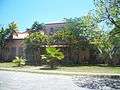
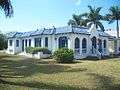
| 1 |
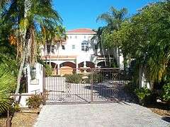
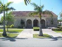
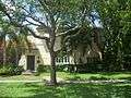
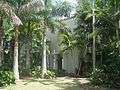
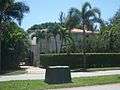
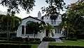
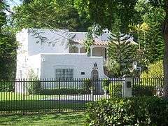
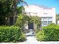
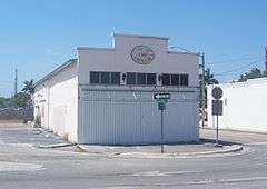
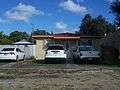
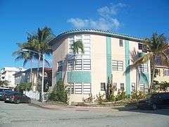
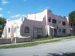
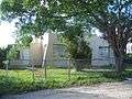
Carl G. Adams House |
|
000000001985-11-01-0000November 1, 1985
(#85003464) |
31 Hunting Lodge Court
25°48′54″N 80°17′48″W / 25.815°N 80.296667°W / 25.815; -80.296667 (Carl G. Adams House) |
Miami Springs |
Part of the Country Club Estates TR
|
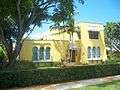
| 2 |
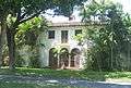
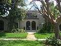
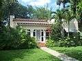
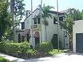
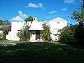
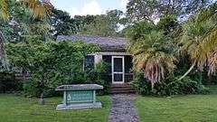
Hervey Allen Study |
|
000000001974-05-07-0000May 7, 1974
(#74002256) |
8251 Southwest 52nd Avenue
25°41′47″N 80°16′36″W / 25.696389°N 80.276667°W / 25.696389; -80.276667 (Hervey Allen Study) |
South Miami |
|
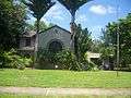
| 3 |
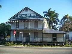
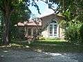
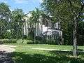
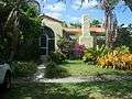
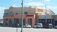
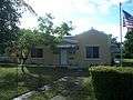
William Anderson General Merchandise Store |
|
000000001977-10-18-0000October 18, 1977
(#77000402) |
15700 Southwest 232nd Street, Southwest
25°33′00″N 80°26′45″W / 25.55°N 80.445833°W / 25.55; -80.445833 (William Anderson General Merchandise Store) |
Goulds |
|
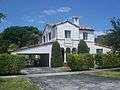
| 4 |
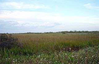
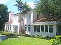
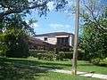
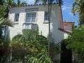
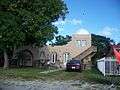
Anhinga Trail |
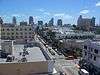
|
000000001996-11-05-0000November 5, 1996
(#96001178) |
Address Restricted
25°22′54″N 80°36′35″W / 25.381667°N 80.609722°W / 25.381667; -80.609722 (Anhinga Trail) |
Homestead |
Part of the Archeological Resources of Everglades National Park MPS
|
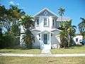
| 5 |
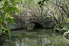
Arch Creek Historic and Archeological Site |
|
000000001986-07-15-0000July 15, 1986
(#86001700) |
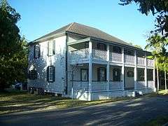
Address Restricted
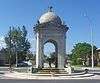
25°54′04″N 80°09′41″W / 25.901111°N 80.161389°W / 25.901111; -80.161389 (Arch Creek Historic and Archeological Site) |
North Miami |
|
| 6 |
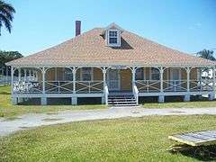
Baird House |
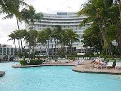
|
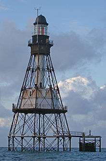
000000001987-08-17-0000August 17, 1987
(#87001313) |
401 Dunad Avenue
25°54′11″N 80°15′22″W / 25.903056°N 80.256111°W / 25.903056; -80.256111 (Baird House) |
Opa-locka |
Part of the Opa-locka TR
|
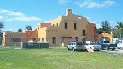
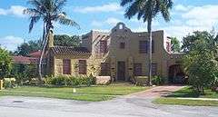
| 7 |
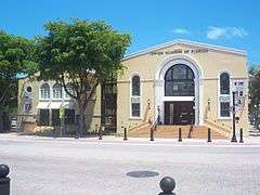
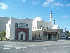
Beth Jacob Social Hall and Congregation |
|
000000001980-10-16-0000October 16, 1980
(#80000946) |
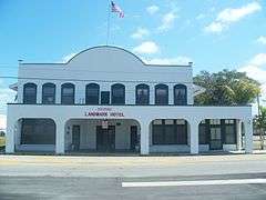
301 and 311 Washington Avenue
25°46′20″N 80°08′04″W / 25.772222°N 80.134444°W / 25.772222; -80.134444 (Beth Jacob Social Hall and Congregation) |
Miami Beach |
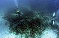
|
| 8 |
Boca Chita Key Historic District |
|
000000001997-08-01-0000August 1, 1997
(#97000795) |
Northwestern section of Boca Chita Key, roughly bounded by Biscayne Bay and a stone wall
25°31′29″N 80°10′34″W / 25.524710°N 80.176085°W / 25.524710; -80.176085 (Boca Chita Key Historic District) |
Biscayne National Park |
|
| 9 |
Lily Lawrence Bow Library |
|
000000001996-08-05-0000August 5, 1996
(#96000823) |
212 Northwest 1st Avenue
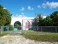
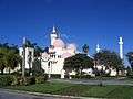
25°28′17″N 80°28′47″W / 25.471389°N 80.479722°W / 25.471389; -80.479722 (Lily Lawrence Bow Library) |
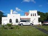
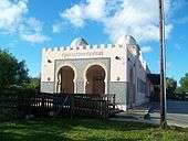
Homestead |
Part of the Homestead MPS
|
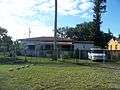
| 10 |
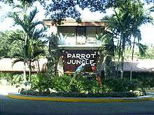
Building at 107 Northeast 96th Street |
|
000000001988-11-14-0000November 14, 1988
(#88002094) |
107 Northeast 96th Street
25°51′49″N 80°11′44″W / 25.863611°N 80.195556°W / 25.863611; -80.195556 (Building at 107 Northeast 96th Street) |
Miami Shores |
Part of the Miami Shores TR
|
| 11 |
Building at 121 Northeast 100th Street |
|
000000001988-11-14-0000November 14, 1988
(#88002107) |
121 Northeast 100th Street
25°52′00″N 80°12′05″W / 25.866667°N 80.201389°W / 25.866667; -80.201389 (Building at 121 Northeast 100th Street) |
Miami Shores |
Part of the Miami Shores TR
|
| 12 |
Building at 145 Northeast 95th Street |
|
000000001988-11-14-0000November 14, 1988
(#88002093) |
145 Northeast 95th Street
25°51′44″N 80°11′40″W / 25.862222°N 80.194444°W / 25.862222; -80.194444 (Building at 145 Northeast 95th Street) |
Miami Shores |
Part of the Miami Shores TR
|
| 13 |
Building at 253 Northeast 99th Street |
|
000000001988-11-14-0000November 14, 1988
(#88002103) |
253 Northeast 99th Street
25°51′57″N 80°11′33″W / 25.865833°N 80.1925°W / 25.865833; -80.1925 (Building at 253 Northeast 99th Street) |
Miami Shores |
Part of the Miami Shores TR
|
| 14 |
Building at 257 Northeast 91st Street |
|
000000001988-11-14-0000November 14, 1988
(#88002086) |
257 Northeast 91st Street
25°51′31″N 80°11′31″W / 25.858611°N 80.191944°W / 25.858611; -80.191944 (Building at 257 Northeast 91st Street) |
Miami Shores |
Part of the Miami Shores TR
|
| 15 |
Building at 262 Northeast 96th Street |
|
000000001988-11-14-0000November 14, 1988
(#88002095) |
262 Northeast 96th Street
25°51′49″N 80°11′33″W / 25.863611°N 80.1925°W / 25.863611; -80.1925 (Building at 262 Northeast 96th Street) |
Miami Shores |
Part of the Miami Shores TR
|
| 16 |
Building at 273 Northeast 98th Street |
|
000000001988-11-14-0000November 14, 1988
(#88002101) |
273 Northeast 98th Street
25°51′54″N 80°11′33″W / 25.865°N 80.1925°W / 25.865; -80.1925 (Building at 273 Northeast 98th Street) |
Miami Shores |
Part of the Miami Shores TR
|
| 17 |
Building at 276 Northeast 98th Street |
|
000000001988-11-14-0000November 14, 1988
(#88002102) |
276 Northeast 98th Street
25°51′55″N 80°11′32″W / 25.865278°N 80.192222°W / 25.865278; -80.192222 (Building at 276 Northeast 98th Street) |
Miami Shores |
Part of the Miami Shores TR
|
| 18 |
Building at 284 Northeast 96th Street |
|
000000001988-11-14-0000November 14, 1988
(#88002096) |
284 Northeast 96th Street
25°51′49″N 80°11′32″W / 25.863611°N 80.192222°W / 25.863611; -80.192222 (Building at 284 Northeast 96th Street) |
Miami Shores |
Part of the Miami Shores TR
|
| 19 |
Building at 287 Northeast 96th Street |
|
000000001988-11-14-0000November 14, 1988
(#88002097) |
287 Northeast 96th Street
25°51′49″N 80°11′30″W / 25.863611°N 80.191667°W / 25.863611; -80.191667 (Building at 287 Northeast 96th Street) |
Miami Shores |
Part of the Miami Shores TR
|
| 20 |
Building at 310 Northeast 99th Street |
|
000000001988-11-14-0000November 14, 1988
(#88002105) |
310 Northeast 99th Street
25°51′58″N 80°11′29″W / 25.866111°N 80.191389°W / 25.866111; -80.191389 (Building at 310 Northeast 99th Street) |
Miami Shores |
Part of the Miami Shores TR
|
| 21 |
Building at 353 Northeast 91st Street |
|
000000001988-11-14-0000November 14, 1988
(#88002087) |
353 Northeast 91st Street
25°51′31″N 80°11′26″W / 25.858611°N 80.190556°W / 25.858611; -80.190556 (Building at 353 Northeast 91st Street) |
Miami Shores |
Part of the Miami Shores TR
|
| 22 |
Building at 357 Northeast 92nd Street |
|
000000001988-11-14-0000November 14, 1988
(#88002088) |
357 Northeast 92nd Street
25°51′34″N 80°11′26″W / 25.859444°N 80.190556°W / 25.859444; -80.190556 (Building at 357 Northeast 92nd Street) |
Miami Shores |
Part of the Miami Shores TR
|
| 23 |
Building at 361 Northeast 97th Street |
|
000000001988-11-14-0000November 14, 1988
(#88002100) |
361 Northeast 97th Street
25°51′52″N 80°11′26″W / 25.864444°N 80.190556°W / 25.864444; -80.190556 (Building at 361 Northeast 97th Street) |
Miami Shores |
Part of the Miami Shores TR
|
| 24 |
Building at 384 Northeast 94th Street |
|
000000001988-11-14-0000November 14, 1988
(#88002091) |
384 Northeast 94th Street
25°51′41″N 80°11′24″W / 25.861389°N 80.19°W / 25.861389; -80.19 (Building at 384 Northeast 94th Street) |
Miami Shores |
Part of the Miami Shores TR
|
| 25 |
Building at 389 Northeast 99th Street |
|
000000001988-11-14-0000November 14, 1988
(#88002106) |
389 Northeast 99th Street
25°51′58″N 80°11′25″W / 25.866111°N 80.190278°W / 25.866111; -80.190278 (Building at 389 Northeast 99th Street) |
Miami Shores |
Part of the Miami Shores TR
|
| 26 |
Building at 431 Northeast 94th Street |
|
000000001988-11-14-0000November 14, 1988
(#88002092) |
431 Northeast 94th Street
25°51′42″N 80°11′20″W / 25.861667°N 80.188889°W / 25.861667; -80.188889 (Building at 431 Northeast 94th Street) |
Miami Shores |
Part of the Miami Shores TR
|
| 27 |
Building at 477 Northeast 92nd Street |
|
000000001988-11-14-0000November 14, 1988
(#88002089) |
477 Northeast 92nd Street
25°51′34″N 80°11′17″W / 25.859444°N 80.188056°W / 25.859444; -80.188056 (Building at 477 Northeast 92nd Street) |
Miami Shores |
Part of the Miami Shores TR
|
| 28 |
Building at 540 Northeast 96th Street |
|
000000001988-11-14-0000November 14, 1988
(#88002098) |
540 Northeast 96th Street
25°51′49″N 80°11′12″W / 25.863611°N 80.186667°W / 25.863611; -80.186667 (Building at 540 Northeast 96th Street) |
Miami Shores |
Part of the Miami Shores TR
|
| 29 |
Building at 553 Northeast 101st Street |
|
000000001988-11-14-0000November 14, 1988
(#88002108) |
553 Northeast 101st Street
25°52′03″N 80°11′12″W / 25.8675°N 80.186667°W / 25.8675; -80.186667 (Building at 553 Northeast 101st Street) |
Miami Shores |
Part of the Miami Shores TR
|
| 30 |
Building at 561 Northeast 101st Street |
|
000000001988-11-14-0000November 14, 1988
(#88002109) |
561 Northeast 101st Street
25°52′04″N 80°11′11″W / 25.867778°N 80.186389°W / 25.867778; -80.186389 (Building at 561 Northeast 101st Street) |
Miami Shores |
Part of the Miami Shores TR
|
| 31 |
Building at 577 Northeast 96th Street |
|
000000001988-11-14-0000November 14, 1988
(#88002099) |
577 Northeast 96th Street
25°51′49″N 80°11′10″W / 25.863611°N 80.186111°W / 25.863611; -80.186111 (Building at 577 Northeast 96th Street) |
Miami Shores |
Part of the Miami Shores TR
|
| 32 |
Building at 1291 Northeast 102nd Street |
|
000000001988-11-14-0000November 14, 1988
(#88002110) |
1291 Northeast 102nd Street
25°52′07″N 80°10′46″W / 25.868611°N 80.179444°W / 25.868611; -80.179444 (Building at 1291 Northeast 102nd Street) |
Miami Shores |
Part of the Miami Shores TR
|
| 33 |
Building at 10108 Northeast 1st Avenue |
|
000000001988-11-14-0000November 14, 1988
(#88002111) |
10108 Northeast 1st Avenue
25°52′03″N 80°11′45″W / 25.8675°N 80.195833°W / 25.8675; -80.195833 (Building at 10108 Northeast 1st Avenue) |
Miami Shores |
Part of the Miami Shores TR
|
| 34 |
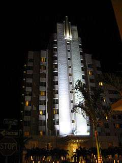
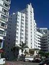
Cadillac Hotel |
|
000000002005-10-05-0000October 5, 2005
(#05001117) |
3925 Collins Ave.
25°48′48″N 80°07′22″W / 25.813333°N 80.122778°W / 25.813333; -80.122778 (Cadillac Hotel) |
Miami Beach |
|
| 35 |
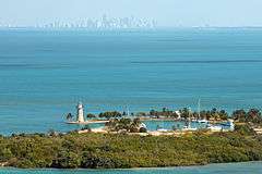
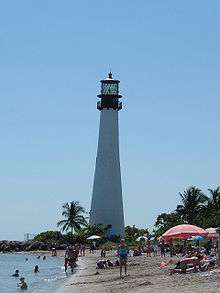
Cape Florida Lighthouse |
|
000000001970-09-29-0000September 29, 1970
(#70000180) |
Southeast tip of Key Biscayne off U.S. Route 1
25°39′58″N 80°09′22″W / 25.666111°N 80.156111°W / 25.666111; -80.156111 (Cape Florida Lighthouse) |
Key Biscayne |
|
| 36 |
Clune Building |
|
000000001985-11-01-0000November 1, 1985
(#85003467) |
45 Curtiss Parkway
25°49′17″N 80°16′53″W / 25.821389°N 80.281389°W / 25.821389; -80.281389 (Clune Building) |
Miami Springs |
Part of the Country Club Estates TR
|
| 37 |
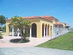
Coco Plum Woman's Club |
|
000000002005-06-17-0000June 17, 2005
(#05000598) |
1375 Sunset Drive (SW 72nd Street)
25°42′24″N 80°16′49″W / 25.706667°N 80.280278°W / 25.706667; -80.280278 (Coco Plum Woman's Club) |
Coral Gables |
Part of the Clubhouses of Florida's Woman's Clubs MPS
|
| 38 |
Collins Waterfront Architectural District |
|
000000002011-12-15-0000December 15, 2011
(#11000905) |
Bounded by 24th St., Atlantic Ocean, Indian Creek Dr., Pine Tree Dr. & Collins Canal
25°47′43″N 80°07′53″W / 25.795255°N 80.131359°W / 25.795255; -80.131359 (Collins Waterfront Architectural District) |
Miami Beach |
|
| 39 |
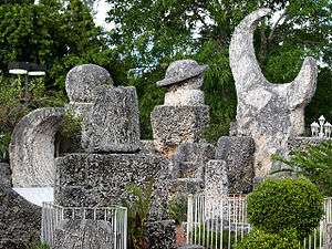
Coral Castle |
|
000000001984-05-10-0000May 10, 1984
(#84000840) |
28655 South Federal Highway
25°30′00″N 80°26′34″W / 25.5°N 80.442778°W / 25.5; -80.442778 (Coral Castle) |
Homestead |
|
| 40 |
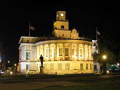
Coral Gables City Hall |
|
000000001974-07-24-0000July 24, 1974
(#74000616) |
405 Biltmore Way
25°44′55″N 80°15′49″W / 25.748611°N 80.263611°W / 25.748611; -80.263611 (Coral Gables City Hall) |
Coral Gables |
|
| 41 |
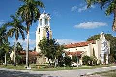
Coral Gables Congregational Church |
|
000000001978-10-10-0000October 10, 1978
(#78000937) |
3010 DeSoto Boulevard
25°44′33″N 80°16′44″W / 25.7425°N 80.278889°W / 25.7425; -80.278889 (Coral Gables Congregational Church) |
Coral Gables |
|
| 42 |
Coral Gables Elementary School |
|
000000001988-06-30-0000June 30, 1988
(#88000750) |
105 Minorca Avenue
25°45′13″N 80°15′28″W / 25.753611°N 80.257778°W / 25.753611; -80.257778 (Coral Gables Elementary School) |
Coral Gables |
|
| 43 |
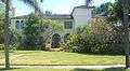
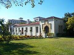
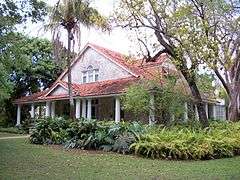
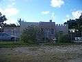
Coral Gables House |
|
000000001973-04-13-0000April 13, 1973
(#73000573) |
907 Coral Way
25°44′56″N 80°16′26″W / 25.748889°N 80.273889°W / 25.748889; -80.273889 (Coral Gables House) |
Coral Gables |
|
| 44 |
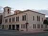
Coral Gables Police and Fire Station |
|
000000001984-11-06-0000November 6, 1984
(#84000354) |
2325 Salzedo Street
25°45′00″N 80°15′39″W / 25.75°N 80.260833°W / 25.75; -80.260833 (Coral Gables Police and Fire Station) |
Coral Gables |
|
| 45 |
Coral Gables Woman's Club |
|
000000001990-03-27-0000March 27, 1990
(#90000423) |
1001 East Ponce de Leon Boulevard
25°45′40″N 80°15′28″W / 25.761111°N 80.257778°W / 25.761111; -80.257778 (Coral Gables Woman's Club) |
Coral Gables |
|
| 46 |
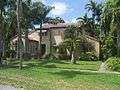
Cravero House |
|
000000001987-08-17-0000August 17, 1987
(#87001315) |
1011 Sharar Avenue
25°54′28″N 80°15′05″W / 25.907778°N 80.251389°W / 25.907778; -80.251389 (Cravero House) |
Opa-locka |
Part of the Opa-locka TR
|
| 47 |
Crouse House |
|
000000001987-08-17-0000August 17, 1987
(#87001316) |
1156 Peri Street
25°54′33″N 80°14′56″W / 25.909167°N 80.248889°W / 25.909167; -80.248889 (Crouse House) |
Opa-locka |
Part of the Opa-locka TR
|
| 48 |
Glenn Curtiss House |
|
000000002001-12-21-0000December 21, 2001
(#85003579) |
500 Deer Run
25°48′35″N 80°17′01″W / 25.809722°N 80.283611°W / 25.809722; -80.283611 (Glenn Curtiss House) |
Miami Springs |
Part of the Country Club Estates TR
|
| 49 |
Lua Curtiss House I |
|
000000001985-11-01-0000November 1, 1985
(#85003465) |
85 Deer Run
25°49′01″N 80°17′17″W / 25.816944°N 80.288056°W / 25.816944; -80.288056 (Lua Curtiss House I) |
Miami Springs |
Part of the Country Club Estates TR
|
| 50 |
Lua Curtiss House II |
|
000000001985-11-01-0000November 1, 1985
(#85003466) |
150 Hunting Lodge
25°49′05″N 80°17′30″W / 25.818056°N 80.291667°W / 25.818056; -80.291667 (Lua Curtiss House II) |
Miami Springs |
Part of the Country Club Estates TR
|
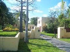
| 51 |
Charles Deering Estate |
|
000000001986-03-11-0000March 11, 1986
(#86000325) |
Southwest One Hundred Sixty-seventh Street and Old Cutler Road
25°36′57″N 80°18′38″W / 25.615833°N 80.310556°W / 25.615833; -80.310556 (Charles Deering Estate) |
Cutler |
|
| 52 |
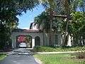
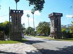
Douglas Entrance |
|
000000001972-09-22-0000September 22, 1972
(#72000305) |
Junction of Douglas Road and 8th Street Southwest
25°45′49″N 80°15′21″W / 25.763611°N 80.255833°W / 25.763611; -80.255833 (Douglas Entrance) |
Coral Gables |
|
| 53 |
Entrance to Central Miami |
|
000000001989-01-19-0000January 19, 1989
(#88003199) |
West of Red Road between Southwest 34th and Southwest 35th Streets
25°44′10″N 80°17′06″W / 25.736111°N 80.285°W / 25.736111; -80.285 (Entrance to Central Miami) |
Coral Gables |
|
| 54 |
Etheredge House |
|
000000001987-08-17-0000August 17, 1987
(#87001317) |
915 Sharar Avenue
25°54′27″N 80°15′09″W / 25.9075°N 80.2525°W / 25.9075; -80.2525 (Etheredge House) |
Opa-locka |
Part of the Opa-locka TR
|
| 55 |
Thomas Faust House |
|
000000001996-09-27-0000September 27, 1996
(#96001034) |
69 Northwest 4th Street
25°28′23″N 80°28′44″W / 25.473056°N 80.478889°W / 25.473056; -80.478889 (Thomas Faust House) |
Homestead |
Part of the Homestead MPS
|
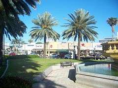
| 56 |
Florida Pioneer Museum |
|
000000001973-08-14-0000August 14, 1973
(#73000574) |
½ mile south of Lucy Street on State Road 27 (Krome Avenue)
25°27′20″N 80°28′40″W / 25.455556°N 80.477778°W / 25.455556; -80.477778 (Florida Pioneer Museum) |
Florida City |
|
| 57 |
Fontainebleau Hotel |
|
000000002008-12-22-0000December 22, 2008
(#08001318) |
4441 Collins Avenue
25°49′05″N 80°07′23″W / 25.818056°N 80.122972°W / 25.818056; -80.122972 (Fontainebleau Hotel) |
Miami Beach |
|
| 58 |
Fowey Rocks Light |
|
000000002011-01-26-0000January 26, 2011
(#10001181) |
Offshore in Straits of Florida 6.3 miles south southeast of Cape Florida on Key Biscayne, Florida
25°35′26″N 80°05′48″W / 25.590556°N 80.096667°W / 25.590556; -80.096667 (Fowey Rocks Light) |
Key Biscayne |
(Light Stations of the United States MPS)
|
| 59 |
Fuchs Bakery |
|
000000001996-11-15-0000November 15, 1996
(#96001335) |
102 South Krome Street
25°28′07″N 80°28′42″W / 25.468611°N 80.478333°W / 25.468611; -80.478333 (Fuchs Bakery) |
Homestead |
Part of the Homestead MPS
|
| 60 |
Fulford by the Sea Entrance |
|
000000002010-11-29-0000November 29, 2010
(#10000937) |
Intersection of NE 172 Street and NE 23 Avenue
25°56′05″N 80°09′15″W / 25.934722°N 80.154167°W / 25.934722; -80.154167 (Fulford by the Sea Entrance) |
North Miami Beach |
|
| 61 |
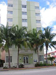
Grand Concourse Apartments |
|
000000001985-12-02-0000December 2, 1985
(#85003060) |
421 Grand Concourse
25°51′50″N 80°11′21″W / 25.863889°N 80.189167°W / 25.863889; -80.189167 (Grand Concourse Apartments) |
Miami Shores |
|
| 62 |
Griffiths House |
|
000000001987-08-17-0000August 17, 1987
(#87001318) |
826 Superior Street
25°53′53″N 80°15′04″W / 25.898056°N 80.251111°W / 25.898056; -80.251111 (Griffiths House) |
Opa-locka |
Part of the Opa-locka TR
|
| 63 |
Haislip House |
|
000000001987-08-17-0000August 17, 1987
(#87001319) |
1141 Jann Avenue
25°54′31″N 80°14′57″W / 25.908611°N 80.249167°W / 25.908611; -80.249167 (Haislip House) |
Opa-locka |
Part of the Opa-locka TR
|
| 64 |
Helm Stores and Apartments |
|
000000001987-08-17-0000August 17, 1987
(#87001321) |
1217 Sharazad Boulevard
25°54′18″N 80°14′53″W / 25.905°N 80.248056°W / 25.905; -80.248056 (Helm Stores and Apartments) |
Opa-locka |
Part of the Opa-locka TR
|
| 65 |
Helms House |
|
000000001987-08-17-0000August 17, 1987
(#87001320) |
721 Sharar Avenue
25°54′24″N 80°15′17″W / 25.906667°N 80.254722°W / 25.906667; -80.254722 (Helms House) |
Opa-locka |
Part of the Opa-locka TR
|
| 66 |
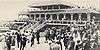
Hialeah Park Race Track |
|
000000001979-03-05-0000March 5, 1979
(#79000664) |
East 4th Avenue
25°50′31″N 80°16′27″W / 25.841944°N 80.274167°W / 25.841944; -80.274167 (Hialeah Park Race Track) |
Hialeah |
Determined to be eligible for National Historic Landmark status on January 12, 1988, but not made one (refnum 88003477).
|
| 67 |
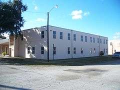
Hialeah Seaboard Air Line Railway Station |
|
000000001995-07-14-0000July 14, 1995
(#95000854) |
1200 Southeast 10th Court
25°48′43″N 80°15′33″W / 25.811944°N 80.259167°W / 25.811944; -80.259167 (Hialeah Seaboard Air Line Railway Station) |
Hialeah |
|
| 68 |
Higgins Duplex |
|
000000001987-08-17-0000August 17, 1987
(#87001322) |
1210–1212 Sesame Street
25°54′20″N 80°14′53″W / 25.905556°N 80.248056°W / 25.905556; -80.248056 (Higgins Duplex) |
Opa-locka |
Part of the Opa-locka TR
|
| 69 |
Homestead Historic Downtown District |
|
000000002007-11-19-0000November 19, 2007
(#07001199) |
Bounded by Northwest 4th Street, South Railroad Avenue, Southeast 1st Road, and N. Krome Drive
Coordinates missing |
Homestead |
|
| 70 |
Homestead Public School-Neva King Cooper School |
|
000000001985-12-04-0000December 4, 1985
(#85003112) |
520 Northwest First Avenue
25°28′28″N 80°28′48″W / 25.474444°N 80.48°W / 25.474444; -80.48 (Homestead Public School-Neva King Cooper School) |
Homestead |
|
| 71 |
Homestead Town Hall |
|
000000001997-11-07-0000November 7, 1997
(#97001327) |
43 North Krome Avenue
25°28′09″N 80°28′39″W / 25.469167°N 80.4775°W / 25.469167; -80.4775 (Homestead Town Hall) |
Homestead |
Part of the Homestead MPS
|
| 72 |
Harry Hurt Building |
|
000000001982-03-22-0000March 22, 1982
(#82004795) |
490 Ali-Baba Avenue
25°54′05″N 80°15′04″W / 25.901389°N 80.251111°W / 25.901389; -80.251111 (Harry Hurt Building) |
Opa-locka |
Part of the Opa-locka TR
|
| 73 |
Jones Family Historic District |
|
000000002013-10-23-0000October 23, 2013
(#13000846) |
Biscayne National Park
25°22′37″N 80°14′29″W / 25.376911°N 80.241394°W / 25.376911; -80.241394 (Jones Family Historic District) |
Islandia |
|
| 74 |
King Trunk Factory and Showroom |
|
000000001987-08-17-0000August 17, 1987
(#87001323) |
951 Superior Street
25°53′55″N 80°14′54″W / 25.898611°N 80.248333°W / 25.898611; -80.248333 (King Trunk Factory and Showroom) |
Opa-locka |
Part of the Opa-locka TR
|
| 75 |
Lincoln Road Mall |
|
000000002011-05-16-0000May 16, 2011
(#11000287) |
400-1100 Lincoln Road, Washington Avenue to Alton Road
25°47′26″N 80°08′11″W / 25.790556°N 80.136389°W / 25.790556; -80.136389 (Lincoln Road Mall) |
Miami Beach |
|
| 76 |
Lindeman-Johnson House |
|
000000001996-11-15-0000November 15, 1996
(#96001332) |
906 North Krome Avenue
25°28′43″N 80°28′40″W / 25.478611°N 80.477778°W / 25.478611; -80.477778 (Lindeman-Johnson House) |
Homestead |
Part of the Homestead MPS
|
| 77 |
Long House |
|
000000001987-08-17-0000August 17, 1987
(#87001324) |
613 Sharar Avenue
25°54′21″N 80°15′20″W / 25.905833°N 80.255556°W / 25.905833; -80.255556 (Long House) |
Opa-locka |
Part of the Opa-locka TR
|
| 78 |
MacFarlane Homestead Historic District |
|
000000001994-05-26-0000May 26, 1994
(#94000533) |
Roughly bounded by Jefferson Street, Frow Avenue, Brooker Street, and Grand Avenue
25°43′40″N 80°15′32″W / 25.727778°N 80.258889°W / 25.727778; -80.258889 (MacFarlane Homestead Historic District) |
Coral Gables |
|
| 79 |
McMinn-Horne House |
|
000000001996-08-30-0000August 30, 1996
(#96000943) |
25 Northeast 12th Street
25°28′54″N 80°28′39″W / 25.481667°N 80.4775°W / 25.481667; -80.4775 (McMinn-Horne House) |
Homestead |
Part of the Homestead MPS
|
| 80 |
Miami Beach Architectural District |
|
000000001979-05-14-0000May 14, 1979
(#79000667) |
Roughly bounded by the Atlantic Ocean, Miami Beach Boulevard, Alton Road, and the Collins Canal
Coordinates missing |
Miami Beach |
|
| 81 |
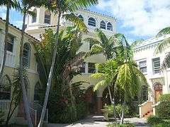
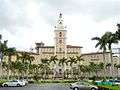
Miami-Biltmore Hotel |
|
000000001972-09-27-0000September 27, 1972
(#72000306) |
1210 Anastasia Avenue
25°44′28″N 80°16′45″W / 25.741111°N 80.279167°W / 25.741111; -80.279167 (Miami-Biltmore Hotel) |
Coral Gables |
|
| 82 |
Millard-McCarty House |
|
000000001986-04-22-0000April 22, 1986
(#86000872) |
424 Hunting Lodge
25°49′04″N 80°17′43″W / 25.817778°N 80.295278°W / 25.817778; -80.295278 (Millard-McCarty House) |
Miami Springs |
Part of the Country Club Estates TR
|
| 83 |
Monroe Lake Archeological District |
Upload image |
000000001996-11-05-0000November 5, 1996
(#96001184) |
Address Restricted
|
Homestead |
Part of the Archeological Resources of Everglades National Park MPS
|
| 84 |
Nike Missile Site HM-69 |
|
000000002004-07-27-0000July 27, 2004
(#04000758) |
Long Pine Key Road
25°22′11″N 80°41′05″W / 25.369722°N 80.684722°W / 25.369722; -80.684722 (Nike Missile Site HM-69) |
Homestead |
|
| 85 |
Normandy Isles Historic District |
|
000000002008-11-12-0000November 12, 2008
(#08001041) |
Roughly by Normandy Shores Golf Course, Indian Creek, Biscayne Bay, Rue Versailles, 71st., and Rue Notre Dame
Coordinates missing |
Miami Beach |
|
| 86 |
North Shore Historic District |
|
000000002009-11-18-0000November 18, 2009
(#09000926) |
Roughly by 87th Street, Collins Avenue, 73rd Street, and Hawthorne Avenue
25°51′50″N 80°07′29″W / 25.863889°N 80.124722°W / 25.863889; -80.124722 (North Shore Historic District) |
Miami Beach |
|
| 87 |
Ocean Spray Hotel |
|
000000002004-06-02-0000June 2, 2004
(#04000564) |
4130 Collins Avenue
25°48′54″N 80°07′12″W / 25.815°N 80.12°W / 25.815; -80.12 (Ocean Spray Hotel) |
Miami Beach |
|
| 88 |
Offshore Reefs Archeological District |
Upload image |
000000001984-08-24-0000August 24, 1984
(#84000838) |
Address Restricted
|
Homestead |
|
| 89 |
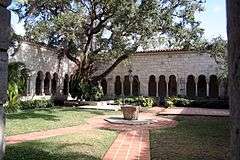
Old Spanish Monastery |
|
000000001972-11-09-0000November 9, 1972
(#72000307) |
16711 West Dixie Highway
25°55′45″N 80°09′17″W / 25.929167°N 80.154722°W / 25.929167; -80.154722 (Old Spanish Monastery) |
North Miami Beach |
|
| 90 |
Opa-locka Bank |
|
000000001983-05-19-0000May 19, 1983
(#83001420) |
940 Caliph Street
25°54′21″N 80°15′01″W / 25.905833°N 80.250278°W / 25.905833; -80.250278 (Opa-locka Bank) |
Opa-locka |
Part of the Opa-locka TR
|
| 91 |
Opa-locka Company Administration Building |
|
000000001982-03-22-0000March 22, 1982
(#82004796) |
777 Sharazad Boulevard
25°54′17″N 80°15′11″W / 25.904722°N 80.253056°W / 25.904722; -80.253056 (Opa-locka Company Administration Building) |
Opa-locka |
Part of the Opa-locka TR
|
| 92 |
Opa-locka Railroad Station |
|
000000001987-06-25-0000June 25, 1987
(#87000998) |
490 Ali Baba Avenue
25°54′01″N 80°15′12″W / 25.900278°N 80.253333°W / 25.900278; -80.253333 (Opa-locka Railroad Station) |
Opa-locka |
Part of the Opa-locka TR
|
| 93 |
Osceola Apartment Hotel |
|
000000001985-11-01-0000November 1, 1985
(#85003469) |
200 Azure Way
25°49′08″N 80°17′08″W / 25.818889°N 80.285556°W / 25.818889; -80.285556 (Osceola Apartment Hotel) |
Miami Springs |
Part of the Country Club Estates TR
|
| 94 |
Parrot Jungle Historic District |
|
000000002011-10-17-0000October 17, 2011
(#11000735) |
11000 SW 57th Avenue
25°40′10″N 80°17′09″W / 25.669444°N 80.285833°W / 25.669444; -80.285833 (Parrot Jungle Historic District) |
Pinecrest |
|
| 95 |
Populo |
|
000000002006-06-15-0000June 15, 2006
(#06000498) |
Biscayne National Park
Coordinates missing |
Homestead |
Part of the 1733 Spanish Plate Fleet Shipwrecks MPS
|
| 96 |
Root Building |
|
000000001987-08-17-0000August 17, 1987
(#87001326) |
111 Perviz Avenue
25°54′15″N 80°15′14″W / 25.904167°N 80.253889°W / 25.904167; -80.253889 (Root Building) |
Opa-locka |
Part of the Opa-locka TR
|
| 97 |
Seminole Cafe and Hotel |
|
000000002008-07-10-0000July 10, 2008
(#08000641) |
55 South Flagler Avenue
25°28′10″N 80°28′35″W / 25.469444°N 80.476389°W / 25.469444; -80.476389 (Seminole Cafe and Hotel) |
Homestead |
|
| 98 |
Shark River Slough Archeological District |
Upload image |
000000001996-11-05-0000November 5, 1996
(#96001181) |
Address Restricted
|
Homestead |
Part of the Archeological Resources of Everglades National Park MPS
|
| 99 |
Silver Palm Schoolhouse |
|
000000001987-07-02-0000July 2, 1987
(#87000581) |
Silver Palm Drive and Newton Road
25°33′03″N 80°26′43″W / 25.550833°N 80.445278°W / 25.550833; -80.445278 (Silver Palm Schoolhouse) |
Goulds |
|
| 100 |
Sunshine State Arch |
|
000000002014-05-19-0000May 19, 2014
(#14000210) |
Jct. of NW. 13th Ave. and NW. 167th St.
25°55′37″N 80°13′18″W / 25.9268682°N 80.2216355°W / 25.9268682; -80.2216355 (Sunshine State Arch) |
Miami Gardens |
|
| 101 |
Sweeting Homestead |
Upload image |
000000001997-09-19-0000September 19, 1997
(#97001088) |
Address Restricted
|
Biscayne National Park |
|
| 102 |
Taber Duplex |
|
000000001987-08-17-0000August 17, 1987
(#87001327) |
1214–1216 Sesame Street
25°54′21″N 80°14′52″W / 25.905833°N 80.247778°W / 25.905833; -80.247778 (Taber Duplex) |
Opa-locka |
Part of the Opa-locka TR
|
| 103 |
Arden "Doc" Thomas House |
|
000000002014-06-13-0000June 13, 2014
(#14000320) |
5530 Sunset Dr.
25°42′14″N 80°17′03″W / 25.703783°N 80.284089°W / 25.703783; -80.284089 (Arden "Doc" Thomas House) |
South Miami |
|
| 104 |
Tinsman House |
|
000000001987-08-17-0000August 17, 1987
(#87001328) |
1110 Peri Street
25°54′34″N 80°15′00″W / 25.909444°N 80.25°W / 25.909444; -80.25 (Tinsman House) |
Opa-locka |
Part of the Opa-locka TR
|
| 105 |
Tooker House |
|
000000001987-08-17-0000August 17, 1987
(#87001329) |
811 Dunad Avenue
25°54′23″N 80°15′12″W / 25.906389°N 80.253333°W / 25.906389; -80.253333 (Tooker House) |
Opa-locka |
Part of the Opa-locka TR
|
| 106 |
Venetian Causeway |
|
000000001989-07-13-0000July 13, 1989
(#89000852) |
Northeast 15th Street and Dade Boulevard
25°47′21″N 80°11′21″W / 25.789167°N 80.189167°W / 25.789167; -80.189167 (Venetian Causeway) |
Miami Beach |
Extends into Miami
|
| 107 |
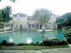
Venetian Pool |
|
000000001981-08-20-0000August 20, 1981
(#81000193) |
2701 De Soto Boulevard
25°44′46″N 80°16′27″W / 25.746111°N 80.274167°W / 25.746111; -80.274167 (Venetian Pool) |
Coral Gables |
|
| 108 |
Wheeler House |
|
000000001987-08-17-0000August 17, 1987
(#87001330) |
1035 Dunad Avenue
25°54′24″N 80°15′01″W / 25.906667°N 80.250278°W / 25.906667; -80.250278 (Wheeler House) |
Opa-locka |
Part of the Opa-locka TR |