List of Sites of Special Scientific Interest in Greater London
Greater London is split by the River Thames. The London region has a population of 7,512,400 within an area of 1,579 km², making it the second-largest populated region in the United Kingdom.[1] However, even though it is one of the largest urban conglomerations in Europe, almost two-thirds of London is made up of greenspace and wetlands, consisting primarily of extensive areas of green belt, large parks and the Thames basin.[2] As of January 2016, there are 37 sites designated within this Area of Search, 30 of which have been designated for their biological interest and 7 for their geological interest.[3][4]
In England, the body responsible for designating Sites of Special Scientific Interests is Natural England, which chooses sites because of their fauna, flora, geological or physiographical features.[5] Natural England took over the role of designating and managing SSSIs from English Nature in October 2006 when it was formed from the amalgamation of English Nature, parts of the Countryside Agency and the Rural Development Service. The data in the table is taken from Natural England's website in the form of citation sheets for each SSSI.
Key
Interest
- B = a site of biological interest
- G = a site of geological interest
Access
- YES = free public access to all or most of the site
- PP = free public access to part of the site
- PL = public access at limited times
- NO = no public access
Other classifications
- GCR = Geological Conservation Review
- EWT = Essex Wildlife Trust
- HMWT = Herts and Middlesex Wildlife Trust
- KWT = Kent Wildlife Trust
- LB = Listed building
- LNR = Local nature reserve
- LWT = London Wildlife Trust
- NNR = National nature reserve
- RHPG = Register of Historic Parks and Gardens of Special Historic Interest in England
- RSPB = Royal Society for the Protection of Birds
- SAC = Special Area of Conservation
- SM = Scheduled Monument
- SPA = Special Protection Area
- WWT = Wildfowl & Wetlands Trust
- WT = Woodland Trust
Sites
| Site name | Photograph | B | G | Area[lower-alpha 1] | Public access |
Location[lower-alpha 1] | Other classifications |
Map[lower-alpha 1] | Citation[lower-alpha 1] | Description |
|---|---|---|---|---|---|---|---|---|---|---|
| Abbey Wood | 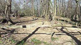 |
6.3 hectares (16 acres) | YES | Abbey Wood 51°29′13″N 0°07′46″E / 51.48706°N 0.12942°E TQ481786 |
GCR[6] | Map | Citation | The site is late Palaeocene and early Eocene 50 to 60 million years ago. It has yielded one of only two Palaeocene birds found in Britain, the holotype of Marinavis longirostris, a large Procellariiform.[7][8] | ||
| Barn Elms Wetland Centre | 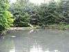 |
29.9 hectares (74 acres) | YES | Barnes 51°28′43″N 0°13′59″W / 51.4786°N 0.2331°W TQ228770 |
WWT[9] | Map | Citation | The site is a mosaic of wetland areas, with open water, marshland and reed beds. It has nationally important numbers of shovellers, and other birds include gadwalls, little grebes, grey herons, mute swans and little ringed plovers.[10] | ||
| Bentley Priory | 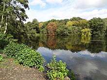 |
55.1 hectares (136 acres) | YES | Stanmore 51°37′19″N 0°19′48″W / 51.622°N 0.330°W TQ156297 |
LNR[11] | Map | Citation | The dominant grasses in the site are common bent, red fescue and Yorkshire Fog. Uncommon wild flowers include greater burnet, great burnet and spotted orchid. There are many birds including buzzard, spotted flycatcher, and bullfinch[12] | ||
| Brent Reservoir | .jpg) |
68.6 hectares (170 acres) | YES | Hendon 51°34′16″N 0°14′42″W / 51.571°N 0.245°W TQ217873 |
LNR[13] | Map | Citation | The reservoir is mainly significant for its nesting birds, especially for its nesting great crested grebe. Other birds include coots, little grebes, tufted ducks and gadwalls. There are also areas of swamp and wet woodland.[14] | ||
| Bushy Park and Home Park | 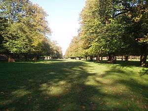 |
541.0 hectares (1,337 acres) | YES | Teddington 51°24′04″N 0°20′06″W / 51.4010°N 0.3349°W TQ159692 |
Map | Citation | The site has nationally important dead and decaying wood invertebrates, including the beetles Aeletes atomarius, Stenichnus godarti and Trichonyx sulcicollis. It also has ancient trees and acid grassland.[15] | |||
| Chingford Reservoirs | 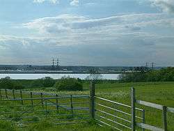 |
316.3 hectares (782 acres) | NO | Chingford 51°38′23″N 0°01′13″W / 51.6398°N 0.0202°W TQ371953 |
Map | Citation | The reservoirs are majoring wintering grounds for wildfowl, including nationally important populations of shoverllers and great crested grebes. There are also important numbers of Goldeneye (duck), tufted ducks and goosander. A total of over 85 species of wetlands birds have been recorded.[16] | |||
| Crofton Woods | 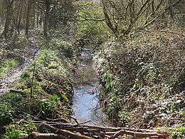 |
76.6 hectares (189 acres) | YES | Crofton 51°22′44″N 0°03′47″E / 51.379°N 0.063°E TQ437665 |
Map | Citation | It is a large area of ancient woodland on London Clay, which supports many types of trees, shrubs and herbs.[17] Trees in the ancient wood are mainly oak and hazel, with a central area of former fields. It has high botanical diversity, including fourteen species of sedge, and a rich invertebrate fauna.[18] | |||
| Croham Hurst |  |
33.6 hectares (83 acres) | YES | South Croydon 51°21′03″N 0°04′38″W / 51.3509°N 0.0773°W TQ338632 |
Map | Citation | This site, on a steep hill, has a diverse community on its lower slopes of plants dominated by oak and hazel on rich soils overlying chalk. Further up the trees are mainly beech on Thanet Sands, and towards the top the main trees are oak and birch on the acidic Blackheath pebble beds.[19][20] | |||
| Denham Lock Wood | 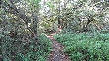 |
6.3 hectares (16 acres) | YES | Denham 51°33′58″N 0°28′44″W / 51.566°N 0.479°W TQ05863 |
LWT[21] | Map | Citation | It is a poorly drained wet woodland and fen site which is skirted by the Frays River. The main trees are alder and crack willow in the wetter areas, and elsewhere oak and ash with a shrub layer of hazel. In winter wildfowl are visible and in spring many flower species. Invertebrates include red cardinal beetles, banded demoiselles and the rare and protected Desmoulin's whorl snail.[22][23][24] | ||
| Downe Bank and High Elms | 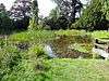 |
86.8 hectares (214 acres) | YES | Downe 51°19′52″N 0°03′50″E / 51.331°N 0.064°E TQ438610 51°21′04″N 0°04′30″E / 51.351°N 0.075°E TQ446625 |
KWT,[25] LNR,[26] LB[27] | Map | Citation | Downe Bank is a meadow and woodland area associated with Charles Darwin, who lived locally. High Elms is woodland which has locally uncommon species, such as green hellebore, bird's-nest orchid, spurgelaurel and yellow bird's-nest.[28] | ||
| Elmstead Pit | 0.05 hectares (0.12 acres) | NO | Elmstead 51°25′02″N 0°02′43″E / 51.4171°N 0.0453°E TQ42327066 |
GCR[29] | Map | Citation | The pit exposes an important layer of the Oldhaven or Blackheath Beds laid down about 50 million years ago during the Eocene epoch. It has a rich and diverse selection of fossil fauna from a sub-tidal estuarine environment. Fossils include molluscs, sharks' teeth and fish scales.[30] | |||
| Epping Forest | 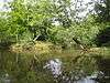 |
1,728.0 hectares (4,270 acres) | YES | Epping 51°40′N 0°03′E / 51.66°N 0.05°E TL475035 – TQ405865 |
EWT,[31] NCR[31] SAC[32] | Map | Citation | The forest has one of the few major examples of lowland wood pasture in England, with areas of pasture and wetland. According to Natural England it "supports a nationally outstanding assemblage of invertebrates, a major amphibian interest and an exceptional breeding bird community".[31] | ||
| Farthing Downs and Happy Valley | 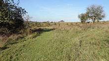 |
120.5 hectares (298 acres) | YES | Coulsdon 51°17′56″N 0°07′55″W / 51.299°N 0.132°W TQ303572 |
SM[33] | Map | Citation | This site has chalk and neutral grasslands and an area of ancient woodland. It has the largest British colony of the rare wildflower greater yellow-rattle, and nationally scarce herbs. Eight species of orchid have been recorded.[34] | ||
| Frays Farm Meadows | 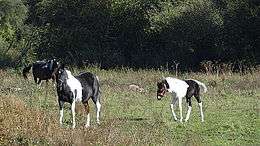 |
28.2 hectares (70 acres) | YES | Denham 51°33′50″N 0°28′35″W / 51.5639°N 0.4765°W TQ057861 |
LWT,[35] LNR[36] | Map | Citation | The Meadows are one of the few remaining examples of unimproved wet alluvial grassland in Greater London. The linear features, river, embankment, ditches and hedges, contribute to the rich diversity of plants and animals. Mammals on site include the nationally endangered water vole.[37][38] | ||
| Gilbert's Pit | .jpg) |
5.2 hectares (13 acres) | YES | Charlton 51°29′20″N 0°02′30″E / 51.4888°N 0.0418°E TQ418786 |
GCR,[39] LNR[40] | Map | Citation | This is an important Lower Tertiary site, displaying one of the most complete sequence of sediments in Greater London. The Paleocene Thanet and Woolwich Beds date to around 55 million years ago. Some of the beds yield many fossils of plants, sponges, molluscs, fish and reptiles.[41] | ||
| Hainault Forest | 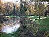 |
136.0 hectares (336 acres) | YES | Hainault 51°37′25″N 0°07′56″E / 51.6236°N 0.1323°E TQ477938 |
Map | Citation | This is mainly pedunculate oak and hornbeam on Claygate beds, glacial gravels and boulder clay. There is a varied flora and fauna, including many bird species, including nightingales, wood warblers and spotted flycatchers.[42] | |||
| Hampstead Heath Woods |  |
16.6 hectares (41 acres) | YES | Hampstead 51°34′20″N 0°10′08″W / 51.5721°N 0.1689°W TQ270875 51°34′03″N 0°10′03″W / 51.5676°N 0.1676°W TQ271870 |
Map | Citation | The site has many old and over-mature trees, and extensive dead wood which provides a habitat for invertebrates, including the nationally rare jewel beetle Agrilus pannonicus. The main trees are sessile oak and beech. The shrub layer is dominated by holly and rowan. [43] | |||
| Harefield Pit | 1.8 hectares (4.4 acres) | YES | Harefield 51°35′53″N 0°29′10″W / 51.598°N 0.486°W TQ049898 |
GCR[44][45] | Map | Citation | This is described by Natural England as an important Tertiary site in the London Basin, which displays a sequence through the Upper Chalk, Reading Beds and London Clay. It is the only known source of charophytes in the Reading Beds, and these have potential for correlation with other localities in Europe.[46] | |||
| Harrow Weald |  |
3.7 hectares (9.1 acres) | YES | Harrow Weald 51°37′24″N 0°20′41″W / 51.6233°N 0.3447°W TQ147929 |
GCR[47] | Map | Citation | It provides the most complete exposure of Pleistocene gravel beds above the Claygate Beds, the youngest layer of London Clay. They were formerly thought to have been of marine origin but recent research has cast doubt on this view. It is considered a key site for further studies.[48] | ||
| Hornchurch Cutting | 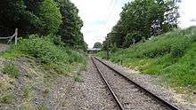 |
0.8 hectares (2.0 acres) | YES | Hornchurch 51°33′49″N 0°13′51″E / 51.5636°N 0.2308°E TQ547874 |
GCR[49] | Map | Citation | This is at the southern edge of the Anglian ice sheet 450,000 years ago, the most extreme ice age during the Pleistocence ice ages of the last 2.58 million years. It is the type site for Hornchurch Till, boulder clay laid down by the ice sheet in the Ingrebourne Valley.[50] | ||
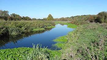
| Ingrebourne Marshes | 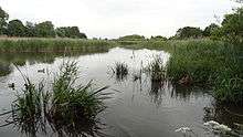 |
74.8 hectares (185 acres) | YES | Hornchurch 51°31′48″N 0°12′25″E / 51.530°N 0.207°E TQ532835 |
EWT,[51] LNR[52] | Map | Citation | The site is the largest area of freshwater marsh in Greater London. It is very diverse, with large areas of reed sweet-grass, common reed swamp, wet neutral grassland and tall fen. There are two nationally rare Red Data Book species, the hoverfly Anasimyia interpuncta and the scarce emerald damselfly Lestes dryas.[53] | ||
| Inner Thames Marshes |  |
479.3 hectares (1,184 acres) | YES | Purfleet 51°29′24″N 0°13′30″E / 51.490°N 0.225°E TQ531800 |
RSPB,[54] LNR[55] | Map | Citation | The site has a wide variety of breeding and wintering birds, with internationally important levels of wintering teal. The marshes also have rare plants and invertebrates, such as the pondweed Potamogeton pusillus and the emerald damselfly.[56] | ||
| Kempton Park Reservoirs | 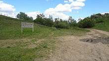 |
25.6 hectares (63 acres) | NO | Kempton Park 51°25′34″N 0°23′42″W / 51.426°N 0.395°W TQ118707 |
LNR[57] | Map | Citation | Waders that breed regularly include northern lapwing, common redshank, ringed plover and little ringed plover. The first successful inland breeding in the British Isles of pied avocet was at this reservoir. Other birds recorded include smew, garganey, Temminck's stint, spotted crake and red-necked phalarope.[58] | ||
| Keston And Hayes Commons | 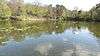 |
26.6 hectares (66 acres) | YES | Keston 51°21′30″N 0°02′05″E / 51.3584°N 0.0348°E TQ417643 |
Map | Citation | This site has both acid dry and wet neutral grassland. Heather on dry infertile soil has unusual lichens. There are also areas of valley mire, a brook and ponds.[59] | |||
| Mid Colne Valley | 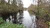 |
132.0 hectares (326 acres) | YES | Harefield 51°35′35″N 0°29′38″W / 51.593°N 0.494°W TQ043896 |
HMWT[60] | Map | Citation | The site is significant for its breeding wetland birds and over-wintering water birds. Wintering birds which are present in nationally important numbers are great crested grebes, cormorants, shovellers and tufted ducks, and the number of gadwalls is internationally significant. The River Colne is important for bats, particularly Daubentons.[61] | ||
| Old Park Wood | 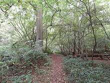 |
16.7 hectares (41 acres) | YES | Harefield 51°36′40″N 0°29′28″W / 51.611°N 0.491°W TQ046913 |
HMWT[62] | Map | Citation | The site is dissected by small valleys and has a variety of types of soil and plants. The trees are mainly oak, birch, hornbeam and ash. Golden saxifrage and marsh marigolds grow along small streams and there is a pond which is important for dragonflies and invertebrates.[63][64] | ||
| Oxleas Woodlands | 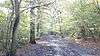 |
72.7 hectares (180 acres) | YES | Eltham 51°28′01″N 0°03′58″E / 51.467°N 0.066°E TQ442760 |
LNR[65] | Map | Citation | The site is mature woodland on London clay. Most of it is hazel with pedunculate or sessile oak, or birch and pedunculate oak. Insects include the beetles Oligota flavicormis and Scolytus intricatus, and the fly Dolichopus wahlbergi.[66] | ||
| Richmond Park | 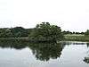 |
856.0 hectares (2,115 acres) | YES | Richmond 51°26′N 0°16′W / 51.44°N 0.27°W TQ200730 |
NNR,[67] SAC,[68] RHPG[69] | Map | Citation | The park is an important refuge for wildlife, including woodpeckers, squirrels, rabbits, snakes, frogs, toads, stag beetles and many other insects plus numerous ancient trees and varieties of fungi. It is particularly notable for its rare beetles.[70] | ||
| Riddlesdown | 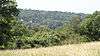 |
32.0 hectares (79 acres) | YES | Kenley |51°19′25″N 0°05′33″W / 51.3236°N 0.0926°W TQ330600 |
Map | Citation | This is the largest area of calcareous scrub in Greater London, with a herb-rich chalk grassland. There are two nationally rare herbs, early gentian (Gentianella anglica) and round-headed rampion. Invertebrate species include the scarce Roesel's bush-cricket.[71] | |||
| Ruislip Woods | 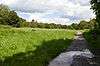 |
305.4 hectares (755 acres) | YES | Ruislip 51°35′35″N 0°25′52″W / 51.593°N 0.431°W TQ081892 |
NNR[67] | Map | Citation | This site has some of the largest unbroken blocks of semi-natural woodland in Greater London, almost all on clay soils, and it also has areas of wetland and grassland. It has some rare plant and insect species, including the orchid broad-leaved helleborine and the herb common cow-wheat.[72] | ||
| Ruxley Gravel Pits |  |
18.7 hectares (46 acres) | NO | Orpington 51°24′36″N 0°07′01″E / 51.410°N 0.117°E TQ474700 |
KWT[73] | Map | Citation | There are four water filled pits with areas of fen. Over 500 plants species have been recorded and 169 birds, out of which 53 are breeding species. There are also 23 butterfly species, 23 dragonfly and over 500 beetles. Water quality is high.[74] | ||
| Saltbox Hill | 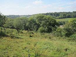 |
22.2 hectares (55 acres) | YES | Biggin Hill 51°19′30″N 0°00′33″E / 51.3251°N 0.0093°E TQ402604 TQ408607 |
LWT[75] | Map | Citation | Much of it is chalk grassland which is rich in plants which are rare in Greater London, and it is one of only two sites in London which has the Dark Green Fritillary butterfly. Ten species of orchid and over thirty of butterflies have been recorded. The site also has an area of woodland.[76][77] | ||
| Syon Park | 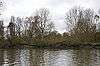 |
21.5 hectares (53 acres) | PL | Isleworth 51°28′34″N 0°18′29″W / 51.4761°N 0.3080°W TQ176766 |
Map | Citation | This site is tide meadow of reed-grasses, with rye-grass and meadow-grass on higher ground. There are many small ditches, and it is used by many over-wintering birds and has a number of rare invertebrate species, including uncommon flies.[78] | |||
| Walthamstow Marshes | 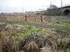 |
36.7 hectares (91 acres) | YES | Walthamstow 51°34′14″N 0°03′00″W / 51.5706°N 0.0499°W TQ352875 |
Map | Citation | The site has areas of semi-natural wetland and some of drier grassland. There are a variety of marshland breeding birds, and butterflies such as the Essex skipper. Species such as the Roesel's bush-cricket are indicators of ancient marshland.[79] | |||
| Walthamstow Reservoirs | 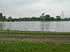 |
178.3 hectares (441 acres) | NO | Walthamstow 51°35′08″N 0°03′05″W / 51.5855°N 0.0514°W TQ351892 |
SPA[80] | Map | Citation | The Walthamstow Reservoirs support the most notable variety of breeding wetland birds among all of London's drinking water reservoirs. Great crested grebe, pochard, tufted duck, coot, yellow wagtail, sedge warbler and reed warbler are all regular breeding visitors.[81] | ||
| Wansunt Pit | 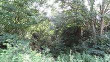 |
1.9 hectares (4.7 acres) | PP | Dartford 51°26′28″N 0°10′37″E / 51.44116°N 0.17701°E TQ514736 TQ515738 |
GCR[82] | Map | Citation | The site exposes the Dartford Heath Gravel, and the relationship of this exposure to the Swanscombe sequence and the Thames Terraces is a controversial issue in Thames Pleistocene studies.[83] Stone tools have been found of Homo Heidelbergensis, dating from the Hoxnian Stage, an interglacial period between 424,000 and 374,000 years ago.[84] | ||
| Wimbledon Common | 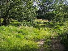 |
346.5 hectares (856 acres) | YES | Wimbledon 51°26′02″N 0°14′10″W / 51.434°N 0.236°W TQ227720 |
SAC[85] | Map | Citation | The common has an extensive area of wet acidic heathland, and other areas of dense semi-natural woodland on clay. There are many streams and plants uncommon in the London area. Other features are bog mosses and locally important breeding birds.[86] |
| Wikimedia Commons has media related to Sites of Special Scientific Interest in London. |
See also
Notes
References
- ↑ "T 08: Selected age groups for local authorities in the United Kingdom; estimated resident population; Mid-2006 Population Estimates". Office for National Statistics. August 22, 2007. Retrieved 2007-12-23.
- ↑ "Urban Greater London". Natural England. Archived from the original on 2007-12-14. Retrieved 2007-12-23.
- ↑ "London, Landscape and geodiversity". Natural England. Retrieved 2012-06-03.
- ↑ "SSSIs in Greater London". Natural England. Retrieved 13 January 2016.
- ↑ "Notification of SSSIs". Natural England. Retrieved 2007-12-23.
- ↑ "Geological Conservation Review - search results for Abbey Wood". Joint Nature Conservation Committee. Retrieved 13 January 2016.
- ↑ Natural England Citation, Abbey Wood
- ↑ Geological Conservation Review, Volume 16: Fossil Fishes of Great Britain, Chapter 14: British Cenozoic fossil fishes sites, Site: ABBEY WOOD (GCR ID: 2903), 1980-2007
- ↑ "London Wetland Centre". Wildfowl & Wetlands Trust. Retrieved 13 January 2016.
- ↑ "Barn Elms Wetland Centre citation" (PDF). Sites of Special Scientific Interest. Natural England. Retrieved 30 May 2016.
- ↑ "Bentley Priory". Local Nature Reserves. Natural England. 1 March 2013. Retrieved 22 January 2014.
- ↑ Harrow Heritage Trust, Bentley Priory Nature Reserve
- ↑ "Brent Reservoir/Welsh Harp". Local Nature Reserves. Natural England. 1 March 2013. Retrieved 22 January 2014.
- ↑ "Brent Reservoir citation" (PDF). Sites of Special Scientific Interest. Natural England. Retrieved 30 May 2016.
- ↑ "Bushy Park and Home Park citation" (PDF). Sites of Special Scientific Interest. Natural England. Retrieved 30 May 2016.
- ↑ "Chingford Reservoirs citation" (PDF). Natural England. Retrieved 30 May 2016.
- ↑ Natural England, Crofton Woods citation
- ↑ "Crofton Wood". Greenspace Information for Greater London. 2006. Retrieved 10 September 2012.
- ↑ "Croham Hurst citation" (PDF). Natural England.
- ↑ Croydon Online, Croham Hurst
- ↑ "Denham Lock Wood". London Wildlife Trust. Retrieved 14 January 2016.
- ↑ London Wildlife Trust, Denham Lock Wood
- ↑ "Denham Lock Wood citation" (PDF). Sites of Special Scientific Interest. Natural England. Retrieved 20 January 2016.
- ↑ London Wildlife Trust noticeboard in Denham Lock Wood
- ↑ "Downe Bank". Kent Wildlife Trust. Retrieved 14 January 2016.
- ↑ "High Elms". Local Nature Reserves. Natural England. 5 March 2013. Retrieved 22 January 2014.
- ↑ "Search Results for 'high elms'". Historic England. Retrieved 14 January 2016.
- ↑ "Downe Bank and High Elms citation" (PDF). Sites of Special Scientific Interest. Natural England. Retrieved 30 May 2016.
- ↑ "Elmstead Rock Pit, Chislehurst (Palaeogene)". Joint Nature Conservation Committee. Retrieved 14 January 2016.
- ↑ "Elmstead Pit citation" (PDF). Sites of Special Scientific Interest. Natural England. Retrieved 30 May 2016.
- 1 2 3 "Epping Forest citation" (PDF). Sites of Special Scientific Interest. Natural England. Retrieved 30 May 2016.
- ↑ "Special Areas of Conservation: Epping Forest". Joint Nature Conservation Committee. Retrieved 14 January 2016.
- ↑ "Regular aggregate field system, associated trackway and Anglo-Saxon barrow field on Farthing Down, 490m east of Hooley Farm". Historic England. Retrieved 14 January 2016.
- ↑ "Farthing Downs and Happy Valley citation" (PDF). Sites of Special Scientific Interest. Natural England. Retrieved 30 May 2016.
- ↑ "Frays Farm Meadows SSSI". London Wildlife Trust. Retrieved 14 January 2016.
- ↑ "Frays Valley". Local Nature Reserves. Natural England. 4 March 2013. Retrieved 22 January 2014.
- ↑ Natural England, Cows MOOve in to rescue West London Meadow, Press release 22 May 2010 Archived June 12, 2010, at the Wayback Machine.
- ↑ Natural England Citation, Fray's Farm Meadows
- ↑ "Charlton Sand Pit (Gilbert's Pit) (Palaeogene)". Joint Nature Conservation Committee. Retrieved 15 January 2016.
- ↑ "Maryon Wilson Park and Gilbert's Pit". Local Nature Reserves. Natural England. 6 March 2013. Retrieved 22 January 2014.
- ↑ "Gilbert's Pit (Charlton) SSSI citation" (PDF). Natural England. Retrieved 30 May 2016.
- ↑ "Hainault Forest citation" (PDF). Sites of Special Scientific Interest. Natural England. Retrieved 30 May 2016.
- ↑ "Hampstead Heath Woods citation" (PDF). Sites of Special Scientific Interest. Natural England. Retrieved 15 December 2014.
- ↑ "Harefield (Palaeogene)". Joint Nature Conservation Committee. Retrieved 15 January 2016.
- ↑ "Harefield (Tertiary Palaeobotany)". Joint Nature Conservation Committee. Retrieved 15 January 2016.
- ↑ Natural England, Harefield Pit citation
- ↑ "Harrow Weald Common (Quaternary of the Thames)". Joint Nature Conservation Committee. Retrieved 15 January 2016.
- ↑ Natural England, Harrow Weald citation
- ↑ "Hornchurch Railway Cutting (Quaternary of the Thames)". Joint Nature Conservation Committee. Retrieved 15 January 2016.
- ↑ "Hornchurch Cutting citation" (PDF). Sites of Special Scientific Interest. Natural England. Retrieved 15 January 2016.
- ↑ "Ingrebourne Valley". Essex Wildlife Trust. Retrieved 23 May 2016.
- ↑ "Ingrebourne Valley". Local Nature Reserves. Natural England. 25 March 2015. Retrieved 15 January 2016.
- ↑ "Ingrebourne Marshes citation" (PDF). Sites of Special Scientific Interest. Natural England. Retrieved 15 January 2016.
- ↑ "Rainham Marshes". Royal Society for the Protection of Birds. Retrieved 15 January 2016.
- ↑ "Rainham Marshes". Local Nature Reserves. Natural England. 24 June 2015. Retrieved 15 January 2016.
- ↑ "Inner Thames Marshescitation" (PDF). Sites of Special Scientific Interest. Natural England. Retrieved 31 May 2016.
- ↑ "Kempton". Local Nature Reserves. Natural England. 5 March 2013. Retrieved 15 November 2013.
- ↑ "Kempton Park Reservoirs citation" (PDF). Sites of Special Scientific Interest. Natural England. Retrieved 16 January 2016.
- ↑ "Keston and Hayes Commons citation" (PDF). Sites of Special Scientific Interest. Natural England. Retrieved 31 May 2016.
- ↑ "Broadwater Lake". Herts and Middlesex Wildlife Trust. Retrieved 16 January 2016.
- ↑ Herts & Middlesex Wildlife Trust, Broadwater Lake
- ↑ "Old Park Wood". Herts and Middlesex Wildlife Trust. Retrieved 16 January 2016.
- ↑ Natural England, Old Park Wood SSSI designation
- ↑ Herts & Middlesex Wildlife Trust, Old Park Wood
- ↑ "Oxleas/Shooters Hill Woodlands". Local Nature Reserves. Natural England. 24 March 2015. Retrieved 16 January 2016.
- ↑ "Oxleas Woodlands citation" (PDF). Sites of Special Scientific Interest. Natural England. Retrieved 31 May 2016.
- 1 2 "London's National Nature Reserves". Natural England. Retrieved 16 January 2016.
- ↑ "Richmond Park". Joint Nature Conservation Committee. Retrieved 3 December 2012.
- ↑ "Richmond Park". Historic England. Retrieved 16 January 2016.
- ↑ "London NNRs". Natural England. Retrieved 20 June 2012.
- ↑ Natural England, Riddlesdown Unit 1
- ↑ "Ruislip Woods citation" (PDF). Sites of Special Scientific Interest. Natural England. Retrieved 31 May 2016.
- ↑ "Ruxley Gravel Pits". Kent Wildlife Trust. Retrieved 16 January 2016.
- ↑ "Ruxley Gravel Pits citation" (PDF). Sites of Special Scientific Interest. Natural England. Retrieved 31 May 2016.
- ↑ "Saltbox Hill". London Wildlife Trust. Retrieved 16 January 2016.
- ↑ Greater London Authority/London Biodiversity Partnership 2007, Dark green fritillary butterfly
- ↑ "Saltbox Hill citation" (PDF). Sites of Special Scientific Interest. Natural England. Retrieved 16 January 2016.
- ↑ "Syon Park citation" (PDF). Sites of Special Scientific Interest. Natural England. Retrieved 15 December 2014.
- ↑ "Walthamstow Marshes citation" (PDF). Sites of Special Scientific Interest. Natural England. Retrieved 31 May 2016.
- ↑ "Lee Valley". Joint Nature Conservation Committee. Retrieved 16 January 2016.
- ↑ "Walthamstow Reservoirs citation" (PDF). Sites of Special Scientific Interest. Natural England. Retrieved 31 May 2016.
- ↑ "Wansunt Pit, Dartford Heath (Quaternary of the Thames)". Joint Nature Conservation Committee. Retrieved 16 January 2016.
- ↑ Natural England, Wansunt Pit SSSI citation
- ↑ Juby, Caroline (2011) London before London: Reconstructing a Palaeolithic Landscape, Royal Holloway, University of London, Department of Geography, p. 94
- ↑ "Wimbledon Common". Joint Nature Conservation Committee. Retrieved 16 January 2016.
- ↑ "Wimbledon Common citation" (PDF). Sites of Special Scientific Interest. Natural England. Retrieved 31 May 2016.