Llaima
| Llaima | |
|---|---|
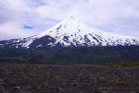 The snowy cone of Llaima volcano | |
| Highest point | |
| Elevation | 3,125 m (10,253 ft) [1] |
| Prominence | 1,819 m (5,968 ft) [1] |
| Listing |
Region high point Ultra |
| Coordinates | 38°41′45″S 71°43′54″W / 38.69583°S 71.73167°WCoordinates: 38°41′45″S 71°43′54″W / 38.69583°S 71.73167°W [1] |
| Geography | |
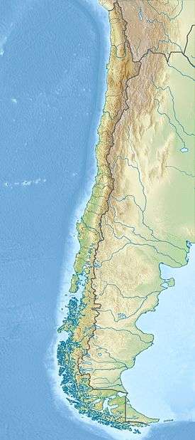 Llaima Location in Chile | |
| Location | Melipeuco and Vilcún, Cautín Province, La Araucanía Region, Chile |
| Parent range | Andes |
| Geology | |
| Mountain type | Stratovolcano |
| Last eruption | 2008 to 2009 |
The Llaima Volcano is one of the largest and most active volcanoes in Chile. It is situated 82 km northeast of Temuco and 663 km southeast of Santiago, within the borders of Conguillío National Park.
Geography
The top of Llaima consists of two summits; the lower of the two, Pichillaima, is about 2,920 m (9,580 ft) high and is significantly less prominent than the higher northern summit.[2]
The average elevation of the terrain around Llaima is about 740 m asl.[2]
The volcano, along with Sierra Nevada, surrounds the Conguillío Lake. Its slopes are drained by the rivers Captrén, Quepe and Trufultruful.[2] The former ones are tributaries of Cautín River and the latter is affluent of Allipén River.
Eruptions
Llaima is one of Chile's most active volcanoes and has frequent but moderate eruptions. Llaima’s activity has been documented since the 17th century, and consists of several separate episodes of moderate explosive eruptions with occasional lava flows. The last major eruption occurred in 1994.[3]
An eruption on January 1, 2008 forced the evacuation of hundreds of people from nearby villages. A column of smoke approximately 3000 m high was observed. An amateur caught the early eruption phase on video.[4] The volcanic ash expelled by Llaima travelled east over the Andes into Argentina. Ash fall was recorded in the area of Zapala, Neuquén Province, and forced the cancellation of flights to and from Presidente Perón Airport near the city of Neuquén.[5] On July 2, 2008, another eruption resulted in evacuation of 40 people from a 15 km exclusion zone.[6]
An eruption occurred on April 5, 2009, with pyroclastic flows, ash and lava seen on the slopes.
Recreation
The ski center Las Araucarias lies on the volcano's western slopes.
Gallery
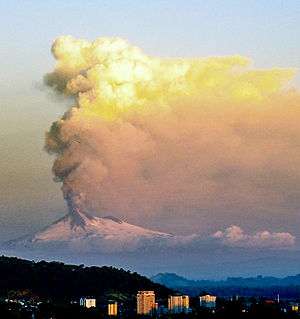 January 2008 Llaima eruption
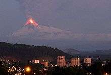 January 2008 Llaima eruption
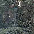 The April 2009 eruption seen from space
 Summit of Llaima volcano
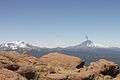 Llaima volcano a few days after the January 2008 eruption
 Llaima volcano with a blanket of snow covering its solidified lava flows
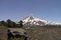 Llaima volcano
 Snow-capped Llaima in springtime seen from space
See also
References
- 1 2 3 "Argentina and Chile, Central Ultra Prominences". Peaklist.org. Retrieved 2013-07-16.
- 1 2 3 (Spanish) Sernageomin. "Volcán Llaima". Archived from the original on 2007-04-29. Retrieved 2007-08-30.
- ↑ "Chile volcano forces evacuations". BBC. January 2, 2008.
- ↑ Volcan LLAIMA on YouTube
- ↑ "Cancelan vuelos en el aeropuerto de Neuquén por la erupción en Chile del volcán Llaima". Clarín. January 2, 2008.
- ↑ "Chile ski station evacuated as volcano erupts". Yahoo!News. July 2, 2008.
External links
| Wikimedia Commons has media related to Llaima. |
- Llaima Volcano Visual Observation Project
- Sulfur Dioxide Plume from Llaima Volcano at the NASA Earth Observatory
- "Volcán Llaima, Chile" on Peakbagger
- BBC video of eruption