Lockport, Louisiana
| Town of Lockport | |
| Town | |
| Country | United States |
|---|---|
| State | Louisiana |
| Parish | Lafourche |
| Elevation | 10 ft (3.0 m) |
| Coordinates | 29°38′33″N 90°32′24″W / 29.64250°N 90.54000°WCoordinates: 29°38′33″N 90°32′24″W / 29.64250°N 90.54000°W |
| Area | 0.6 sq mi (1.6 km2) |
| - land | 0.6 sq mi (2 km2) |
| - water | 0.04 sq mi (0 km2), 6.67% |
| Population | 2,624 (2000) |
| Density | 4,221.0/sq mi (1,629.7/km2) |
| Mayor | Paul Champagne (R) (elected 2012) |
| Timezone | CST (UTC-6) |
| - summer (DST) | CDT (UTC-5) |
| Area code | 985 |
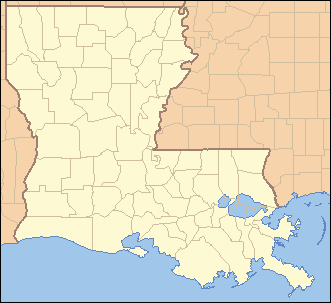 Location of Lockport in Louisiana
| |
 Location of Louisiana in the United States
| |
| Website: http://www.townoflockport.com | |
Lockport is a town on Bayou Lafourche in Lafourche Parish, Louisiana, United States. The population was 2,624 at the 2000 census. It is part of the Houma–Bayou Cane–Thibodaux Metropolitan Statistical Area.
History
Lockport, founded in 1835, traces its history to Jacques Lamotte, who in 1790 owned a large tract of land along Bayou Lafourche. Lemotte sold a portion of the tract to Messrs. Mercier and Marcantel in 1814. In 1823 William Field purchased a parcel of the land and later donated 5 arpents of it on both banks of Bayou Lafourche to Barataria and Lafourche Canal Company. As part of the transaction, the company agreed to build a canal, which would link Bayou Terrebonne to New Orleans. Allou D'Hemecourt surveyed the area in 1835. His map bears the name Longueville. Eventually, the village's name would become Lockport.
At first the canal, completed in 1847, brought prosperity to the area. Three years later locks were completed at the point where the canal reached Bayou Lafourche. Shipping along the canal was brisk until 1868. After that time, part of the waterway was no longer in use. The crevasse of 1876 partially destroyed the locks. Today remnants of the brick bulwark are still visible under a blanket of weeds.
Lockport prospered in spite of the canal's failure as a business venture. In 1849 the first public school opened. It was a one-room affair in Scanian's Cooperage. In 1850 Holy Savior Catholic Church was dedicated, and in 1879 an order of nuns established Holy Savoir School.
The Village of Lockport was incorporated in 1899, and a mayor and board of aldermen were named. At the turn of the century, the village boasted a post office, brick sidewalks, an iron bridge over the bayou, a newspaper, ice house, banks, hotels, liveries, blacksmith shop, clothing stores, grocery and general merchandise stores, and various other enterprises. The iron bridge created quite a stir among the populace. It joined Lockport to Rita, the settlement on the east bank of the bayou.
One of the worst calamities to touch the village occurred in 1916, when a disastrous fire destroyed a large part of the business area and several homes. As a result of this tragedy, a water tower was erected on Main Street near the present day Sheriff's Annex, where it stood until Hurricane Betsy destroyed it in 1965. By 1948 Lockport's population had grown to the point where its status was changed from village to town. Its boundaries had been expanded, and later the site of the canal bridge was changed to fifth street, now Crescent Avenue. Highway 1 no longer ran along Main Street. Several businesses sprang up along the new route, and that area has become the business hub of the town. Today Lockport is a progressive community, dependent upon a diversified economy, surrounded by industries such as shipbuilding, sugarcane farming, oil and gas exploration, cattle, fishing, and a variety of vegetable farms. Through the years Lockport has managed to retain its small town quality - a quality that welcomes visitors who travel along Bayou Lafourche, the longest street in the world [1]
Geography
Lockport is located at 29°38′33″N 90°32′24″W / 29.64250°N 90.54000°W (29.642584, -90.539895).[2]
According to the United States Census Bureau, the town has a total area of 0.6 square miles (1.6 km2), of which 0.6 square miles (1.6 km2) is land and 0.04 square miles (0.10 km2) (3.12%) is water.
Demographics
| Historical population | |||
|---|---|---|---|
| Census | Pop. | %± | |
| 1880 | 171 | — | |
| 1900 | 401 | — | |
| 1910 | 669 | 66.8% | |
| 1920 | 803 | 20.0% | |
| 1930 | 866 | 7.8% | |
| 1940 | 877 | 1.3% | |
| 1950 | 1,388 | 58.3% | |
| 1960 | 2,221 | 60.0% | |
| 1970 | 2,398 | 8.0% | |
| 1980 | 2,424 | 1.1% | |
| 1990 | 2,503 | 3.3% | |
| 2000 | 2,624 | 4.8% | |
| 2010 | 2,578 | −1.8% | |
| Est. 2015 | 2,531 | [3] | −1.8% |
As of the census[5] of 2000, there were 2,624 people, 1,009 households, and 724 families residing in the town. The population density was 4,221.0 people per square mile (1,634.1/km²). There were 1,063 housing units at an average density of 1,709.9 per square mile (662.0/km²). The racial makeup of the town was 95.73% White, 1.03% African American, 1.64% Native American, 0.42% Asian, 0.61% from other races, and 0.57% from two or more races. Hispanic or Latino of any race were 1.18% of the population.
There were 1,009 households out of which 34.5% had children under the age of 18 living with them, 56.3% were married couples living together, 10.4% had a female householder with no husband present, and 28.2% were non-families. 24.1% of all households were made up of individuals and 12.9% had someone living alone who was 65 years of age or older. The average household size was 2.59 and the average family size was 3.06.
In the town the population was spread out with 25.8% under the age of 18, 9.5% from 18 to 24, 30.0% from 25 to 44, 20.7% from 45 to 64, and 13.9% who were 65 years of age or older. The median age was 36 years. For every 100 females there were 88.0 males. For every 100 females age 18 and over, there were 85.5 males.
The median income for a household in the town was $34,688, and the median income for a family was $40,288. Males had a median income of $37,151 versus $19,474 for females. The per capita income for the town was $15,769. About 15.3% of families and 19.7% of the population were below the poverty line, including 23.5% of those under age 18 and 22.8% of those age 65 or over.
Education
Lafourche Parish Public Schools operates public schools, including:
- Lockport Lower Elementary School (K-2)[6]
- Lockport Upper Elementary School (3-5)[7]
- Lockport Middle School[8]
Lockport is served by Central Lafourche High School in Mathews, formed by a 1966 merger of Lockport High School and Raceland High School.[9]
A one-room schoolhouse established in 1849 at Scanian’s Cooperage was the first school in Lockport. Holy Savior School opened in 1879, established by an order of nuns.[10]
The 501(C)(3) Camille and Braxton Hebert Memorial Fund Inc. was used to establish recreational areas/playgrounds at both elementary schools. The fund was named after the brother and sister Camille and Braxton Hebert,[11] who were murdered by their mother, Amy Hebert, on August 20, 2007. The playground at Lockport Lower has the text "Braxton's Buddies".[12] Camille's Court, at Lockport Upper, was scheduled to be a basketball court decorated with a plaque and flowerbed.[13]
Lafourche Parish Library operates the Lockport Branch.[14]
Notable people
- Donald G. Bollinger, founder Bollinger Shipyards (1946) and state chairman of the Louisiana Republican Party (1986-1988)
- Jefferson DeBlanc, received the Medal of Honor for his actions in World War II.[15]
- Dick Guidry, former state representative from Lafourche Parish and former owner of drive-in theaters, resided in Lockport.
References
- ↑ Town of Lockport Official Website
- ↑ "US Gazetteer files: 2010, 2000, and 1990". United States Census Bureau. 2011-02-12. Retrieved 2011-04-23.
- ↑ "Annual Estimates of the Resident Population for Incorporated Places: April 1, 2010 to July 1, 2015". Retrieved July 2, 2016.
- ↑ "Census of Population and Housing". Census.gov. Retrieved June 4, 2015.
- ↑ "American FactFinder". United States Census Bureau. Retrieved 2008-01-31.
- ↑ Home. Lockport Lower Elementary School. Retrieved on November 27, 2016. "1421 Crescent Avenue Lockport, LA 70374"
- ↑ Home. Lockport Upper Elementary School. Retrieved on November 27, 2016. "201 School Street Lockport, LA 70374"
- ↑ Home. Lockport Middle School. Retrieved on November 27, 2016. "720 Main Street Lockport, LA 70374"
- ↑ Theriot, Clifton. Lafourche Parish. Arcadia Publishing, December 1, 2014. ISBN 1439648662, 9781439648667. p. 71.
- ↑ "History." Town of Lockport. Retrieved on November 29, 2016.
- ↑ Home. Camille and Braxton Hebert Memorial Fund Inc. October 10, 2008. Retrieved on November 27, 2016.
- ↑ Ruffin, Sophia (2009-06-24). "Mom sentenced to 2 life terms". Houma Times. Retrieved 2016-11-27.
- ↑ Thurston, Dee Dee (2007-09-12). "Memorials to be built for slain children". Houma Times. Retrieved 2016-11-28.
- ↑ "Branch Locations and Contact." Lafourche Parish Library. Retrieved on November 28, 2018.
- ↑ "DEBLANC, JEFFERSON JOSEPH". Congressional Medal of Honor Society. Retrieved February 2014. Check date values in:
|access-date=(help)
External links
Municipalities and communities of Lafourche Parish, Louisiana, United States | ||
|---|---|---|
| City | 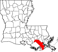 | |
| Towns | ||
| CDPs | ||
| Other Unincorporated communities |
| |
| Footnotes | ‡This populated place also has portions in an adjacent parish or parishes | |