Los Mártires
| Los Mártires | |
|---|---|
| Locality of Bogotá | |
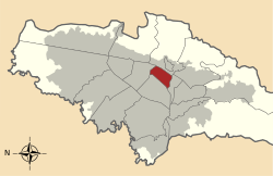 Location of the locality in the city of Bogotá | |
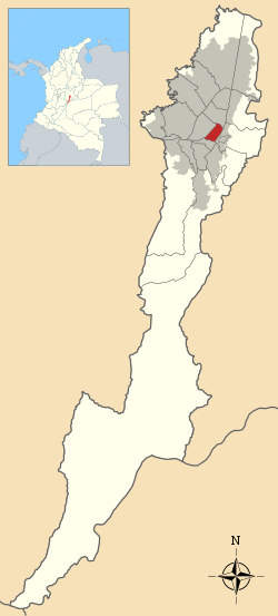 Location of the locality in the Capital District of Bogotá | |
| Country |
|
| City | Bogotá D.C. |
| Neighbourhoods | |
| Area | |
| • Total | 6.51 km2 (2.51 sq mi) |
| Elevation | 2,600 m (8,500 ft) |
| Population (2007)[1] | |
| • Total | 94,944 |
| • Density | 15,000/km2 (38,000/sq mi) |
| Time zone | Colombia Standard Time (UTC-5) |
| Website | Official website |
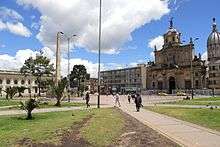
Los Mártires (Spanish: The Martyrs) is the 14th locality of Bogotá, capital of Colombia. It is located near the city's downtown to its west. It takes its name in honor of those who died during the war for independence from Spain. It is completely urbanized, save for its parks and the banks of its rivers.
General information
Borders
North: Diagonal 22 and Avenida El Dorado, with the locality of Teusaquillo.
South: Calle 8 Sur and Avenida Primera, with the locality of Antonio Nariño.
East: Avenida Caracas, with the locality of Santa Fe.
West: Carrera 30 with the locality of Puente Aranda.
Hydrology
The Fucha River runs through the locality.
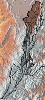
Topography
Los Mártires is relatively flat due to its being part of the savannah of Bogotá. It slopes slightly upward to the west.
Transportation
The locality is served by the Avenida Caracas and Calle 13 lines of the TransMilenio system, including the Avenida Jiménez transfer station.
History
In the area that is now Los Mártires Park Policarpa Salavarrieta, Antonia Santos, Mercedes Ábrego, Camilo Torres Tenorio, and Antonio José de Caldas died. In 1850, an obelisk was erected in their memory.
Neighborhoods
The following neighborhoods form part of the locality: Santa Isabel, Ciudad Montes, and Paloquemao
References
- ↑ (Spanish) Population 2007 - DANE
External links
-
 Santa Fé-Los Mártires travel guide from Wikivoyage
 - (Spanish) National University of Colombia site about Los Mártires
 | Administrative subdivision in 19 localities | 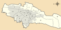 | |
|---|---|---|---|
| Metropolitan Area | |||
| Geography | |||
| |||
Coordinates: 4°36′16″N 74°05′24″W / 4.60444°N 74.09000°W