Lost Lake Woods, Michigan
| Lost Lake Woods, Michigan | |
|---|---|
| Census-designated place & Unincorporated community | |
 Location of Lost Lake Woods, Michigan | |
| Coordinates: 44°46′43″N 83°25′31″W / 44.77861°N 83.42528°WCoordinates: 44°46′43″N 83°25′31″W / 44.77861°N 83.42528°W | |
| Country | United States |
| State | Michigan |
| County | Alcona |
| Area | |
| • Total | 5.2 sq mi (13.4 km2) |
| • Land | 5.1 sq mi (13.1 km2) |
| • Water | 0.2 sq mi (0.4 km2) |
| Elevation | 860 ft (262 m) |
| Population (2010) | |
| • Total | 312 |
| • Density | 62/sq mi (23.9/km2) |
| Time zone | Eastern (EST) (UTC-5) |
| • Summer (DST) | EDT (UTC-4) |
| FIPS code | 26-49450[1] |
| GNIS feature ID | 1620636[2] |
Lost Lake Woods is an unincorporated community in Alcona Township, Alcona County in the U.S. state of Michigan. It is a Census-designated place (CDP) used for statistical purposes and has no legal status as a municipality. The population was 312 at the 2010 census.[3]
Lost Lake Woods is a private club with control of over 10,000 acres (40 km2) of woodland. Entry is strictly for members and guests only.[4] It is located just north of Lincoln, Michigan.
Geography
Lost Lake Woods is at 44°46′37″N 83°25′28″W / 44.77694°N 83.42444°W. The FIPS place code is 26-49450 and the elevation is about 830 feet (250 m) above sea level.
According to the United States Census Bureau, the CDP has a total area of 5.2 square miles (13.4 km2), of which 5.1 square miles (13.1 km2) is land and 0.15 square miles (0.4 km2), or 2.68%, is water.[3]
Demographics
As of the census[1] of 2000, there were 339 people, 189 households, and 127 families residing in the CDP. The population density was 67.8 per square mile (26.2/km²). There were 511 housing units at an average density of 102.2 per square mile (39.5/km²). The racial makeup of the CDP was 99.41% White, 0.29% Native American, and 0.29% from two or more races. Hispanic or Latino of any race were 0.29% of the population.
There were 189 households out of which 5.3% had children under the age of 18 living with them, 64.6% were married couples living together, 1.6% had a female householder with no husband present, and 32.3% were non-families. 31.2% of all households were made up of individuals and 23.8% had someone living alone who was 65 years of age or older. The average household size was 1.79 and the average family size was 2.14.
In the CDP the population was spread out with 4.7% under the age of 18, 0.6% from 18 to 24, 8.3% from 25 to 44, 31.6% from 45 to 64, and 54.9% who were 65 years of age or older. The median age was 67 years. For every 100 females there were 101.8 males. For every 100 females age 18 and over, there were 97.0 males.
The median income for a household in the CDP was $32,361, and the median income for a family was $40,714. Males had a median income of $21,875 versus $19,688 for females. The per capita income for the CDP was $22,546. About 1.5% of families and 3.8% of the population were below the poverty line, including none of those under age 18 and 3.6% of those age 65 or over.
References
- 1 2 "American FactFinder". United States Census Bureau. Retrieved 2008-01-31.
- ↑ "US Board on Geographic Names". United States Geological Survey. 2007-10-25. Retrieved 2008-01-31.
- 1 2 "Geographic Identifiers: 2010 Demographic Profile Data (G001): Lost Lake Woods CDP, Michigan". U.S. Census Bureau, American Factfinder. Retrieved June 3, 2013.
- ↑ "Lost Lake Woods Club". Retrieved November 20, 2013.
External links
Municipalities and communities of Alcona County, Michigan, United States | ||
|---|---|---|
| City | 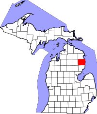 | |
| Village | ||
| Townships | ||
| Unincorporated communities | ||