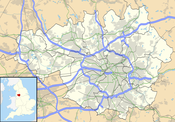
Lostock, Bolton
| Lostock | |
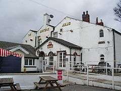 The Lostock Arms, Lostock |
|
 Lostock |
|
| OS grid reference | SD669088 |
|---|---|
| Metropolitan borough | Bolton |
| Metropolitan county | Greater Manchester |
| Region | North West |
| Country | England |
| Sovereign state | United Kingdom |
| Post town | BOLTON |
| Postcode district | BL6 |
| Dialling code | 01204 |
| Police | Greater Manchester |
| Fire | Greater Manchester |
| Ambulance | North West |
| EU Parliament | North West England |
| UK Parliament | Bolton West |
|
|
Coordinates: 53°34′30″N 2°30′04″W / 53.575003°N 2.500999°W
Lostock is a mostly residential district of Bolton in Greater Manchester, England. It lies 3.5 miles (5.6 km) west of Bolton town centre and 18.1 miles (29.1 km) northwest of Manchester.[1] Historically part of Lancashire, Lostock is bounded by Deane to the southeast, Markland Hill to the northeast and the Middlebrook development, including Bolton Wanderers' football ground, the Macron Stadium in nearby Horwich.. Lostock, alongside Heaton and Edgworth, is known for being one of the most expensive places to live in Bolton.
History
The name derives from Old English hlose a pig and stoc meaning a farm, usually 'stock' or 'Stoke' in place-names, but here referring to a pigsty. Another source suggested that the name is derived from Celtic, llostog meaning beaver, inferring the site of a stream where beavers were found, the reasoning due to the proliferation of Brythonic and Celtic place-names in Lancashire.[2] It has been variously recorded as Lostoc in 1212; Lastok in 1279; Lostok in 1292; Lostoke in 1301 and Lostock and Lostocke in the 16th century.[3]
In the Middle Ages Lostock was part of the barony of Manchester. It was subsequently held by Richard de Hulton and passed to the Andertons and the Blundells of Ince.[4] Lostock Hall was an Elizabethan manor house built for the Anderton family in 1563.[3] The hall was demolished in 1824, but the gatehouse remains and is a Grade II* listed building.[5]
Local government
Lostock was a township in the ancient Parish of Bolton le Moors, in the hundred of Salford, in the historic county of Lancashire.[4] In 1837 Lostock joined with other townships (or civil parishes) in the area to form the Bolton Poor Law Union and took joint responsibility for the administration and funding of the Poor Law in that area.[6] In 1866, Lostock became a civil parish,[7] and in 1894 it became part of the Bolton Rural District, which was dissolved in 1898.[8] Under the Bolton, Turton and Westhoughton Extension Act of 1898, Lostock ceased to be a civil parish and became part of the County Borough of Bolton.[9]
Lostock is part of the Heaton and Lostock Ward, one of twenty wards in the Metropolitan Borough of Bolton. The population of the ward at the 2011 Census was 13,564.[10] The ward has three councillors who are elected for up to four years and represent the Lostock and Heaton areas.[11]
Geography
Lostock was a hamlet covering 1364 acres of land 4½ miles west of Bolton.[4][12] Chew Moor in the southwest was the principal settlement of the township, it was a cluster of cottages housing the landless labourers and tenant farmers.[13]
Demography
Township population
| Population of the township/civil parish of Lostock | ||||||||||
|---|---|---|---|---|---|---|---|---|---|---|
| Year | 1801 | 1811 | 1821 | 1831 | 1841 | 1851 | 1861 | 1871 | 1881 | 1891 |
| Population | ||||||||||
| Source: Vision of Britain - Lostock Tn/CP: Total Population. | ||||||||||
Ward population
In 1898, Lostock became part of the Deane-cum-Lostock Ward of the County Borough of Bolton. The ward's boundaries were used as a framework in censuses to enumerate the total population in that area of the county borough. No census took place in 1941 because of the Second World War.
| Population of the Deane-cum-Lostock Ward | |||||||
|---|---|---|---|---|---|---|---|
| Year | 1901 | 1911 | 1921 | 1931 | 1951 | 1961 | 1971 |
| Population | |||||||
| Source: Pauline Tatton, Local population statistics 1801–1986, Bolton Central Library.[14] | |||||||
In 1974, Lostock became part of the Deane-cum-Heaton Ward of the Metropolitan Borough of Bolton. In the 2001 Census the ward had a population of 16,987.[15] In 2004, electoral ward changes took place which saw the creation of the present Heaton and Lostock Ward.[16]
Transport
Lostock is located north of junctions 5 and 6 of the M61 motorway. The main roads which run through Lostock are the A58 (Beaumont Road), the A673 (Chorley New Road), and the A6027 (De Havilland Way).
Lostock railway station was re-opened in 1988 and is served by Northern Rail who operate services on the Manchester to Preston Line.[17] The earlier railway station, then named Lostock Junction, was opened in 1852, but was closed by the Beeching cuts in November 1966.[18]
Education

Lostock Playschool, established in 1977, is situated in the Lostock Parish Centre which opened in 1992 on Tempest Road.[19] Lostock Primary School is situated on Glengarth Drive. Built in 1974, the school has a maximum of 210 pupils.[20]
Bolton Wanderers Free School is a sixth form centre that opened at the Macron Stadium in September 2014.[21]
Sport
Chew Moor is home to football clubs Tempest United and CMB Sports Club. The youth teams of Ladybridge F.C. relocated to the Rumworth area in 2003.
See also
References
- ↑ The AA Route Planner. URL accessed 22 November 2007.
- ↑ Photos and information about Lostock. URL accessed 22 November 2007.
- 1 2 Farrer, William; Brownbill, J., eds. (1911), "Lostock", A History of the County of Lancaster: Volume 5, British History Online, pp. 295–299, retrieved 30 November 2010
- 1 2 3 Lewis, Samuel (1848), "Lostock", A Topographical Dictionary of England, British History Online, pp. 175–179, retrieved 2010-11-30
- ↑ "Former gatehouse to Lostock Hall (demolished) with cottage range to rear, Bolton". Images of England. Retrieved 2008-05-16.
- ↑ Bolton Workhouse. URL accessed 22 November 2007.
- ↑ Relationships / unit history of Lostock (Vision of Britain). URL accessed 22 November 2007.
- ↑ A vision of Bolton Rural District (Vision of Britain). URL accessed 22 November 2007.
- ↑ Bolton County Borough (boltonmuseums.org.uk). URL accessed 22 November 2007.
- ↑ "Bolton Ward population 2011". Retrieved 3 January 2016.
- ↑ Heaton and Lostock Ward (PDF). URL accessed 22 November 2007.
- ↑ Lostock Township Map, genuki.org, retrieved 2010-11-30
- ↑ Lostock Township Boundaries, GenUKI, retrieved 6 January 2012
- ↑ Full reference: Pauline Tatton, Local population statistics 1801–1986, Bolton Central Library Archives, Le Mans Crescent, Bolton, BL1 1SE.
- ↑ Office for National Statistics (2001 Census) Deane-Cum-Heaton (Ward). URL accessed 22 November 2007.
- ↑ The Borough of Bolton (Electoral Changes) Order 2004. URL accessed 22 November 2007.
- ↑ Park & Ride - Lostock rail station. URL accessed 22 November 2007.
- ↑ Lostock and Chew Moor - Railways. URL accessed 22 November 2007.
- ↑ http://www.lostockplayschool.co.uk http://www.lostockplayschool.co.uk
- ↑ Lostock Primary School. URL accessed 22 November 2007.
- ↑ http://www.bwfreeschool.org.uk/
External links
- Welcome to the villages of Lostock & Chew Moor
- Lostock Residents Group
- Photos and information about Lostock
- British History Online: Lostock
- GENUKI: Lostock genealogy information
- GENUKI: Lostock Township Boundaries Map (407 A)