Lovejoy, Georgia
| Lovejoy, Georgia | |
|---|---|
| City | |
| Motto: A great place to grow and prosper | |
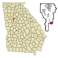 Location in Clayton County and the state of Georgia | |
| Coordinates: 33°26′39″N 84°18′54″W / 33.44417°N 84.31500°WCoordinates: 33°26′39″N 84°18′54″W / 33.44417°N 84.31500°W | |
| Country | United States |
| State | Georgia |
| County | Clayton |
| Area | |
| • Total | 2.62 sq mi (6.78 km2) |
| • Land | 2.59 sq mi (6.72 km2) |
| • Water | 0.02 sq mi (0.06 km2) |
| Elevation | 951 ft (290 m) |
| Population (2010) | |
| • Total | 6,422 |
| • Density | 2,475/sq mi (955.5/km2) |
| Time zone | Eastern (EST) (UTC-5) |
| • Summer (DST) | EDT (UTC-4) |
| ZIP code | 30250 |
| Area code(s) | 770 |
| FIPS code | 13-47616[1] |
| GNIS feature ID | 0317440[2] |
| Website |
www |
Lovejoy is a city in Clayton County, Georgia, United States. As of the 2010 census, the city had a population of 6,422,[3] up from 2,495 at the 2000 census. During the American Civil War, it was the site of the Battle of Lovejoy's Station during the Atlanta Campaign of 1864.
During the 2000s, Lovejoy was proposed by the Georgia Department of Transportation to be the endpoint of metro Atlanta's first commuter rail line.
Geography
Lovejoy is located in southern Clayton County at 33°26′39″N 84°18′54″W / 33.44417°N 84.31500°W (33.444164, -84.315105).[4] It is bordered by Henry County to the south and the unincorporated community of Bonanza to the north. U.S. Routes 19 and 41 pass through the western part of Lovejoy, leading north 24 miles (39 km) to downtown Atlanta and south 14 miles (23 km) to Griffin.
According to the United States Census Bureau, the city has a total area of 2.6 square miles (6.8 km2), of which 0.02 square miles (0.06 km2), or 0.91%, is water.[3]
Demographics
| Historical population | |||
|---|---|---|---|
| Census | Pop. | %± | |
| 1910 | 198 | — | |
| 1920 | 221 | 11.6% | |
| 1930 | 178 | −19.5% | |
| 1980 | 205 | — | |
| 1990 | 754 | 267.8% | |
| 2000 | 2,495 | 230.9% | |
| 2010 | 6,422 | 157.4% | |
| Est. 2015 | 6,487 | [5] | 1.0% |
As of the census[1] of 2000, there were 2,495 people, 491 households, and 369 families residing in the city. The population density was 1,064.3 people per square mile (411.7/km²). There were 596 housing units at an average density of 254.2 per square mile (98.3/km²). The racial makeup of the city was 64.09% White, 33.51% African American, 0.36% Native American, 0.60% Asian, 0.12% Pacific Islander, 0.60% from other races, and 0.72% from two or more races. Hispanic or Latino of any race were 2.44% of the population.
There were 491 households out of which 41.5% had children under the age of 18 living with them, 50.7% were married couples living together, 19.1% had a female householder with no husband present, and 24.8% were non-families. 18.9% of all households were made up of individuals and 3.9% had someone living alone who was 65 years of age or older. The average household size was 2.66 and the average family size was 2.99.
In the city the population was spread out with 17.2% under the age of 18, 19.2% from 18 to 24, 45.0% from 25 to 44, 14.9% from 45 to 64, and 3.7% who were 65 years of age or older. The median age was 30 years. For every 100 females there were 265.3 males. For every 100 females age 18 and over, there were 314.9 males.
The median income for a household in the city was $40,139, and the median income for a family was $40,268. Males had a median income of $21,964 versus $23,229 for females. The per capita income for the city was $14,642. About 6.1% of families and 11.8% of the population were below the poverty line, including 13.8% of those under age 18 and 2.8% of those age 65 or over.
Education
Clayton County Public Schools operates public schools.
The schools in this area are:
- Lovejoy Middle School
- Lovejoy High School
Infrastructure
Transit systems
MARTA serves the city.
Notable People
- Kokomo Arnold (1901-1968) blues singer and guitarist
- Jocasta Odom Contestant on Big Brother 16.
References
- 1 2 "American FactFinder". United States Census Bureau. Retrieved 2008-01-31.
- ↑ "US Board on Geographic Names". United States Geological Survey. 2007-10-25. Retrieved 2008-01-31.
- 1 2 "Geographic Identifiers: 2010 Demographic Profile Data (G001): Lovejoy city, Georgia". U.S. Census Bureau, American Factfinder. Retrieved July 28, 2014.
- ↑ "US Gazetteer files: 2010, 2000, and 1990". United States Census Bureau. 2011-02-12. Retrieved 2011-04-23.
- ↑ "Annual Estimates of the Resident Population for Incorporated Places: April 1, 2010 to July 1, 2015". Retrieved July 2, 2016.
- ↑ "Census of Population and Housing". Census.gov. Retrieved June 4, 2015.
External links
- City of Lovejoy official website
- Cavalry Action at Lovejoy's Station historical marker
- Georgia Militia at Lovejoy's Station historical marker
Municipalities and communities of Clayton County, Georgia, United States | ||
|---|---|---|
| Cities | 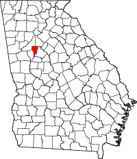 | |
| CDPs | ||
| Unincorporated communities | ||
| Footnotes | ‡This populated place also has portions in an adjacent county or counties | |