Lympsham
| Lympsham | |
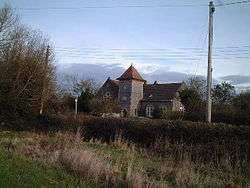 Former Methodist Chapel - now converted to a private dwelling |
|
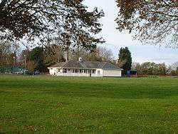 Cricket Pavilion |
|
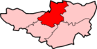
 Lympsham |
|
| Population | 960 [1] |
|---|---|
| OS grid reference | ST335545 |
| District | Sedgemoor |
| Shire county | Somerset |
| Region | South West |
| Country | England |
| Sovereign state | United Kingdom |
| Post town | WESTON-SUPER-MARE |
| Postcode district | BS24 |
| Dialling code | 01934 |
| Police | Avon and Somerset |
| Fire | Devon and Somerset |
| Ambulance | South Western |
| EU Parliament | South West England |
| UK Parliament | Wells |
Coordinates: 51°17′10″N 2°57′18″W / 51.286°N 2.955°W
Lympsham is a village and civil parish six miles west of Axbridge and six miles south-east of Weston-super-Mare, close to the River Axe in Somerset, England. The parish includes the hamlet of Wick where Wick Farmhouse dates from the mid 18th century.[2]
History
It has been suggested that the name means 'a suitable home' from the Old English ge-limplic and ham.[3] More probable is a combination of a personal name beginning "Lin-" or something like "lind-pyll" (pool where lime trees grow) with "ham" (in Old English this usually means either "village" or "estate"). The first appearance of the name in records is in 1225 "Linpelesham" (in 1254 "Limpelesham").[4]
It is likely that efforts were made to improve the drainage of the soil in the area during the Saxon period. In 1129, the Abbot of Glastonbury Abbey recorded that corn was growing here on land which had previously been classified as worthless.[5]
Governance
The parish council has responsibility for local issues, including setting an annual precept (local rate) to cover the council’s operating costs and producing annual accounts for public scrutiny. The parish council evaluates local planning applications and works with the local police, district council officers, and neighbourhood watch groups on matters of crime, security, and traffic. The parish council's role also includes initiating projects for the maintenance and repair of parish facilities, as well as consulting with the district council on the maintenance, repair, and improvement of highways, drainage, footpaths, public transport, and street cleaning. Conservation matters (including trees and listed buildings) and environmental issues are also the responsibility of the council.
The village falls within the Non-metropolitan district of Sedgemoor, which was formed on 1 April 1974 under the Local Government Act 1972, having previously been part of Axbridge Rural District,[6] which is responsible for local planning and building control, local roads, council housing, environmental health, markets and fairs, refuse collection and recycling, cemeteries and crematoria, leisure services, parks, and tourism.
Somerset County Council is responsible for running the largest and most expensive local services such as education, social services, libraries, main roads, public transport, policing and fire services, trading standards, waste disposal and strategic planning.
It is also part of the Wells county constituency represented in the House of Commons of the Parliament of the United Kingdom. It elects one Member of Parliament (MP) by the first past the post system of election, and part of the South West England constituency of the European Parliament which elects seven MEPs using the d'Hondt method of party-list proportional representation.
Religious sites
The Church of St Christopher originates from the 15th century, but includes significant 19th-century restoration by Rev A. J. Stephenson and his son, J. H. Stephenson. It has been designated by English Heritage as a Grade I listed building.[7]
See also
References
- ↑ "Statistics for Wards, LSOAs and Parishes — SUMMARY Profiles" (Excel). Somerset Intelligence. Retrieved 4 January 2014.
- ↑ "Wick Farmhouse". Images of England. English Heritage. Retrieved 2009-02-04.
- ↑ Robinson, Stephen (1992). Somerset Place Names. Wimborne, Dorset: Dovecote Press. ISBN 1-874336-03-2.
- ↑ Ekwall, E. (1940) The Concise Oxford Dictionary of English Place-names; 2nd ed. Oxford: Clarendon Press; pp. 204, 294
- ↑ Hawkins, Desmond (1982). Avalon and Sedgemoor. Gloucester: Alan Sutton. ISBN 0-86299-016-5.
- ↑ "Axbridge RD". A vision of Britain Through Time. University of Portsmouth. Retrieved 4 January 2014.
- ↑ "Church of St Christopher". Images of England. Retrieved 2007-10-30.
External links
| Wikimedia Commons has media related to Lympsham. |