Lynnwood, Washington
| City of Lynnwood | |
|---|---|
| City | |
 | |
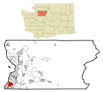 Location of Lynnwood, Washington | |
| Coordinates: 47°49′40″N 122°18′19″W / 47.82778°N 122.30528°WCoordinates: 47°49′40″N 122°18′19″W / 47.82778°N 122.30528°W | |
| Country | United States |
| State | Washington |
| County | Snohomish |
| Government | |
| • Mayor | Nicola Smith |
| Area[1] | |
| • Total | 7.86 sq mi (20.36 km2) |
| • Land | 7.84 sq mi (20.31 km2) |
| • Water | 0.02 sq mi (0.05 km2) |
| Elevation | 350-600 ft (167-182 m) |
| Population (2010)[2] | |
| • Total | 36,485 |
| • Estimate (2015)[3] | 36,997 |
| • Density | 4,570.9/sq mi (1,764.8/km2) |
| Time zone | PST (UTC-8) |
| • Summer (DST) | PDT (UTC-7) |
| ZIP codes | 98026, 98036, 98037, 98046, 98087 |
| Area code | 425 |
| FIPS code | 53-40840 |
| GNIS feature ID | 1512414[4] |
| Website | www.ci.lynnwood.wa.us |
Lynnwood is a city in Snohomish County, Washington, United States. The population was 36,485 at the 2010 census, making it the fourth largest in Snohomish County and thirtieth largest in Washington State. The city is a mix of urban, suburban, small city, crossroads, and bedroom community to many professionals who work in Seattle. Straddling the junction between Interstate 5 and the north end of Interstate 405 in Washington, it is a part of "Greater Seattle".
History
In 1889, William Morrice purchased 100 acres of land which is now the site of the Alderwood mall. Only a few pioneering families lived in this remote central part of South Snohomish County. A trip to Seattle for supplies took two days by horse-drawn wagon.
Early in the twentieth century, the area occupied by Lynnwood today was owned by the Puget Mill Company. Logging began and by 1916, most of the timber had been cut and the Puget Mill Company was liable for taxes on 6,285 acres of unproductive land. Puget Mill began selling five-acre "stump farms" and in 1917 they developed a 30-acre poultry farm, known as the Demonstration Farm, to demonstrate how a farmer might make a five-acre tract pay for itself. The Demonstration Farm was located next to the Interurban Railway that ran between Seattle and Everett. Across the tracks from the Demonstration Farm, ten acres were set aside as urban lots, and a brick Tudor-style general store was built to serve the growing new community of Alderwood Manor.[5]
State Route 99 opened in October 1927 and brought major changes to the area. In 1931, a road (now 196th St SW) was paved connecting Alderwood Manor to State Route 99, and for a decade the highway corridor and the rail corridor complemented one another.
By the 1930s, the remaining chicken farmers in the Alderwood Manor area were struggling to survive. Income from the sale of eggs and broilers was down at the Demonstration Farm, but despite these losses, the Puget Mill Company made a handy profit in land sales. Some five-acre tracts were sold two or three time as buyers abandoned the Puget Mill contracts which carried an interest rate double the standard rate at the time. In 1933, the Puget Mill Company closed the Demonstration Farm, turning the central five acres over to Norm Collins who established the Washington Breeders Hatchery. The remaining 25 acres was subdivded into one-acre "ranchettes".
By the end of World War II, Lynnwood emerged along Highway 99, a mile west of Alderwood Manor, as an assertive business district catering to the motoring public. By the mid-1950s, growth dictated the need for municipal services such as fire prevention, sewers, policing and land use controls. This demand for services spurred an incorporation effort.[5] Lynnwood was officially incorporated on April 23, 1959, from a larger unincorporated area called Alderwood Manor. Even today you can see many of the original 80-year-old homes,[6] and old buildings.
The name "Lynnwood" comes from a developer from Seattle who planned to build something at Highway 99 and Alderwood Road (now 196th ST SW). He named the building "Lynn" for his wife and "wood" for Alderwood. Many other stores around took the name Lynnwood and were known as the Lynnwood Business District.
The initial center of the incorporated city was the intersection of State Route 99 (Highway 99) and State Route 524 (196th Street SW). When I-5 was built, the exit onto 44th Avenue West became the main Lynnwood exit. At that time, the city zoned the area East of 48th W, south of 194th SW, and west of the new freeway for commercial development, and the current city center area was born, with the construction of the Fred Meyer store, a new hotel called the Landmark (now La Quinta Inns & Suites) on 200th and 44th, and other commercial developments.
With the planned construction of I-405 bringing more people by the city, developers built the Alderwood Mall, effectively moving the main commercial area even farther east.
Geography
Lynnwood is located at 47°49′40″N 122°18′19″W / 47.827868°N 122.305391°W (47.827868, -122.305391).[7]
According to the United States Census Bureau, the city has a total area of 7.86 square miles (20.36 km2), of which, 7.84 square miles (20.31 km2) is land and 0.02 square miles (0.05 km2) is water.[1]
Natural features within Lynnwood include Scriber Lake, Hall Lake, and Swamp Creek.
Demographics
| Historical population | |||
|---|---|---|---|
| Census | Pop. | %± | |
| 1960 | 7,207 | — | |
| 1970 | 17,381 | 141.2% | |
| 1980 | 22,641 | 30.3% | |
| 1990 | 28,695 | 26.7% | |
| 2000 | 33,847 | 18.0% | |
| 2010 | 35,836 | 5.9% | |
| Est. 2015 | 36,997 | [8] | 3.2% |
| U.S. Decennial Census[9] 2015 Estimate[3] | |||
2010 census
As of the census[10] of 2010, there were 35,836 people, 13,950 households, and 8,501 families residing in the city. The population density was 4,570.9 inhabitants per square mile (1,764.8/km2). There were 14,939 housing units at an average density of 1,905.5 per square mile (735.7/km2). The racial makeup of the city was 68.2% White (58.6% Non-Hispanic White), 5.5% African American, 1.1% Native American, 17.3% Asian, 0.5% Pacific Islander, 6.6% from other races, and 5.1% from two or more races. Hispanic or Latino of any race were 13.3% of the population.
There were 14,107 households of which 26.9% had children under the age of 18 living with them, 42.6% were married couples living together, 12.2% had a female householder with no husband present, 5.5% had a male householder with no wife present, and 39.7% were non-families. 30.8% of all households were made up of individuals and 9.4% had someone living alone who was 65 years of age or older. The average household size was 3.50 and the average family size was 4.87.
The median age in the city was 37.3 years. 21.7% of residents were under the age of 18. http://factfinder.census.gov/faces/tableservices/jsf/pages/productview.xhtml?src=bkmk
2000 census
As of the 2000 census, there were 33,847 people, 13,328 households, and 8,330 families residing in the city. The population density was 4,431.2 people per square mile (1,710.5/km2). There were 13,808 housing units at an average density of 1,807.7 per square mile (697.8/km2). The racial makeup of the city was 74.3% White, 3.3% African American, 1.0% Native American, 13.87% Asian, 0.40% Pacific Islander, 2.80% from other races, and 4.35% from two or more races. Hispanic or Latino of any race were 29.96% of the population.
There were 13,328 households out of which 32.1% had children under the age of 18 living with them, 46.3% were married couples living together, 11.5% had a female householder with no husband present, and 37.5% were non-families. 29.3% of all households were made up of individuals and 9.4% had someone living alone who was 65 years of age or older. The average household size was 2.50 and the average family size was 3.13.
In the city the age distribution of the population shows 24.4% under the age of 18, 10.4% from 18 to 24, 32.1% from 25 to 44, 21.3% from 45 to 64, and 11.8% who were 65 years of age or older. The median age was 35 years. For every 100 females there were 95.0 males. For every 100 females age 18 and over, there were 92.0 males.
The median income for a household in the city was $22,814, and the median income for a family was $21,825. Males had a median income of $27,395 versus $30,070 for females. The per capita income for the city was $19,971. About 16.2% of families and 23.5% of the population were below the poverty line, including 9.8% of those under age 18 and 12.2% of those age 65 or over. http://censtats.census.gov/data/WA/1605340840.pdf
Crime
Lynnwood has one of the highest concentrations of crime in Washington State. Lynnwood has a property crime rate of 56.51 per 1000 residents, more than 3 times the National average of 18.37. Lynnwood also has high rates of burglary, roughly 50% higher than the national average.[11] According to the Lynnwood Police Department, in 2014, a felony was committed every 3 hours, a theft occurred approximately every 4 hours, and a vehicular theft was reported roughly every 2 days. The Lynnwood Police Department has also reported a 33% Year-over-year increase in Drug-related arrests between 2013 and 2014. During that time period Methamphetamine seizures have also increased 142%.[12]
Education
- Central Washington University- Lynnwood offers bachelor's degrees in Accounting, Business Administration, Elementary Education, Food Service Management, Social Sciences, Information Technology and Administrative Management, Law and Justice, Mathematics: Teaching Secondary, and Safety and Health Management as well as a master's degree in Professional Accountancy all located on the Edmonds Community College campus.
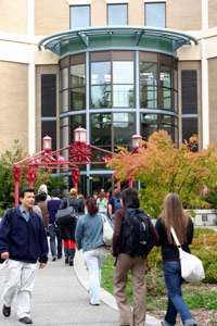
- Edmonds Community College established in 1967 is a two-year public college with a 50-acre (200,000 m2) campus in Lynnwood. It offers the first two years of a four-year degree, bachelor's degree completion via local and online university partnerships, career-training degrees and certificates in business, technology or human services, as well as college credit in high school.
- High schools: Lynnwood High School, Meadowdale High School, and Scriber Lake High School.
- Middle schools: Alderwood Middle School, Meadowdale Middle School, College Place Middle School.
- Elementary schools: Beverly Elementary, Lynnwood Elementary, Oak Heights Elementary, Cedar Valley Elementary, College Place Elementary, Seaview Elementary, Spruce Elementary, Meadowdale Elementary, Hilltop Elementary, Hazelwood Elementary, Martha Lake Elementary, and Lynndale Elementary.
Landmarks

Alderwood is a regional shopping mall in Lynnwood. It is anchored by J.C. Penney, Macy's, Nordstrom and Sears, and comprises a traditional enclosed mall and two open-air areas known as The Village and The Terraces. General Growth Properties manages and co-owns the property with an institutional investor. Alderwood is Snohomish County's largest malls and one of the major malls in the Puget Sound Region.[13]
The Pine Cone Cafe on 188th SW and Highway 99 was open for decades. It resembled greatly Beth's Cafe about fifteen miles (24 km) south on 99 in Seattle and was historically a big draw for Lynnwood's now long gone biker culture. The interior was like a rail car with tables on each side of a central aisle. In the rear were two very playable pinball machines. Many teenagers came to the restaurant just to play pinball during the mid-1970s. In more recent times the Pine Cone was very popular among counter-culture teenagers in general, and seniors as well. No longer a restaurant, it is currently a smoke shop named "Crown Smoke." Jimbos, a burger restaurant that closed down in 2006 due to excavation was a well known burger restaurant for families to go out and eat.
On 164th St. SW and Highway 99 lies Keeler's Corner, an old-fashioned gas station long out of service (not to be confused with Keeler's Corner Apartments, which is across the street). The Pantry Cafe on Lincoln and Highway 99 was burned down in 2004, but before the accident its legacy was certainly considerable. Most locals are familiar with the House of Clocks, an old-fashioned clock store, on 156th and Highway 99. A little farther south on Highway 99 was the Sno-King Drive-In which opened in 1946 and closed in 1986. Now a Value Village occupies the site of the former drive-in theatre. The local bowling and roller skating center, Lynnwood Bowl & Skate (formerly Lynnwood Lanes and Lynnwood Roll-A-Way), on 200th St. SW and Highway 99 opened for business in the 1950s and still operates today.
The Lynnwood Convention Center opened in 2005 on 196th St SW. With 34,000 square feet of flexible meeting space, the Lynnwood Convention Center can accommodate groups from 20 to 2,500.
Parks
See Also: City of Lynnwood Parks & Recreation Homepage
Neighborhood parks
- Daleway Park
- Gold Park
- Meadowdale Park
- N. Lynnwood Neighborhood Park
- Pioneer Park
- Scriber Creek Park
- South Lynnwood Park
- Spruce Park
Community parks
- Lynndale Park, with Skate Park

- Lynnwood Athletic Complex (Closed in 2009 at the same time Lynnwood High School Moved to North Road Location)
- Meadowdale Playfields
- Scriber Lake Park Twenty-two acre of wetlands south of Wilcox Park.
- Wilcox Park, also known as "Flag Park", Lynnwood's first park built on the former Wilcox homestead.
Mini parks
- Veterans Park, park south of Library honoring local veterans.
- Maple Mini Park
- Mini Park at Sprague's Pond
Facilities
- Golf Course
- Heritage Park, shows historic buildings of the Lynnwood, Washington area formerly called Alderwood Manor.
- Recreation Center
- Senior Center
Trails
- Golf Course Trail
- Interurban Trail, former site of Interurban Trolley tracks between Seattle and Everett (1910–1939).
- Mesika Trail, trail runs along west border of Lynnwood Civic Center campus.
- Scriber Creek Trail, trail runs along Scriber Creek wetlands near Lynnwood Transit Center.
Open space
- Lund's Gulch
Notable people
- Kenneth Bae, Prisoner[14][15][16]
- Carol Channing, Actress
- Randy Couture, MMA Fighter and Actor
- Paul Kenneth Keller, Serial arsonist
- Sanjaya Malakar, American Idol finalist
- Tom McGrath, Animator
- Travis Snider, Professional baseball player
- Layne Staley, Musician
References
- 1 2 "US Gazetteer files 2010". United States Census Bureau. Retrieved 19 December 2012.
- ↑ "American FactFinder". United States Census Bureau. Retrieved 19 December 2012.
- 1 2 "Population Estimates". United States Census Bureau. Retrieved June 15, 2016.
- ↑ "US Board on Geographic Names". United States Geological Survey. 2007-10-25. Retrieved 2008-01-31.
- 1 2 Little, 1 Stadler, 2, Marie, 1 Kevin, 2 (2006). Images of American Alderwood Manor. Charleston SC, Chicago IL, Portmouth NH, San Francisco CA: Arcadia Publishing. pp. 7–8, 87. ISBN 978-0-7385-3101-4.
- ↑ Satterfield, Archie (1990). Edmonds, The First Century. Edmonds, Washington: City of Edmonds. ISBN 0-9625484-0-5.
- ↑ "US Gazetteer files: 2010, 2000, and 1990". United States Census Bureau. 2011-02-12. Retrieved 2011-04-23.
- ↑ "Annual Estimates of the Resident Population for Incorporated Places: April 1, 2010 to July 1, 2015". Retrieved July 2, 2016.
- ↑ "U.S. Decennial Census". Census.gov. Retrieved June 12, 2014.
- ↑ "Census QuickFacts for Lynnwood". United States Census Bureau. Retrieved 22 September 2013.
- ↑ "Lynnwood crime rates and statistics - NeighborhoodScout". www.neighborhoodscout.com. Retrieved 2016-06-10.
- ↑ "Lynnwood Police Department Annual Report 2014" (PDF).
- ↑ Enlow, Clair (December 9, 2004). "Alderwood get urbanized and upscaled". Retrieved November 19, 2015 – via Daily Journal of Commerce.
- ↑ http://bigstory.ap.org/article/video-shows-us-mans-life-nkorean-prison
- ↑ https://www.nbcnews.com/id/53704142/ns/local_news-seattle_wa/#.UqQcPaWredA
- ↑ http://www.kgw.com/news/White-House-renews-urge-for-N-Korea-to-release-Kenneth-Bae-233944681.html
External links
| Wikimedia Commons has media related to Lynnwood, Washington. |
 |
Mukilteo | Everett | Mill Creek | |
| Edmonds | |
Bothell | ||
| ||||
| | ||||
| Edmonds | Mountlake Terrace | Brier |
Municipalities and communities of Snohomish County, Washington, United States | ||
|---|---|---|
| Cities |  | |
| Towns | ||
| CDPs |
| |
| Other unincorporated communities | ||
| Ghost town | ||
| Indian reservation | ||
| Footnotes | ‡This populated place also has portions in an adjacent county or counties | |