Woodway, Washington
| Woodway, Washington | |
|---|---|
| City | |
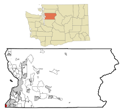 Location of Woodway, Washington | |
| Coordinates: 47°47′24″N 122°22′56″W / 47.79000°N 122.38222°WCoordinates: 47°47′24″N 122°22′56″W / 47.79000°N 122.38222°W | |
| Country | United States |
| State | Washington |
| County | Snohomish |
| Area[1] | |
| • Total | 3.90 sq mi (10.10 km2) |
| • Land | 1.11 sq mi (2.87 km2) |
| • Water | 2.79 sq mi (7.23 km2) |
| Elevation | 203 ft (62 m) |
| Population (2010)[2] | |
| • Total | 1,307 |
| • Estimate (2015)[3] | 1,364 |
| • Density | 1,177.5/sq mi (454.6/km2) |
| Time zone | Pacific (PST) (UTC-8) |
| • Summer (DST) | PDT (UTC-7) |
| ZIP code | 98020 |
| Area code, | 206, 425 |
| FIPS code | 53-79835 |
| GNIS feature ID | 1512815[4] |
| Website | www.townofwoodway.com |
Woodway is a city in Snohomish County, Washington, United States. The population was 1,307 at the 2010 census.
Based on per capita income, one of the more reliable measures of affluence, Woodway ranks 6th of 522 areas in the state of Washington to be ranked. It is also the highest rank achieved in Snohomish County.
History
Woodway was officially incorporated on February 26, 1958 in an effort to protect the heavily forested area from development. Lot sizes were deed restricted to a minimum of 2 acres (8,100 m2). At that time, Woodway high school students attended the old Edmonds High school until the new Woodway High School was opened in 1970. In 1990, this school merged with Edmonds High School to create Edmonds Woodway High School. Woodway became a city in 1986 but continues to use the Edmonds post office.
The city includes areas north and south of the original Woodway Park which offer one third acre lots and 1-acre (4,000 m2) lots in addition to the 2-acre (8,100 m2) lots in the park where the original secluded, wooded environment remains.
Woodway is the only city in Snohomish County in Area code 206.
Geography
Woodway is located at 47°47′24″N 122°22′56″W / 47.79000°N 122.38222°W (47.790038, -122.382360).[5]
According to the United States Census Bureau, the city has a total area of 3.90 square miles (10.10 km2), of which, 1.11 square miles (2.87 km2) is land and 2.79 square miles (7.23 km2) is water.[1]
Demographics
| Historical population | |||
|---|---|---|---|
| Census | Pop. | %± | |
| 1960 | 713 | — | |
| 1970 | 879 | 23.3% | |
| 1980 | 832 | −5.3% | |
| 1990 | 914 | 9.9% | |
| 2000 | 936 | 2.4% | |
| 2010 | 1,307 | 39.6% | |
| Est. 2015 | 1,364 | [6] | 4.4% |
| U.S. Decennial Census[7] 2015 Estimate[3] | |||
2010 census
As of the census[2] of 2010, there were 1,307 people, 448 households, and 373 families residing in the city. The population density was 1,177.5 inhabitants per square mile (454.6/km2). There were 466 housing units at an average density of 419.8 per square mile (162.1/km2). The racial makeup of the city was 87.5% White, 0.6% African American, 0.8% Native American, 7.8% Asian, 0.6% from other races, and 2.7% from two or more races. Hispanic or Latino of any race were 2.7% of the population.
There were 448 households of which 41.5% had children under the age of 18 living with them, 75.7% were married couples living together, 4.7% had a female householder with no husband present, 2.9% had a male householder with no wife present, and 16.7% were non-families. 12.9% of all households were made up of individuals and 6.7% had someone living alone who was 65 years of age or older. The average household size was 2.90 and the average family size was 3.18.
The median age in the city was 45.8 years. 28.3% of residents were under the age of 18; 4.9% were between the ages of 18 and 24; 14.9% were from 25 to 44; 37.5% were from 45 to 64; and 14.4% were 65 years of age or older. The gender makeup of the city was 49.2% male and 50.8% female.
2000 census
As of the census of 2000, there were 936 people, 336 households, and 280 families residing in the city. The population density was 840.1 people per square mile (325.6/km²). There were 343 housing units at an average density of 307.9 per square mile (119.3/km²). The racial makeup of the city was 94.12% White, 0.32% Native American, 3.85% Asian, 0.43% from other races, and 1.28% from two or more races. Hispanic or Latino of any race were 0.85% of the population.
There were 336 households out of which 34.8% had children under the age of 18 living with them, 77.7% were married couples living together, 5.4% had a female householder with no husband present, and 16.4% were non-families. 14.0% of all households were made up of individuals and 7.7% had someone living alone who was 65 years of age or older. The average household size was 2.76 and the average family size was 3.02.
In the city the age distribution of the population shows 24.4% under the age of 18, 4.0% from 18 to 24, 17.8% from 25 to 44, 34.1% from 45 to 64, and 19.8% who were 65 years of age or older. The median age was 47 years. For every 100 females there were 91.8 males. For every 100 females age 18 and over, there were 86.3 males.
The median income for a household in the city was $101,633, and the median income for a family was $109,428. Males had a median income of $86,928 versus $33,333 for females. The per capita income for the city was $51,613. About 0.7% of families and 2.4% of the population were below the poverty line, including 0.9% of those under age 18 and 3.3% of those age 65 or over.
References
- 1 2 "US Gazetteer files 2010". United States Census Bureau. Retrieved 2012-12-19.
- 1 2 "American FactFinder". United States Census Bureau. Retrieved 2012-12-19.
- 1 2 "Population Estimates". United States Census Bureau. Retrieved July 9, 2016.
- ↑ "US Board on Geographic Names". United States Geological Survey. 2007-10-25. Retrieved 2008-01-31.
- ↑ "US Gazetteer files: 2010, 2000, and 1990". United States Census Bureau. 2011-02-12. Retrieved 2011-04-23.
- ↑ "Annual Estimates of the Resident Population for Incorporated Places: April 1, 2010 to July 1, 2015". Retrieved July 2, 2016.
- ↑ United States Census Bureau. "Census of Population and Housing". Retrieved July 26, 2013.
External links
Municipalities and communities of Snohomish County, Washington, United States | ||
|---|---|---|
| Cities | 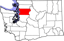 | |
| Towns | ||
| CDPs |
| |
| Other unincorporated communities | ||
| Ghost town | ||
| Indian reservation | ||
| Footnotes | ‡This populated place also has portions in an adjacent county or counties | |
 |
Edmonds | | ||
| Puget Sound | |
Edmonds | ||
| ||||
| | ||||
| Shoreline |