Mandasa
| Mandasa మందస | |
|---|---|
| Village | |
|
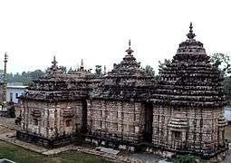
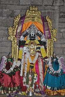
Mandasa Vasudeva Temple | |
 Mandasa  Mandasa Location in Andhra Pradesh, India | |
| Coordinates: 18°52′00″N 84°28′00″E / 18.8667°N 84.4667°ECoordinates: 18°52′00″N 84°28′00″E / 18.8667°N 84.4667°E | |
| Country |
|
| State | Andhra Pradesh |
| District | Srikakulam |
| Talukas | Mandasa |
| Languages | |
| • Official | Telugu |
| Time zone | IST (UTC+5:30) |
| PIN | 532 242 |
| Vehicle registration | AP |
| Lok Sabha constituency | Srikakulam |
| Vidhan Sabha constituency | Palasa |
Mandasa is a village in Srikakulam district of the Indian state of Andhra Pradesh.[1] Mandasa is also known by the name Manjusha.
Geography
Mandasa is located at 18°52′00″N 84°28′00″E / 18.8667°N 84.4667°E.[2] It has an average elevation of 31 meters (104 feet). Mandasa mandal is bordered by Sompeta mandal to the northeast, Palasa mandal to the southwest, Vajrapu Kotturu mandal to the south, Patrapur block of Ganjam district, Odisha to the north, Rayagada block of Gajapati district, Odisha to the west and Bay of Bengal to the east.
Demographics
According to Indian census, 2001, the demographic details of Mandasa mandal is as follows:[3]
- Total Population: 76,402 in 17,814 Households
- Male Population: 37,368 and Female Population: 39,034
- Children Under 6-years of age: 10,823 (Boys - 5,456 and Girls - 5,367)
- Total Literates: 38,425 38,425
Transport
Mandasa is connected with 'Mandasa Road' railway station on Howrah-Chennai mainline in East Coast Railway, Indian Railways.
References
- ↑ "Mandal wise list of villages in Srikakulam district" (PDF). Chief Commissioner of Land Administration. National Informatics Centre. Archived from the original (PDF) on 8 December 2014. Retrieved 6 March 2016.
- ↑ Falling Rain Genomics.Mandasa
- ↑ Mandasa mandal at Our Village India.org
 |
Rayagada block, Gajapati district | Patrapur block, Ganjam district | Sompeta mandal | |
| Rayagada block, Gajapati district | |
Sompeta mandal Bay of Bengal | ||
| ||||
| | ||||
| Palasa mandal | Palasa mandal & Vajrapu Kotturu mandal | Bay of Bengal |